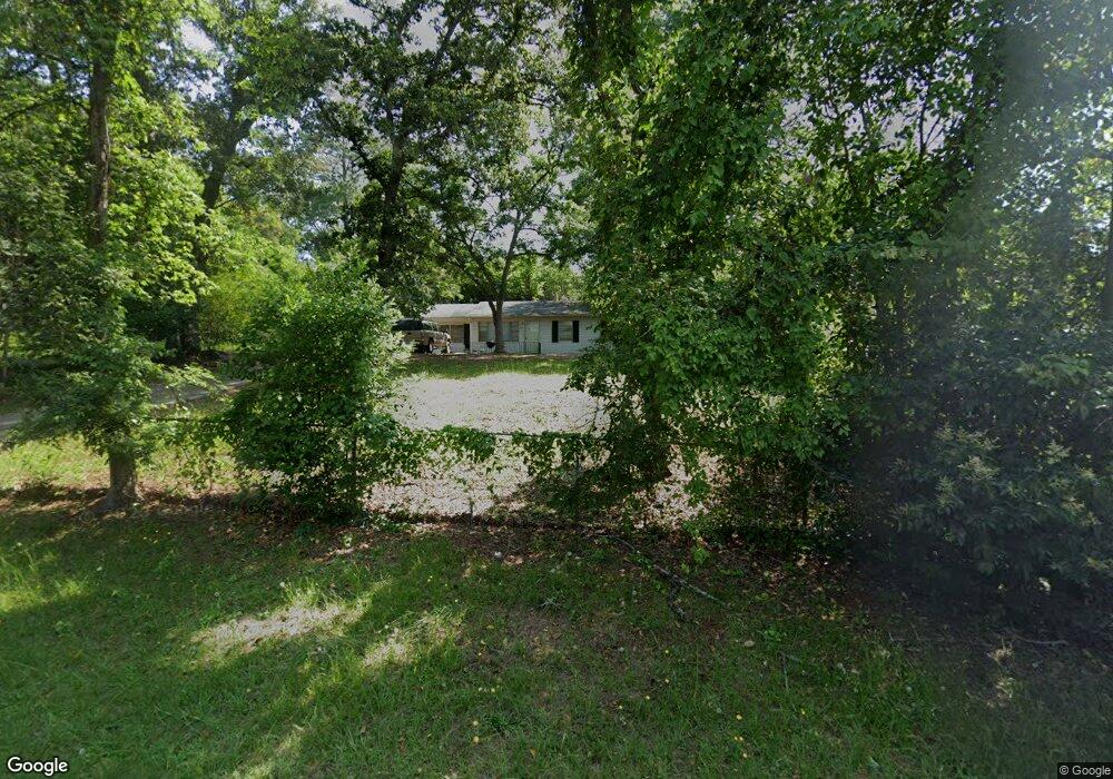
1934 Manson Rd Macon, GA 31217
Estimated Value: $84,905 - $102,000
3
Beds
2
Baths
1,130
Sq Ft
$84/Sq Ft
Est. Value
About This Home
This home is located at 1934 Manson Rd, Macon, GA 31217 and is currently estimated at $94,726, approximately $83 per square foot. 1934 Manson Rd is a home located in Bibb County with nearby schools including Martin Luther King Jr. Elementary School, Appling Middle School, and Northeast High School.
Ownership History
Date
Name
Owned For
Owner Type
Purchase Details
Closed on
Oct 14, 2011
Sold by
Navy Federal Credit Union
Bought by
J Harold Phillips Family Partnership Llp
Current Estimated Value
Purchase Details
Closed on
May 12, 2011
Sold by
Barber Daryl and Barber Joanne
Bought by
Navy Federal Credit Union
Purchase Details
Closed on
Apr 9, 2011
Sold by
Barber Daryl and Barber Joanne
Bought by
Navy Federal Credit Union
Purchase Details
Closed on
May 3, 2006
Sold by
Tbrown & Company Llc
Bought by
Barber Daryl and Barber Joanne
Purchase Details
Closed on
Nov 1, 2005
Purchase Details
Closed on
Oct 1, 2002
Sold by
Cr Stucco And Plastering Llc
Bought by
Patterson Jalanda
Create a Home Valuation Report for This Property
The Home Valuation Report is an in-depth analysis detailing your home's value as well as a comparison with similar homes in the area
Purchase History
| Date | Buyer | Sale Price | Title Company |
|---|---|---|---|
| J Harold Phillips Family Partnership Llp | $14,175 | None Available | |
| Navy Federal Credit Union | $16,560 | None Available | |
| Navy Federal Credit Union | $16,600 | -- | |
| Barber Daryl | -- | None Available | |
| Tbrown And Co Llc | $51,950 | None Availabale | |
| -- | $47,500 | -- | |
| Patterson Jalanda | $69,900 | None Available |
Source: Public Records
Tax History
| Year | Tax Paid | Tax Assessment Tax Assessment Total Assessment is a certain percentage of the fair market value that is determined by local assessors to be the total taxable value of land and additions on the property. | Land | Improvement |
|---|---|---|---|---|
| 2025 | $658 | $26,778 | $2,160 | $24,618 |
| 2024 | $680 | $26,778 | $2,160 | $24,618 |
| 2023 | $634 | $24,980 | $2,160 | $22,820 |
| 2022 | $714 | $20,624 | $2,941 | $17,683 |
| 2021 | $550 | $14,481 | $1,324 | $13,157 |
| 2020 | $523 | $13,475 | $1,324 | $12,151 |
| 2019 | $331 | $8,446 | $1,324 | $7,122 |
| 2018 | $686 | $8,446 | $1,324 | $7,122 |
| 2017 | $316 | $8,446 | $1,324 | $7,122 |
| 2016 | $292 | $8,446 | $1,324 | $7,122 |
| 2015 | $496 | $10,122 | $1,324 | $8,799 |
| 2014 | $891 | $15,813 | $2,823 | $12,990 |
Source: Public Records
Map
Nearby Homes
- 2035 Fairway Dr
- 2113 Joseph Waller Dr
- 0 Shady Road Plaza
- 3147 Wedgewood Dr
- 1669 Griswoldville Rd
- 168 Ruby Dr
- 3020 Millersfield Rd
- 3020 Millerfield Rd
- 3009 Millerfield Rd
- 2954 Tyler Place
- 157 Country World Dr
- 166 Country World Dr
- 176 Country World Dr
- 2877 Wilkes Ct
- 299 E Virginia Ln
- 2792 Jordan Ave
- 2740 Millerfield Rd
- 2750 Lakeshore Dr
- 2720 Jordan Ave
- 0 Champion Dr Unit 10666714
- 1928 Manson Rd
- 1948 Manson Rd
- 3392 Club Dr
- 1956 Manson Rd
- 3409 Millerfield Rd
- 1949 Manson Rd
- 3403 Millerfield Rd
- 3417 Millerfield Rd
- 1964 Manson Rd
- 1959 Manson Rd
- 3393 Millerfield Rd
- 3419 Millerfield Rd
- 3370 Club Dr
- 3361 Club Dr
- 3339 Millerfield Rd
- 1974 Manson Rd
- 3412 Doster Way
- 3376 Millerfield Rd
- 1973 Manson Rd
- 3358 Club Dr
Your Personal Tour Guide
Ask me questions while you tour the home.