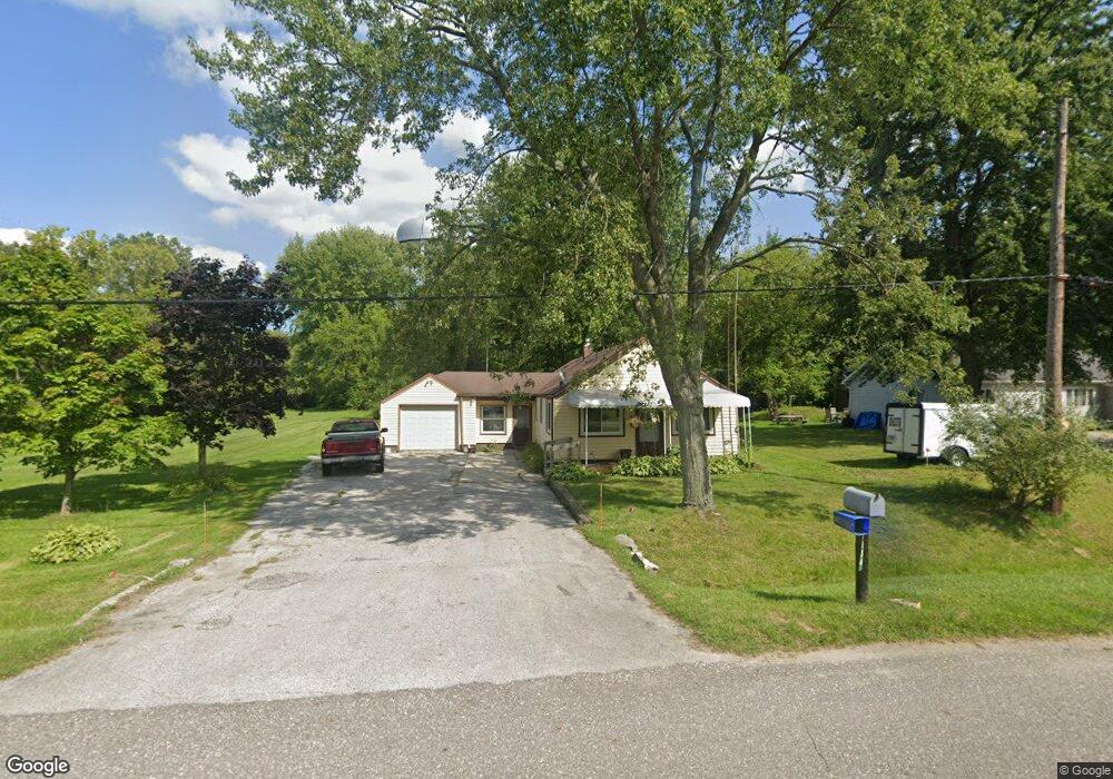
1934 Maple Rd Kimball, MI 48074
Estimated Value: $166,000 - $302,000
3
Beds
1
Bath
1,578
Sq Ft
$136/Sq Ft
Est. Value
About This Home
This home is located at 1934 Maple Rd, Kimball, MI 48074 and is currently estimated at $214,781, approximately $136 per square foot. 1934 Maple Rd is a home located in St. Clair County with nearby schools including Kimball Elementary School, Central Middle School, and Port Huron High School.
Ownership History
Date
Name
Owned For
Owner Type
Purchase Details
Closed on
Dec 16, 2025
Sold by
Lang Janice M
Bought by
Lang Janice M
Current Estimated Value
Purchase Details
Closed on
Jun 24, 2020
Sold by
Lang Janice M
Bought by
Barber Julia M
Purchase Details
Closed on
Jun 11, 2020
Sold by
Lang Janice M
Bought by
Barber Julia M
Purchase Details
Closed on
Feb 15, 1999
Sold by
Turner James and Turner Mae P
Bought by
Walker Janice M and Turner Evelyn J
Create a Home Valuation Report for This Property
The Home Valuation Report is an in-depth analysis detailing your home's value as well as a comparison with similar homes in the area
Home Values in the Area
Average Home Value in this Area
Purchase History
| Date | Buyer | Sale Price | Title Company |
|---|---|---|---|
| Lang Janice M | -- | None Listed On Document | |
| Barber Julia M | -- | None Listed On Document | |
| Barber Julia M | -- | None Listed On Document | |
| Walker Janice M | -- | None Available |
Source: Public Records
Tax History
| Year | Tax Paid | Tax Assessment Tax Assessment Total Assessment is a certain percentage of the fair market value that is determined by local assessors to be the total taxable value of land and additions on the property. | Land | Improvement |
|---|---|---|---|---|
| 2025 | $770 | $76,000 | $0 | $0 |
| 2024 | $747 | $72,000 | $0 | $0 |
| 2023 | $1,541 | $68,800 | $0 | $0 |
| 2022 | $2,040 | $57,500 | $0 | $0 |
| 2020 | $1,114 | $54,800 | $54,800 | $0 |
| 2019 | $1,081 | $44,900 | $0 | $0 |
| 2018 | $1,057 | $44,400 | $0 | $0 |
| 2016 | $559 | $46,100 | $0 | $0 |
| 2015 | -- | $44,900 | $44,900 | $0 |
| 2014 | -- | $39,300 | $39,300 | $0 |
| 2013 | -- | $47,800 | $0 | $0 |
Source: Public Records
Map
Nearby Homes
- V/L Allen
- 1786 Omar Rd
- 1604 Allen Rd
- 0 Allen Rd Unit 20250008597
- 0 Allen Rd Unit 20250008612
- 00 Howard Rd
- 1948 Meadowlark Ln
- 1906 Morningstar Ave
- 0 Wadhams Rd Unit 50155021
- 0000 Range Rd
- 2007 Edward Ln E
- 1405 Range Rd
- 2047 Edward Ln E
- 00 Range Rd
- 0 Lapeer Rd Unit 50137357
- 1091 Allen Rd
- 00 Griswold Rd
- 0 Wall Rd Unit 50185999
- 5117 Ravenswood Rd
- 2758 E Lake Dr
- 1928 Maple Rd
- 1933 Maple Rd
- 1931 Maple Rd
- 1914 Maple Rd
- 1976 Maple Rd
- 1939 Maple Rd
- 1980 Maple Rd
- 1902 Maple Rd
- 1921 Maple Rd
- 5125 Griswold Rd
- 1903 Maple Rd
- 5155 Griswold Rd
- 5165 Griswold Rd
- 1888 Maple Rd
- 5135 Griswold Rd
- 5159 Griswold Rd
- 1887 Maple Rd
- 5145 Griswold Rd
- 5117 Griswold Rd
- 5115 Griswold Rd
Your Personal Tour Guide
Ask me questions while you tour the home.