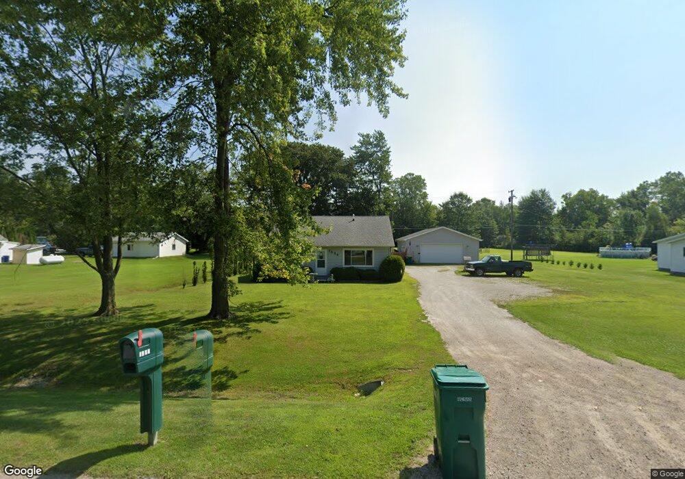
1934 Range Rd Port Huron, MI 48060
Estimated Value: $158,000 - $214,097
3
Beds
1
Bath
1,488
Sq Ft
$127/Sq Ft
Est. Value
About This Home
This home is located at 1934 Range Rd, Port Huron, MI 48060 and is currently estimated at $188,524, approximately $126 per square foot. 1934 Range Rd is a home located in St. Clair County with nearby schools including Kimball Elementary School, Central Middle School, and Port Huron High School.
Ownership History
Date
Name
Owned For
Owner Type
Purchase Details
Closed on
Apr 12, 2024
Sold by
Brown James A and Brown Helen M
Bought by
James A Brown And Helen M Brown Revocable Tru and Brown
Current Estimated Value
Purchase Details
Closed on
Feb 9, 2023
Sold by
Brown James A
Bought by
Brown James A and Brown Helen
Purchase Details
Closed on
Sep 7, 2022
Sold by
Vicky Herbert
Bought by
Brown James A
Purchase Details
Closed on
Nov 7, 2013
Sold by
Vankerschaever Samantha and Taliercio Melanie
Bought by
Vankerschaever Samantha and Taliercio Melanie
Home Financials for this Owner
Home Financials are based on the most recent Mortgage that was taken out on this home.
Original Mortgage
$41,468
Interest Rate
4.38%
Mortgage Type
Commercial
Purchase Details
Closed on
Aug 11, 2011
Sold by
Schall Mary Jo
Bought by
Schall Mary Jo and Mary Jo Shall Revocable Living Trsut
Purchase Details
Closed on
Jun 18, 2010
Sold by
Federal Deposit Insurance Corporation
Bought by
Vigneron Allen H
Purchase Details
Closed on
Nov 8, 2005
Sold by
Mccartney Michael J
Bought by
Kehrberg Vern E Van and Kehrberg Holly Jean Van
Purchase Details
Closed on
Sep 10, 1991
Sold by
Gabriel Nick E and Gabriel Irene H
Bought by
Gabriel Nick E and Gabriel Irene H
Create a Home Valuation Report for This Property
The Home Valuation Report is an in-depth analysis detailing your home's value as well as a comparison with similar homes in the area
Home Values in the Area
Average Home Value in this Area
Purchase History
| Date | Buyer | Sale Price | Title Company |
|---|---|---|---|
| James A Brown And Helen M Brown Revocable Tru | -- | None Listed On Document | |
| Brown James A | -- | -- | |
| Brown James A | -- | -- | |
| Vankerschaever Samantha | -- | None Available | |
| Schall Mary Jo | -- | None Available | |
| Vigneron Allen H | -- | Republic Title Of Texas Inc | |
| Kehrberg Vern E Van | $160,000 | None Available | |
| Gabriel Nick E | -- | None Available |
Source: Public Records
Mortgage History
| Date | Status | Borrower | Loan Amount |
|---|---|---|---|
| Previous Owner | Vankerschaever Samantha | $41,468 |
Source: Public Records
Tax History Compared to Growth
Tax History
| Year | Tax Paid | Tax Assessment Tax Assessment Total Assessment is a certain percentage of the fair market value that is determined by local assessors to be the total taxable value of land and additions on the property. | Land | Improvement |
|---|---|---|---|---|
| 2025 | $1,884 | $88,600 | $0 | $0 |
| 2024 | $913 | $69,700 | $0 | $0 |
| 2023 | $843 | $66,100 | $0 | $0 |
| 2022 | $1,616 | $61,400 | $0 | $0 |
| 2021 | $1,527 | $58,800 | $0 | $0 |
| 2020 | $1,527 | $53,200 | $53,200 | $0 |
| 2019 | $1,503 | $51,100 | $0 | $0 |
| 2018 | $1,434 | $51,100 | $0 | $0 |
| 2017 | $1,407 | $39,700 | $0 | $0 |
| 2016 | $692 | $39,700 | $0 | $0 |
| 2015 | -- | $42,200 | $42,200 | $0 |
| 2014 | -- | $39,700 | $39,700 | $0 |
| 2013 | -- | $39,400 | $0 | $0 |
Source: Public Records
Map
Nearby Homes
- 4595 Griswold Rd
- 0000 Range Rd
- 4632 Cloverdale Ln
- 1405 Range Rd
- 0 Wall Rd Unit 50185999
- 00 Range Rd
- 00 Howard Rd
- 1979 Allen Rd
- V/L Allen
- 1701 Allen Rd
- 1604 Allen Rd
- V/L Partridge Rd
- 4380 Lapeer Rd
- 0 Allen Rd Unit 20250008597
- 0 Allen Rd Unit 20250008612
- 0 Lapeer Rd Unit 50137357
- 174 Meadow Ln
- 104 Oldbrook Ln
- 153 Meadow Ln
- 2650 Alger Rd