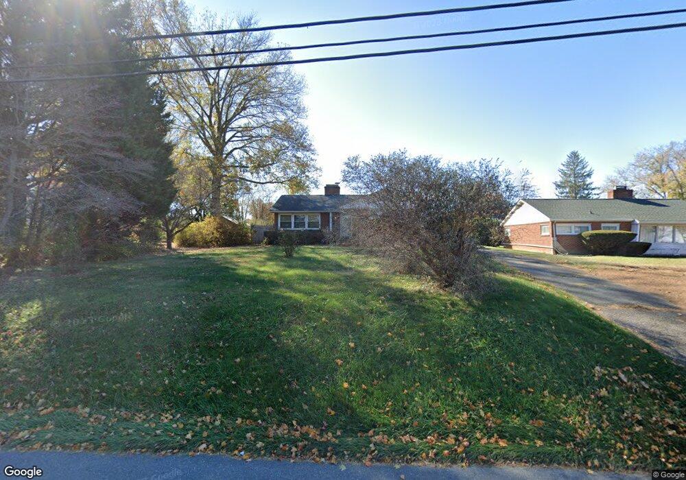
1934 W Main St Waynesboro, VA 22980
Estimated Value: $282,000 - $294,510
3
Beds
2
Baths
1,614
Sq Ft
$178/Sq Ft
Est. Value
About This Home
This home is located at 1934 W Main St, Waynesboro, VA 22980 and is currently estimated at $286,878, approximately $177 per square foot. 1934 W Main St is a home located in Waynesboro City with nearby schools including Westwood Hills Elementary School, Kate Collins Middle School, and Waynesboro High School.
Ownership History
Date
Name
Owned For
Owner Type
Purchase Details
Closed on
Aug 28, 2017
Sold by
Stumpf Kyle T and Stumpf Leisa M
Bought by
Sullivan Peter D and Sullivan Tara J
Current Estimated Value
Home Financials for this Owner
Home Financials are based on the most recent Mortgage that was taken out on this home.
Original Mortgage
$145,319
Outstanding Balance
$122,852
Interest Rate
4.37%
Mortgage Type
FHA
Estimated Equity
$164,026
Purchase Details
Closed on
Dec 8, 2011
Sold by
E W Barger Real Estate Inc
Bought by
Stumpf Kyle T
Home Financials for this Owner
Home Financials are based on the most recent Mortgage that was taken out on this home.
Original Mortgage
$115,983
Interest Rate
4.4%
Mortgage Type
FHA
Create a Home Valuation Report for This Property
The Home Valuation Report is an in-depth analysis detailing your home's value as well as a comparison with similar homes in the area
Home Values in the Area
Average Home Value in this Area
Purchase History
| Date | Buyer | Sale Price | Title Company |
|---|---|---|---|
| Sullivan Peter D | $148,000 | Attorney | |
| Stumpf Kyle T | $119,000 | -- |
Source: Public Records
Mortgage History
| Date | Status | Borrower | Loan Amount |
|---|---|---|---|
| Open | Sullivan Peter D | $145,319 | |
| Previous Owner | Stumpf Kyle T | $115,983 |
Source: Public Records
Tax History Compared to Growth
Tax History
| Year | Tax Paid | Tax Assessment Tax Assessment Total Assessment is a certain percentage of the fair market value that is determined by local assessors to be the total taxable value of land and additions on the property. | Land | Improvement |
|---|---|---|---|---|
| 2025 | $2,085 | $254,300 | $47,500 | $206,800 |
| 2024 | $1,690 | $219,500 | $42,500 | $177,000 |
| 2023 | $1,690 | $219,500 | $42,500 | $177,000 |
| 2022 | $1,562 | $173,500 | $40,000 | $133,500 |
| 2021 | $1,544 | $171,500 | $40,000 | $131,500 |
| 2020 | $1,260 | $140,000 | $40,000 | $100,000 |
| 2019 | $1,260 | $140,000 | $40,000 | $100,000 |
| 2018 | $1,088 | $120,900 | $40,000 | $80,900 |
| 2017 | $1,052 | $120,900 | $40,000 | $80,900 |
| 2016 | $956 | $119,500 | $40,000 | $79,500 |
| 2015 | $956 | $119,500 | $40,000 | $79,500 |
| 2014 | -- | $118,000 | $37,500 | $80,500 |
| 2013 | -- | $0 | $0 | $0 |
Source: Public Records
Map
Nearby Homes
- 656 Edwardian Ln
- 407 Crompton Rd
- 2224 Mount Vernon St
- 2228 Mount Vernon St
- 636 Rosser Ave
- 1073 Pendleton Dr
- 1637 Mulberry St
- 1905 Monroe St
- 233 Camden Dr
- 241 Camden Dr
- 237 Camden Dr
- 200 Bedford Rd
- 2418 Mount Vernon St
- 529 S Linden Ave
- 340 Kingsport Rd
- PENWELL Plan at Kira Heights
- SALEM Plan at Kira Heights
- NEUVILLE Plan at Kira Heights
- 373 S Magnolia Ave
- 2500 Forest Dr
- 1918 W Main St
- 1940 W Main St
- 1925 Monticello St
- 1929 Monticello St
- 1941 Monticello St
- 1914 W Main St
- 1935 W Main St
- 1921 Monticello St
- 1927 W Main St
- 1941 W Main St
- 1915 Monticello St
- 1917 W Main St
- 1910 W Main St
- 2001 Monticello St
- 2001 W Main St
- 1913 Monticello St
- 1907 Monticello St
- 1904 W Main St
- 1928 Monticello St
- 1932 Monticello St