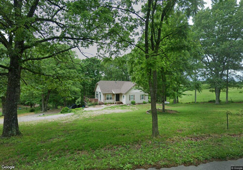
1935 Day Rd Walnut Shade, MO 65771
Estimated Value: $296,854 - $658,000
Studio
--
Bath
1,562
Sq Ft
$284/Sq Ft
Est. Value
About This Home
This home is located at 1935 Day Rd, Walnut Shade, MO 65771 and is currently estimated at $443,714, approximately $284 per square foot. 1935 Day Rd is a home located in Taney County with nearby schools including Buchanan Intermediate School, Buchanan Elementary School, and Branson Junior High School.
Ownership History
Date
Name
Owned For
Owner Type
Purchase Details
Closed on
Jan 8, 2025
Sold by
Blansit James Derek
Bought by
Rein Kody and Rein Jessyka
Current Estimated Value
Purchase Details
Closed on
Aug 25, 2021
Sold by
Walker Johnny O and Walker Georgetta J
Bought by
Johnny O Walker And Georgetta J Walker Revoca and Walker Georgetta
Purchase Details
Closed on
Apr 25, 2013
Sold by
Crockett Laura Ann and Blansit Laura Ann
Bought by
Blansit James Derek
Purchase Details
Closed on
Jul 21, 2006
Sold by
Blansit Jim and Blansit Lois
Bought by
Blansit James D and Blansit Laura A
Create a Home Valuation Report for This Property
The Home Valuation Report is an in-depth analysis detailing your home's value as well as a comparison with similar homes in the area
Purchase History
| Date | Buyer | Sale Price | Title Company |
|---|---|---|---|
| Rein Kody | -- | None Listed On Document | |
| Johnny O Walker And Georgetta J Walker Revoca | -- | None Listed On Document | |
| Blansit James Derek | -- | None Available | |
| Blansit James D | -- | -- |
Source: Public Records
Tax History
| Year | Tax Paid | Tax Assessment Tax Assessment Total Assessment is a certain percentage of the fair market value that is determined by local assessors to be the total taxable value of land and additions on the property. | Land | Improvement |
|---|---|---|---|---|
| 2025 | $2,579 | $25,750 | -- | -- |
| 2023 | $2,579 | $29,350 | -- | -- |
| 2022 | $1,480 | $29,350 | $0 | $0 |
| 2021 | $1,472 | $29,350 | $0 | $0 |
| 2019 | $1,325 | $25,750 | $0 | $0 |
| 2018 | $1,327 | $25,750 | $0 | $0 |
| 2017 | $1,314 | $25,750 | $0 | $0 |
| 2016 | $1,311 | $25,750 | $0 | $0 |
| 2015 | $1,300 | $25,750 | $0 | $0 |
| 2014 | $1,078 | $22,310 | $0 | $0 |
Source: Public Records
Map
Nearby Homes
- Reno Springs Rd
- 500 Briggs Rd
- 710 Hilltop Vista Rd
- 168 Brookside Dr
- 145 Appaloosa Trail
- 149 Appaloosa Trail
- 150 White Oak
- 181 White Oak Cir
- 6041 Highway 65
- 186 Jacks Hollow Rd
- 300 Ridgecrest Dr
- 200 Jacks Hollow Rd
- 220 Jacks Hollow Rd
- 53 Mustang Draw Unit 3.45+/- Acres!
- 259 Jacks Hollow Rd
- 260 Gabby Ln
- Lot 2 Arabian Way
- Lot 14 Appaloosa Trail
- 109 Cedar Bluff
- 109 Appaloosa Trail
Your Personal Tour Guide
Ask me questions while you tour the home.