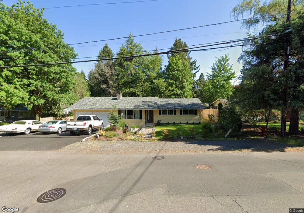
1935 Fernwood Dr Lake Oswego, OR 97034
Palisades NeighborhoodEstimated Value: $785,000 - $918,000
4
Beds
3
Baths
2,100
Sq Ft
$408/Sq Ft
Est. Value
About This Home
This home is located at 1935 Fernwood Dr, Lake Oswego, OR 97034 and is currently estimated at $857,632, approximately $408 per square foot. 1935 Fernwood Dr is a home located in Clackamas County with nearby schools including Hallinan Elementary School, Lakeridge Middle School, and Lakeridge High School.
Ownership History
Date
Name
Owned For
Owner Type
Purchase Details
Closed on
Dec 29, 2016
Sold by
Tahran Rodney L
Bought by
Tahran Rodney Loren and The Rodney Loren Tahran Living Trust
Current Estimated Value
Home Financials for this Owner
Home Financials are based on the most recent Mortgage that was taken out on this home.
Original Mortgage
$364,000
Outstanding Balance
$293,147
Interest Rate
3.52%
Mortgage Type
New Conventional
Estimated Equity
$564,485
Purchase Details
Closed on
Nov 30, 2016
Sold by
Bullock Stephen C and Bullock Zohre
Bought by
Tahran Rodney L
Home Financials for this Owner
Home Financials are based on the most recent Mortgage that was taken out on this home.
Original Mortgage
$364,000
Outstanding Balance
$293,147
Interest Rate
3.52%
Mortgage Type
New Conventional
Estimated Equity
$564,485
Create a Home Valuation Report for This Property
The Home Valuation Report is an in-depth analysis detailing your home's value as well as a comparison with similar homes in the area
Home Values in the Area
Average Home Value in this Area
Purchase History
| Date | Buyer | Sale Price | Title Company |
|---|---|---|---|
| Tahran Rodney Loren | -- | Fidelity Natl Title Oregon | |
| Tahran Rodney L | $455,000 | Fidelity Natl Title Of Or |
Source: Public Records
Mortgage History
| Date | Status | Borrower | Loan Amount |
|---|---|---|---|
| Open | Tahran Rodney L | $364,000 |
Source: Public Records
Tax History Compared to Growth
Tax History
| Year | Tax Paid | Tax Assessment Tax Assessment Total Assessment is a certain percentage of the fair market value that is determined by local assessors to be the total taxable value of land and additions on the property. | Land | Improvement |
|---|---|---|---|---|
| 2025 | $6,808 | $354,520 | -- | -- |
| 2024 | $6,627 | $344,195 | -- | -- |
| 2023 | $6,627 | $334,170 | $0 | $0 |
| 2022 | $6,241 | $324,437 | $0 | $0 |
| 2021 | $5,765 | $314,988 | $0 | $0 |
| 2020 | $5,620 | $305,814 | $0 | $0 |
| 2019 | $5,481 | $296,907 | $0 | $0 |
| 2018 | $5,213 | $288,259 | $0 | $0 |
| 2017 | $5,030 | $279,863 | $0 | $0 |
| 2016 | $4,579 | $271,712 | $0 | $0 |
| 2015 | $4,424 | $263,798 | $0 | $0 |
| 2014 | $4,367 | $256,115 | $0 | $0 |
Source: Public Records
Map
Nearby Homes
- 1951 Greentree Rd
- 2306 Mayors Ln
- 2255 Glen Haven Rd
- 1931 Park Forest Ct
- 0 S Shore Blvd
- 1847 Woodland Terrace
- 17958 Saint Clair Dr
- 2627 Park Rd
- 16878 Canyon Dr
- 17901 Hillside Dr
- 1467 Greentree Cir
- 17360 Alpine Way
- 1410 Woodland Terrace
- 17035 Westview Dr
- 731 Clara Ct
- 17677 Westview Dr
- 1300 Tyndall Ct
- 1224 Tyndall Ct
- 1093 Tyndall Ct
- 1520 Cherry Crest Ave
- 1865 Fernwood Dr
- 1988 Mapleleaf Rd
- 1948 Mapleleaf Rd
- 1875 Fernwood Dr
- 1940 Mapleleaf Rd
- 1940 Mapleaf
- 2102 Fernwood Dr
- 1890 Fernwood Dr
- 1931 Mapleleaf Ct
- 1932 Mapleleaf Rd
- 1835 Fernwood Dr
- 2100 Fernwood Dr
- 1880 Fernwood Dr
- 1975 Mapleleaf Rd
- 1981 Mapleleaf Rd
- 1924 Mapleleaf Rd
- 1931 Mapleleaf Rd
- 2001 Mapleleaf Rd
- 17401 Treetop Ln
- 1840 Cloverleaf Rd