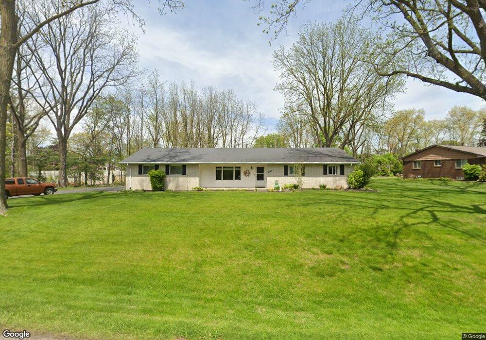
1935 Kemp Rd Bloomfield Hills, MI 48302
Estimated Value: $364,253 - $439,000
3
Beds
3
Baths
1,733
Sq Ft
$233/Sq Ft
Est. Value
About This Home
This home is located at 1935 Kemp Rd, Bloomfield Hills, MI 48302 and is currently estimated at $404,063, approximately $233 per square foot. 1935 Kemp Rd is a home located in Oakland County with nearby schools including Walt Whitman Elementary School, Pontiac Middle School, and Pontiac High School.
Ownership History
Date
Name
Owned For
Owner Type
Purchase Details
Closed on
Mar 15, 2011
Sold by
Eileen M Nelles Revocable Living Trust and Nelles Lori Ann
Bought by
Avery Ricky D and Avery Yvonne M
Current Estimated Value
Home Financials for this Owner
Home Financials are based on the most recent Mortgage that was taken out on this home.
Original Mortgage
$64,900
Outstanding Balance
$45,114
Interest Rate
5.04%
Mortgage Type
New Conventional
Estimated Equity
$358,949
Purchase Details
Closed on
Nov 12, 2007
Sold by
Nelles Eileen M and Estate Of Mark Andrew Nelles
Bought by
Eileen M Nelles Revocable Living Trust and Nelles Eileen M
Create a Home Valuation Report for This Property
The Home Valuation Report is an in-depth analysis detailing your home's value as well as a comparison with similar homes in the area
Home Values in the Area
Average Home Value in this Area
Purchase History
| Date | Buyer | Sale Price | Title Company |
|---|---|---|---|
| Avery Ricky D | $139,900 | Metro Hills Title Agency Llc | |
| Eileen M Nelles Revocable Living Trust | -- | None Available |
Source: Public Records
Mortgage History
| Date | Status | Borrower | Loan Amount |
|---|---|---|---|
| Open | Avery Ricky D | $64,900 |
Source: Public Records
Tax History Compared to Growth
Tax History
| Year | Tax Paid | Tax Assessment Tax Assessment Total Assessment is a certain percentage of the fair market value that is determined by local assessors to be the total taxable value of land and additions on the property. | Land | Improvement |
|---|---|---|---|---|
| 2024 | $1,562 | $145,430 | $0 | $0 |
| 2023 | $1,490 | $132,660 | $0 | $0 |
| 2022 | $2,544 | $128,780 | $0 | $0 |
| 2021 | $2,486 | $131,130 | $0 | $0 |
| 2020 | $1,372 | $138,410 | $0 | $0 |
| 2019 | $2,436 | $133,450 | $0 | $0 |
| 2018 | $2,396 | $123,810 | $0 | $0 |
| 2017 | $2,360 | $122,100 | $0 | $0 |
| 2016 | $2,357 | $120,740 | $0 | $0 |
| 2015 | -- | $114,130 | $0 | $0 |
| 2014 | -- | $92,460 | $0 | $0 |
| 2011 | -- | $90,830 | $0 | $0 |
Source: Public Records
Map
Nearby Homes
- 1785 Ward Rd
- 1253 Atkinson Ave
- 1160 Dorchester Ave
- 0000 Ward Road Ward Rd
- 1061 Dorchester Ave
- 1205 Leinbach Ave
- 1675 Dell Rose Dr
- 1968 Maplewood Ave
- 1947 Maplewood Ave
- 1796 Briarcliff St
- 1075 Canterbury Dr
- 2216 Middlebelt Rd
- 2230 Middlebelt Rd
- 49 Canal Dr Unit 300-049
- 2468 Walce Dr
- 2084 Woodrow Wilson Blvd Unit A6
- 21 Canal Dr Unit 300-021
- 25 Riverbank Dr Unit 300-125
- 27 Riverbank Dr Unit 300-127
- 1775 Woodland Ave
- 1951 Kemp Rd
- 1921 Lakewind Dr
- 1956 E Hammond Lake Dr
- 1901 Kemp Rd
- 1939 Ward Rd
- 1895 Ward Rd
- 1967 Kemp Rd
- 1941 Lakewind Dr
- 1871 Ward Rd
- 1965 Lakeward Ln
- 1983 Kemp Rd
- 1970 E Hammond Lake Dr
- 1963 E Hammond Lake Dr
- 1991 Lakeward Ln
- 1888 Lakewind Dr
- 1890 Ward Rd
- 1864 Lakewind Dr
- 1910 Ward Rd
- 1932 Ward Rd
- 2018 Kemp Rd