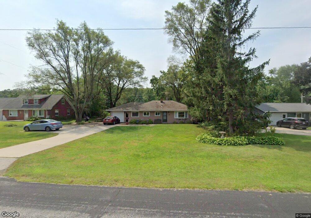
1935 Maple Dale Rd West Bend, WI 53090
Estimated Value: $305,000 - $492,000
--
Bed
--
Bath
--
Sq Ft
0.27
Acres
About This Home
This home is located at 1935 Maple Dale Rd, West Bend, WI 53090 and is currently estimated at $368,920. 1935 Maple Dale Rd is a home located in Washington County with nearby schools including Fair Park Elementary School, Badger Middle School, and East High School.
Ownership History
Date
Name
Owned For
Owner Type
Purchase Details
Closed on
Feb 17, 2012
Sold by
Greenspan Joseph
Bought by
Gaarder Thomas M
Current Estimated Value
Home Financials for this Owner
Home Financials are based on the most recent Mortgage that was taken out on this home.
Original Mortgage
$146,099
Outstanding Balance
$101,803
Interest Rate
4.25%
Mortgage Type
FHA
Estimated Equity
$267,117
Purchase Details
Closed on
Feb 17, 2011
Sold by
The Bank Of New York Mellson Trust
Bought by
Greenspan Joseph
Purchase Details
Closed on
Jun 23, 2010
Sold by
Tearney Timothy W
Bought by
Bank Of New York Trust Company Na and Jpmorgan Chase Bank Na
Create a Home Valuation Report for This Property
The Home Valuation Report is an in-depth analysis detailing your home's value as well as a comparison with similar homes in the area
Home Values in the Area
Average Home Value in this Area
Purchase History
| Date | Buyer | Sale Price | Title Company |
|---|---|---|---|
| Gaarder Thomas M | $149,900 | None Available | |
| Greenspan Joseph | $65,100 | First American Title Insuran | |
| Bank Of New York Trust Company Na | -- | None Available |
Source: Public Records
Mortgage History
| Date | Status | Borrower | Loan Amount |
|---|---|---|---|
| Open | Gaarder Thomas M | $146,099 |
Source: Public Records
Tax History Compared to Growth
Tax History
| Year | Tax Paid | Tax Assessment Tax Assessment Total Assessment is a certain percentage of the fair market value that is determined by local assessors to be the total taxable value of land and additions on the property. | Land | Improvement |
|---|---|---|---|---|
| 2024 | $2,162 | $248,300 | $50,800 | $197,500 |
| 2023 | $1,853 | $193,300 | $42,300 | $151,000 |
| 2022 | $2,049 | $193,300 | $42,300 | $151,000 |
| 2021 | $2,063 | $193,300 | $42,300 | $151,000 |
| 2020 | $2,065 | $155,900 | $40,500 | $115,400 |
| 2019 | $1,828 | $155,900 | $40,500 | $115,400 |
| 2018 | $1,915 | $155,900 | $40,500 | $115,400 |
| 2017 | $1,927 | $155,900 | $40,500 | $115,400 |
| 2016 | $1,974 | $152,800 | $40,500 | $112,300 |
| 2015 | $2,054 | $152,800 | $40,500 | $112,300 |
| 2014 | $2,054 | $152,800 | $40,500 | $112,300 |
| 2013 | $2,217 | $173,900 | $50,400 | $123,500 |
Source: Public Records
Map
Nearby Homes
- 1953 Birch Terrace
- 6819 Eastwood Trail
- 2016 Davids View
- 2008 Davids View
- 6905 Jamestown Ct
- Lt4 Wallace Lake Rd
- 1650 Vivian Ct
- 1606 Vivian Ct
- 7071 N Trenton Rd
- 2161 Wallace Lake Rd
- 2350 E Sandy Acre Rd
- 2181 Wallace Lake Rd
- 1927 Daisy Dr
- 925 Lenora Ct
- 1933 Deerfield Dr
- Lt2 N River Rd
- Lt3 N River Rd
- Lt1 N River Rd
- 2171 Wallace Lake Rd
- 1363 Legion Cir
- 1925 Maple Dale Rd Unit 1927
- 1943 Maple Dale Rd
- 1944 Birch Terrace
- 1928 Birch Terrace
- 1951 Maple Dale Rd
- 1919 Maple Dale Rd
- 1932 Maple Dale Rd
- 1952 Birch Terrace
- 1939 Birch Terrace
- 1944 Maple Dale Rd
- 1926 Maple Dale Rd
- 1950 Maple Dale Rd
- 1918 Maple Dale Rd
- 1961 Maple Dale Rd Unit 1959
- 1925 Birch Terrace
- 1907 Maple Dale Rd Unit 1909
- 1923 Beck Ln S
- 1947 Birch Terrace
- 1935 Beck Ln S
- 1966 Birch Terrace