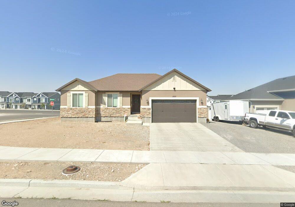
1935 N 350 E Tooele, UT 84074
Estimated Value: $441,000 - $490,000
3
Beds
2
Baths
2,668
Sq Ft
$176/Sq Ft
Est. Value
About This Home
This home is located at 1935 N 350 E, Tooele, UT 84074 and is currently estimated at $469,801, approximately $176 per square foot. 1935 N 350 E is a home located in Tooele County with nearby schools including Copper Canyon Elementary School, Clarke N. Johnsen Junior High School, and Stansbury High School.
Ownership History
Date
Name
Owned For
Owner Type
Purchase Details
Closed on
Dec 26, 2018
Sold by
Mountain Vista Development Inc
Bought by
Gochis Matthew
Current Estimated Value
Home Financials for this Owner
Home Financials are based on the most recent Mortgage that was taken out on this home.
Original Mortgage
$264,430
Outstanding Balance
$233,433
Interest Rate
4.9%
Mortgage Type
FHA
Estimated Equity
$236,368
Purchase Details
Closed on
Aug 2, 2018
Sold by
Canyon Village Rust Llc
Bought by
Mountain Vista Development Inc
Home Financials for this Owner
Home Financials are based on the most recent Mortgage that was taken out on this home.
Original Mortgage
$215,200
Interest Rate
4.5%
Mortgage Type
Construction
Create a Home Valuation Report for This Property
The Home Valuation Report is an in-depth analysis detailing your home's value as well as a comparison with similar homes in the area
Home Values in the Area
Average Home Value in this Area
Purchase History
| Date | Buyer | Sale Price | Title Company |
|---|---|---|---|
| Gochis Matthew | -- | Sutherland Title Company | |
| Mountain Vista Development Inc | -- | Monument Title Insurance Inc |
Source: Public Records
Mortgage History
| Date | Status | Borrower | Loan Amount |
|---|---|---|---|
| Open | Gochis Matthew | $264,430 | |
| Previous Owner | Mountain Vista Development Inc | $215,200 |
Source: Public Records
Tax History Compared to Growth
Tax History
| Year | Tax Paid | Tax Assessment Tax Assessment Total Assessment is a certain percentage of the fair market value that is determined by local assessors to be the total taxable value of land and additions on the property. | Land | Improvement |
|---|---|---|---|---|
| 2025 | $3,008 | $456,177 | $100,000 | $356,177 |
| 2024 | $3,272 | $249,740 | $55,000 | $194,740 |
| 2023 | $3,272 | $263,864 | $52,383 | $211,481 |
| 2022 | $2,906 | $250,045 | $51,906 | $198,139 |
| 2021 | $2,106 | $151,534 | $20,763 | $130,771 |
| 2020 | $2,066 | $257,904 | $37,750 | $220,154 |
| 2019 | $2,100 | $257,904 | $37,750 | $220,154 |
| 2018 | $625 | $40,000 | $40,000 | $0 |
| 2017 | $0 | $0 | $0 | $0 |
Source: Public Records
Map
Nearby Homes
- 1917 N Blue Iris Ave Unit 1090
- Dalton Plan at Western Acres
- Millbrook Plan at Western Acres
- Pioneer B (Mid Unit) Plan at Western Acres
- Oakridge Plan at Western Acres
- Pioneer A (End Unit) Plan at Western Acres
- 1760 N Patchwork Ave Unit 1257
- 1719 N Patchwork Ave Unit 1270
- 1764 N Patchwork Ave Unit 1256
- 1723 N Patchwork Ave Unit 1269
- 1715 Copper Canyon Dr Unit 1280
- 1711 Copper Canyon Dr Unit 1279
- 1707 Copper Canyon Dr Unit 1278
- 277 E Serenity Ave Unit 1009
- 1834 N 370 E
- 203 E Serenity Ave Unit 1214
- 1721 Copper Canyon Dr Unit 1282
- 1725 Copper Canyon Dr Unit 1283
- 1833 N Blue Iris Ave Unit 1073
- 348 1770 N
- 1951 N 350 E
- 1932 N 350 E
- 1969 N 350 E
- 1969 N 350 E Unit 201
- 1918 N 350 E
- 1956 N Blue Iris Ave Unit 1029
- 356 E 1970 N
- 1891 Canyon Rd
- 1908 N 350 E
- 1906 N Blue Iris Ave Unit 1035
- 362 E 1970 N
- 1931 N 370 E
- 1892 N 350 E
- 1917 N 370 E
- 366 E 1970 N
- 359 E 1970 N
- 1909 N 370 E
- 361 E 1970 N
- 1895 N 370 E
- 1878 N 350 E Unit 107