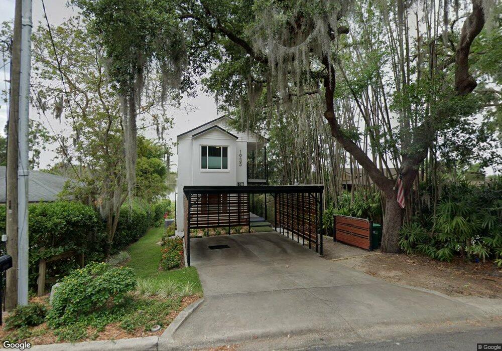
1935 Overlook Dr Mount Dora, FL 32757
Estimated Value: $476,000 - $620,000
2
Beds
2
Baths
1,854
Sq Ft
$291/Sq Ft
Est. Value
About This Home
This home is located at 1935 Overlook Dr, Mount Dora, FL 32757 and is currently estimated at $540,407, approximately $291 per square foot. 1935 Overlook Dr is a home located in Lake County with nearby schools including Triangle Elementary School, Mt. Dora Middle School, and Mt. Dora High School.
Ownership History
Date
Name
Owned For
Owner Type
Purchase Details
Closed on
Oct 24, 2024
Sold by
Watson Kimberly
Bought by
Mobpif Llc
Current Estimated Value
Purchase Details
Closed on
Sep 6, 2023
Sold by
Watson Kimberly and Cuddeback Jeffrey B
Bought by
Watson Kimberly
Purchase Details
Closed on
Mar 2, 2020
Sold by
Shooker Clifford
Bought by
Mobpif Llc
Purchase Details
Closed on
May 26, 1995
Sold by
Gamache Duane J and Gamache Rachel J
Bought by
Shooker Clifford
Create a Home Valuation Report for This Property
The Home Valuation Report is an in-depth analysis detailing your home's value as well as a comparison with similar homes in the area
Home Values in the Area
Average Home Value in this Area
Purchase History
| Date | Buyer | Sale Price | Title Company |
|---|---|---|---|
| Mobpif Llc | $100 | None Listed On Document | |
| Watson Kimberly | $100 | None Listed On Document | |
| Mobpif Llc | $335,875 | Attorney | |
| Shooker Clifford | $138,500 | -- |
Source: Public Records
Tax History
| Year | Tax Paid | Tax Assessment Tax Assessment Total Assessment is a certain percentage of the fair market value that is determined by local assessors to be the total taxable value of land and additions on the property. | Land | Improvement |
|---|---|---|---|---|
| 2026 | $7,673 | $441,876 | $199,500 | $242,376 |
| 2025 | $6,941 | $394,998 | $156,750 | $238,248 |
| 2024 | $6,941 | $394,998 | $156,750 | $238,248 |
| 2023 | $6,941 | $380,130 | $156,750 | $223,380 |
| 2022 | $6,684 | $380,130 | $156,750 | $223,380 |
| 2021 | $5,760 | $296,826 | $0 | $0 |
| 2020 | $3,524 | $209,041 | $0 | $0 |
| 2019 | $3,253 | $191,145 | $0 | $0 |
| 2018 | $3,143 | $187,581 | $0 | $0 |
| 2017 | $2,911 | $183,723 | $0 | $0 |
| 2016 | $2,840 | $179,945 | $0 | $0 |
| 2015 | $2,891 | $178,695 | $0 | $0 |
| 2014 | $2,831 | $177,277 | $0 | $0 |
Source: Public Records
Map
Nearby Homes
- 1824 Crestview Dr
- 809 Northside Dr
- 1765 Hilltop Dr
- 1630 Crestview Dr
- 576 Casey Loop
- 2312 Hillside Dr
- 1438 Crestview Dr
- 2314 Hillside Dr
- 611 Old Eustis Rd
- 1405 Hilltop Dr
- 407 Forest Rd
- 2108 Dogwood Cir
- 333 Forest Rd
- 654 James Moore Dr
- 2115 Oak Leaf Cir
- 1780 Sylvan Point Dr
- 995 W 11th Ave
- 1212 Hilltop Dr
- 1321 Heim Rd
- 1211 W Old Us Highway 441
- 1925 Overlook Dr
- 1945 Overlook Dr
- 927 Northside Dr
- 1924 Overlook Dr
- 1909 Overlook Dr
- 1854 Overlook Dr
- 2055 Overlook Dr
- 1843 Overlook Dr
- 1848 Overlook Dr
- 921 Northside Dr
- 1844 Overlook Dr
- 936 Northside Dr
- 2085 Overlook Dr
- 1833 Overlook Dr
- 926 Northside Dr
- 1826 Overlook Dr
- 922 Northside Dr
- 915 Northside Dr
- 916 Northside Dr
- 1825 Normandy Dr
Your Personal Tour Guide
Ask me questions while you tour the home.