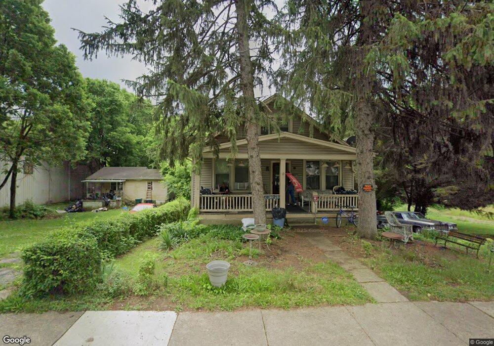
1935 Powers St Cincinnati, OH 45223
South Cumminsville NeighborhoodEstimated Value: $88,000 - $146,000
2
Beds
2
Baths
1,279
Sq Ft
$84/Sq Ft
Est. Value
About This Home
This home is located at 1935 Powers St, Cincinnati, OH 45223 and is currently estimated at $107,946, approximately $84 per square foot. 1935 Powers St is a home located in Hamilton County with nearby schools including Ethel M. Taylor Academy, Robert A. Taft Information Technology High School, and Western Hills High School.
Ownership History
Date
Name
Owned For
Owner Type
Purchase Details
Closed on
Aug 6, 2015
Sold by
Kreyling Bernard J
Bought by
Hutton Jo Ann
Current Estimated Value
Purchase Details
Closed on
Jul 13, 1999
Sold by
Kreyling Bernard
Bought by
Kreyling Bernard A and Kreyling Roselyn C
Create a Home Valuation Report for This Property
The Home Valuation Report is an in-depth analysis detailing your home's value as well as a comparison with similar homes in the area
Home Values in the Area
Average Home Value in this Area
Purchase History
We collect this data history from publicly available records. To have your information removed, we recommend requesting removal directly through your county’s website.
| Date | Buyer | Sale Price | Title Company |
|---|---|---|---|
| Hutton Jo Ann | -- | Attorney | |
| Kreyling Bernard A | -- | -- |
Source: Public Records
Tax History
| Year | Tax Paid | Tax Assessment Tax Assessment Total Assessment is a certain percentage of the fair market value that is determined by local assessors to be the total taxable value of land and additions on the property. | Land | Improvement |
|---|---|---|---|---|
| 2025 | $909 | $13,392 | $3,049 | $10,343 |
| 2024 | $883 | $13,392 | $3,049 | $10,343 |
| 2023 | $902 | $13,392 | $3,049 | $10,343 |
| 2022 | $371 | $4,201 | $3,049 | $1,152 |
| 2021 | $333 | $4,201 | $3,049 | $1,152 |
| 2020 | $341 | $4,201 | $3,049 | $1,152 |
| 2019 | $368 | $4,201 | $3,049 | $1,152 |
| 2018 | $368 | $4,201 | $3,049 | $1,152 |
| 2017 | $347 | $4,201 | $3,049 | $1,152 |
| 2016 | $845 | $11,158 | $3,059 | $8,099 |
| 2015 | $195 | $11,158 | $3,059 | $8,099 |
| 2014 | $197 | $11,158 | $3,059 | $8,099 |
| 2013 | $235 | $11,746 | $3,220 | $8,526 |
Source: Public Records
Map
Nearby Homes
- 1932 Powers St
- 1930 Powers St
- 2784 Cass Ave
- 3923 Cass Ave
- 1817 Elmore St
- 3918 Tappan Ave
- 3813 Borden St
- 1785 Townsend St
- 1771 Townsend St
- 4034 Colerain Ave
- 4210 Colerain Ave
- 4270 Colerain Ave
- 4114 Gordon St
- 1763 Hanfield St
- 4140 Kirby Ave
- 4411 Colerain Ave
- 1619 Burgoyne St
- 1616 Elmore St
- 1619 Powers St
- 1801 Chase Ave
- 1933 Powers St
- 1934 Powers St
- 3838 Herron Ave
- 3832 Herron Ave
- 3900 Sylvan Ave
- 3836 Herron Ave
- 3842 Herron Ave
- 3820 Herron Ave
- 3900 Herron Ave
- 3818 Herron Ave
- 3906 Herron Ave
- 3843 Herron Ave
- 3835 Herron Ave
- 3837 Herron Ave
- 3829 Herron Ave
- 3841 Herron Ave
- 3901 Herron Ave Unit 2
- 3901 Herron Ave
- 3901 Herron Ave
- 3901 Herron Ave Unit 1
Your Personal Tour Guide
Ask me questions while you tour the home.