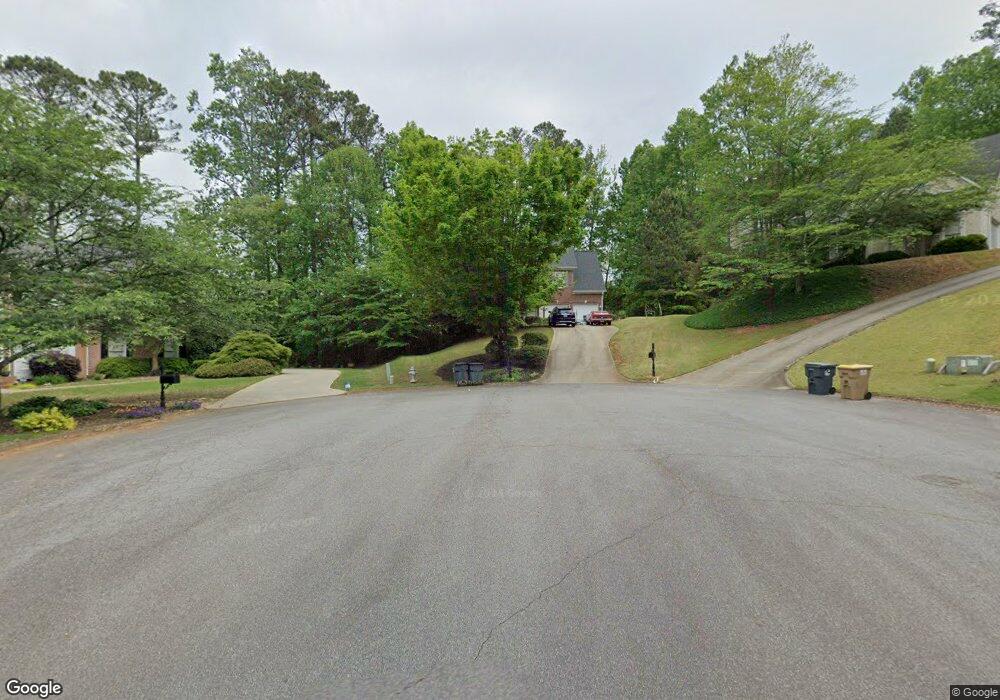
1935 Ravenswood Ct Cumming, GA 30040
Estimated Value: $553,000 - $587,000
4
Beds
3
Baths
2,096
Sq Ft
$271/Sq Ft
Est. Value
About This Home
This home is located at 1935 Ravenswood Ct, Cumming, GA 30040 and is currently estimated at $568,627, approximately $271 per square foot. 1935 Ravenswood Ct is a home located in Forsyth County with nearby schools including Kelly Mill Elementary School, Forsyth Central High School, and Milton Montessori School.
Ownership History
Date
Name
Owned For
Owner Type
Purchase Details
Closed on
Dec 7, 2000
Sold by
Derezinski Marie
Bought by
Taylor Patrick A and Taylor Holli
Current Estimated Value
Home Financials for this Owner
Home Financials are based on the most recent Mortgage that was taken out on this home.
Original Mortgage
$137,192
Interest Rate
7.72%
Mortgage Type
New Conventional
Purchase Details
Closed on
Nov 19, 1999
Sold by
Derezinski Walter
Bought by
Derezinski Holli M
Purchase Details
Closed on
Jul 10, 1998
Sold by
Sharp Devel
Bought by
Derezinski Walter and Derezinski Holli M
Home Financials for this Owner
Home Financials are based on the most recent Mortgage that was taken out on this home.
Original Mortgage
$145,670
Interest Rate
7.04%
Mortgage Type
New Conventional
Create a Home Valuation Report for This Property
The Home Valuation Report is an in-depth analysis detailing your home's value as well as a comparison with similar homes in the area
Home Values in the Area
Average Home Value in this Area
Purchase History
| Date | Buyer | Sale Price | Title Company |
|---|---|---|---|
| Taylor Patrick A | -- | -- | |
| Derezinski Holli M | -- | -- | |
| Derezinski Walter | $182,100 | -- |
Source: Public Records
Mortgage History
| Date | Status | Borrower | Loan Amount |
|---|---|---|---|
| Closed | Taylor Patrick A | $137,192 | |
| Previous Owner | Derezinski Walter | $145,670 |
Source: Public Records
Tax History Compared to Growth
Tax History
| Year | Tax Paid | Tax Assessment Tax Assessment Total Assessment is a certain percentage of the fair market value that is determined by local assessors to be the total taxable value of land and additions on the property. | Land | Improvement |
|---|---|---|---|---|
| 2025 | $4,455 | $229,292 | $64,000 | $165,292 |
| 2024 | $4,455 | $231,044 | $60,000 | $171,044 |
| 2023 | $3,810 | $212,992 | $60,000 | $152,992 |
| 2022 | $3,895 | $146,260 | $32,000 | $114,260 |
| 2021 | $3,468 | $146,260 | $32,000 | $114,260 |
| 2020 | $3,051 | $126,084 | $30,000 | $96,084 |
| 2019 | $2,884 | $120,948 | $28,000 | $92,948 |
| 2018 | $2,758 | $113,928 | $28,000 | $85,928 |
| 2017 | $2,551 | $103,588 | $28,000 | $75,588 |
| 2016 | $2,466 | $99,588 | $24,000 | $75,588 |
| 2015 | $2,386 | $95,588 | $20,000 | $75,588 |
| 2014 | $2,130 | $89,212 | $0 | $0 |
Source: Public Records
Map
Nearby Homes
- 1930 Ravenswood Ct
- 1925 Ravenswood Ct
- 1650 Fox Hill Ln Unit 5
- 1650 Fox Hill Ln
- 1660 Fox Hill Ln Unit 6
- 1660 Fox Hill Ln Unit 6
- 1660 Fox Hill Ln
- 1920 Ravenswood Ct
- 1670 Fox Hill Ln Unit 7
- 1670 Fox Hill Ln Unit 7
- 1670 Fox Hill Ln
- 1670 Fox Hill Ln
- 0 Ravenswood Ct Unit 7497875
- 0 Ravenswood Ct Unit 7456301
- 0 Ravenswood Ct
- 1915 Ravenswood Ct
- 2195 Eagle Trace
- 2185 Eagle Trace
- 1640 Fox Hill Ln Unit 4
- 1640 Fox Hill Ln