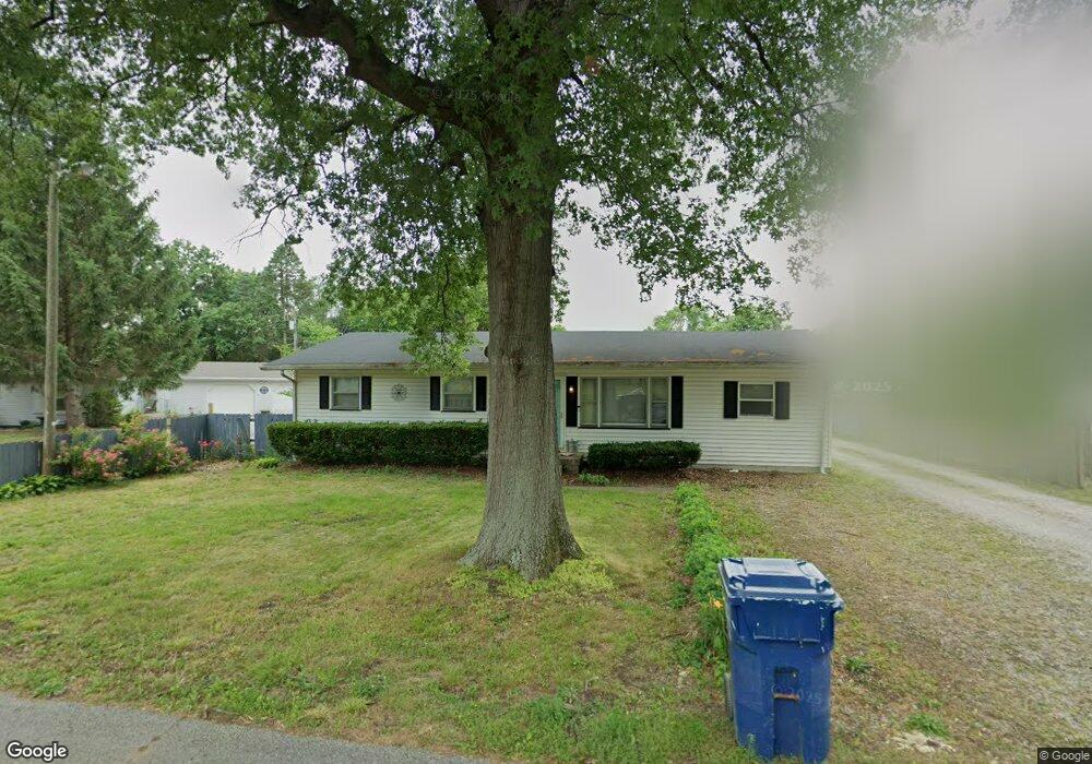
1935 S 22nd St Terre Haute, IN 47802
Sugar Grove-Indian Acres NeighborhoodEstimated Value: $86,000 - $168,000
3
Beds
1
Bath
1,372
Sq Ft
$101/Sq Ft
Est. Value
About This Home
This home is located at 1935 S 22nd St, Terre Haute, IN 47802 and is currently estimated at $137,943, approximately $100 per square foot. 1935 S 22nd St is a home located in Vigo County with nearby schools including Sugar Grove Elementary School, Sarah Scott Middle School, and Terre Haute South Vigo High School.
Ownership History
Date
Name
Owned For
Owner Type
Purchase Details
Closed on
Aug 22, 2019
Sold by
Singer Patricia
Bought by
Bentley Kali M
Current Estimated Value
Home Financials for this Owner
Home Financials are based on the most recent Mortgage that was taken out on this home.
Original Mortgage
$97,206
Outstanding Balance
$85,855
Interest Rate
4.12%
Mortgage Type
FHA
Estimated Equity
$52,088
Purchase Details
Closed on
Jul 24, 2018
Sold by
Gard Harold L and Gard Mildred A
Bought by
Singer Patricia and Singer Jared
Home Financials for this Owner
Home Financials are based on the most recent Mortgage that was taken out on this home.
Original Mortgage
$88,217
Interest Rate
5.62%
Mortgage Type
FHA
Purchase Details
Closed on
May 17, 2013
Sold by
Burns Robert A and Burns Brenda L
Bought by
Gard Harold L and Gard Mildred A
Home Financials for this Owner
Home Financials are based on the most recent Mortgage that was taken out on this home.
Original Mortgage
$6,970
Interest Rate
3.39%
Mortgage Type
New Conventional
Create a Home Valuation Report for This Property
The Home Valuation Report is an in-depth analysis detailing your home's value as well as a comparison with similar homes in the area
Home Values in the Area
Average Home Value in this Area
Purchase History
| Date | Buyer | Sale Price | Title Company |
|---|---|---|---|
| Bentley Kali M | -- | None Available | |
| Singer Patricia | $72,504 | Amrock | |
| Gard Harold L | -- | None Available |
Source: Public Records
Mortgage History
| Date | Status | Borrower | Loan Amount |
|---|---|---|---|
| Open | Bentley Kali M | $97,206 | |
| Previous Owner | Singer Patricia | $88,217 | |
| Previous Owner | Gard Harold L | $6,970 |
Source: Public Records
Tax History Compared to Growth
Tax History
| Year | Tax Paid | Tax Assessment Tax Assessment Total Assessment is a certain percentage of the fair market value that is determined by local assessors to be the total taxable value of land and additions on the property. | Land | Improvement |
|---|---|---|---|---|
| 2024 | $990 | $94,300 | $18,200 | $76,100 |
| 2023 | $961 | $90,700 | $18,200 | $72,500 |
| 2022 | $895 | $86,100 | $18,200 | $67,900 |
| 2021 | $843 | $81,400 | $17,800 | $63,600 |
| 2020 | $830 | $80,200 | $17,500 | $62,700 |
| 2019 | $831 | $78,800 | $17,200 | $61,600 |
| 2018 | $1,149 | $75,800 | $16,500 | $59,300 |
| 2017 | $677 | $73,800 | $15,600 | $58,200 |
| 2016 | $1,480 | $73,800 | $15,600 | $58,200 |
| 2014 | $724 | $71,600 | $15,500 | $56,100 |
| 2013 | $724 | $70,200 | $15,200 | $55,000 |
Source: Public Records
Map
Nearby Homes
- 1941 S 21st St
- 1944 S 19th St
- 1940 S 19th St
- 1810 S 19th St
- 2200 S 23rd St
- 1711 Orin Dr
- 1900 S 25th St
- 1531 S 18th St
- 1530 S 17th St
- 1515 S 18th St
- 2120 Washington Ave
- 2244 Cailynn Dr
- 1335 S 20th St
- 1645 Albert Way
- 1653 Albert Way
- 1660 Albert Way
- 1207 S 20th St
- 1220 S 17th St
- 1810 S 30th St
- 1217 S 17th St