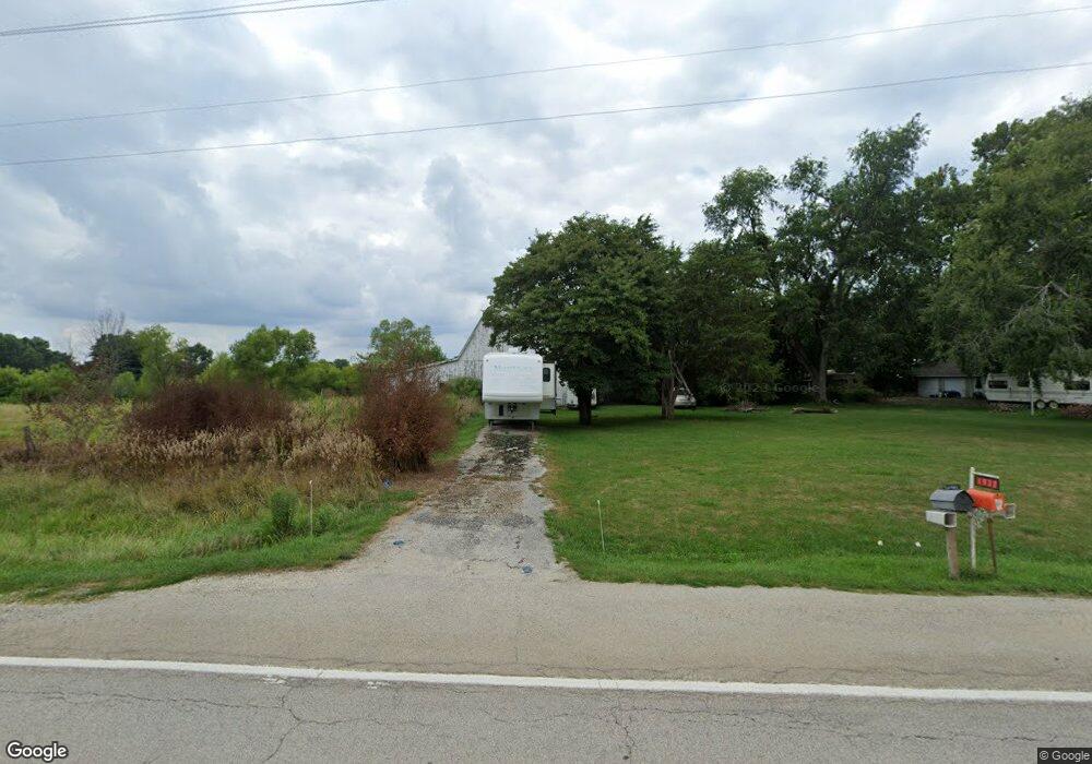
1935 State Highway 78 N Jacksonville, IL 62650
Estimated Value: $106,000 - $168,778
--
Bed
--
Bath
--
Sq Ft
5.81
Acres
About This Home
This home is located at 1935 State Highway 78 N, Jacksonville, IL 62650 and is currently estimated at $142,926. 1935 State Highway 78 N is a home located in Morgan County with nearby schools including Jacksonville High School.
Ownership History
Date
Name
Owned For
Owner Type
Purchase Details
Closed on
Aug 11, 2010
Sold by
Pennell James M and Pennell James L
Bought by
Pennell James M
Current Estimated Value
Home Financials for this Owner
Home Financials are based on the most recent Mortgage that was taken out on this home.
Original Mortgage
$48,000
Interest Rate
4.63%
Mortgage Type
Future Advance Clause Open End Mortgage
Create a Home Valuation Report for This Property
The Home Valuation Report is an in-depth analysis detailing your home's value as well as a comparison with similar homes in the area
Home Values in the Area
Average Home Value in this Area
Purchase History
| Date | Buyer | Sale Price | Title Company |
|---|---|---|---|
| Pennell James M | $63,200 | None Available |
Source: Public Records
Mortgage History
| Date | Status | Borrower | Loan Amount |
|---|---|---|---|
| Closed | Pennell James M | $48,000 |
Source: Public Records
Tax History Compared to Growth
Tax History
| Year | Tax Paid | Tax Assessment Tax Assessment Total Assessment is a certain percentage of the fair market value that is determined by local assessors to be the total taxable value of land and additions on the property. | Land | Improvement |
|---|---|---|---|---|
| 2024 | $2,532 | $34,320 | $6,900 | $27,420 |
| 2023 | $2,518 | $31,200 | $6,270 | $24,930 |
| 2022 | $2,319 | $31,200 | $6,270 | $24,930 |
| 2021 | $1,896 | $26,260 | $5,400 | $20,860 |
| 2020 | $1,869 | $25,270 | $5,400 | $19,870 |
| 2019 | $1,849 | $25,070 | $5,400 | $19,670 |
| 2018 | $1,755 | $24,340 | $5,240 | $19,100 |
| 2017 | $1,702 | $23,870 | $5,140 | $18,730 |
| 2016 | $1,715 | $23,870 | $5,140 | $18,730 |
| 2015 | $1,488 | $20,060 | $4,320 | $15,740 |
| 2014 | $1,488 | $21,360 | $4,240 | $17,120 |
| 2013 | $1,550 | $21,360 | $4,240 | $17,120 |
Source: Public Records
Map
Nearby Homes
- 12 Quail Ln
- 17 Springwater Dr
- 2 Springwater Dr
- 0 Gray Rd
- 70 Applebee Farms Dr
- 6 Fernwood Blvd
- 1001 Cox St
- 840 W Walnut St
- 68 Applebee Farms Dr Unit Apple
- 64 Applebee Farms Dr
- 66 Applebee Farms Dr
- 72 Applebee Farms Dr
- 8 Wadsworth Dr
- 754 Freedman St
- 1 Wadsworth Dr
- None None Ave
- 610 Sandusky St
- 858 N Diamond St
- 617 N East St
- 636 N East St
- 1954 State Highway 78 N
- 1932 State Highway 78 N
- 1918 State Highway 78 N
- 1954 Illinois 78
- 1921 State Highway 78 N
- 2042 Substation Rd
- 2008 Substation Rd
- 2065 Substation Rd
- 2069 Substation Rd
- 10 Springwater Dr
- 12 Springwater Dr
- 1995 State Highway 78 N
- 14 Springwater Dr
- 1889 State Highway 78 N
- 1889 State Highway 78 None
- 10 Quail Ln
- 6 Springwater Dr
- 18 Springwater Dr
- 5 Springwater Dr
- 9 Quail Ln