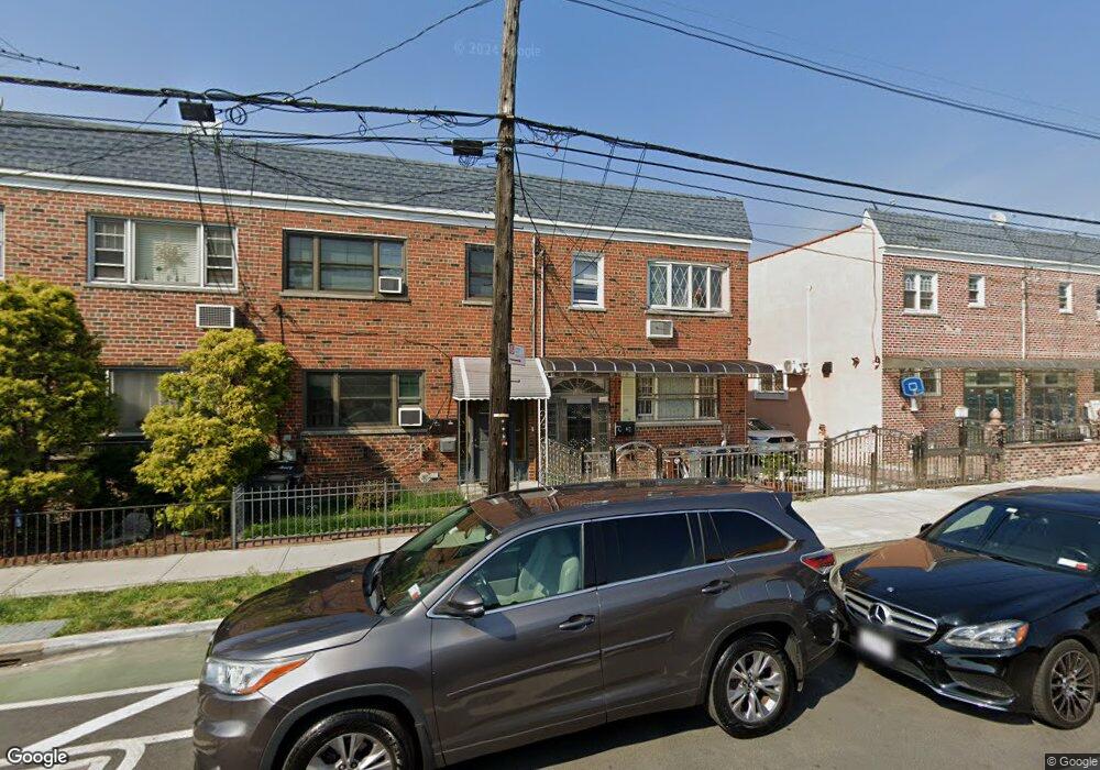
1936 Bronxdale Ave Bronx, NY 10462
Morris Park NeighborhoodEstimated Value: $687,525 - $988,000
--
Bed
--
Bath
1,880
Sq Ft
$458/Sq Ft
Est. Value
About This Home
This home is located at 1936 Bronxdale Ave, Bronx, NY 10462 and is currently estimated at $860,881, approximately $457 per square foot. 1936 Bronxdale Ave is a home located in Bronx County with nearby schools including P.S. 083 The Donald Hertz School, Icahn Charter School 2, and Bronx Excellence 2.
Ownership History
Date
Name
Owned For
Owner Type
Purchase Details
Closed on
Jan 21, 2020
Sold by
Baris and Depascale Ann Marie
Bought by
Baksh Muhammad Akifuzzaman and Islam Athikul
Current Estimated Value
Home Financials for this Owner
Home Financials are based on the most recent Mortgage that was taken out on this home.
Original Mortgage
$584,000
Outstanding Balance
$516,980
Interest Rate
3.7%
Mortgage Type
Unknown
Estimated Equity
$343,901
Purchase Details
Closed on
Aug 21, 2019
Sold by
Baris Michael and Baris-Depascale Ann Marie
Bought by
Baris-Depascale Ann Marie and Depascale Cordie
Create a Home Valuation Report for This Property
The Home Valuation Report is an in-depth analysis detailing your home's value as well as a comparison with similar homes in the area
Home Values in the Area
Average Home Value in this Area
Purchase History
| Date | Buyer | Sale Price | Title Company |
|---|---|---|---|
| Baksh Muhammad Akifuzzaman | $730,000 | -- | |
| Baris-Depascale Ann Marie | -- | -- |
Source: Public Records
Mortgage History
| Date | Status | Borrower | Loan Amount |
|---|---|---|---|
| Open | Baksh Muhammad Akifuzzaman | $584,000 |
Source: Public Records
Tax History Compared to Growth
Tax History
| Year | Tax Paid | Tax Assessment Tax Assessment Total Assessment is a certain percentage of the fair market value that is determined by local assessors to be the total taxable value of land and additions on the property. | Land | Improvement |
|---|---|---|---|---|
| 2025 | $6,239 | $32,928 | $6,035 | $26,893 |
| 2024 | $6,239 | $31,064 | $6,360 | $24,704 |
| 2023 | $5,952 | $29,306 | $6,203 | $23,103 |
| 2022 | $5,519 | $34,140 | $8,280 | $25,860 |
| 2021 | $5,819 | $34,560 | $8,280 | $26,280 |
| 2020 | $5,808 | $38,160 | $8,280 | $29,880 |
| 2019 | $5,415 | $33,900 | $8,280 | $25,620 |
| 2018 | $4,978 | $24,422 | $6,207 | $18,215 |
| 2017 | $4,697 | $23,040 | $8,280 | $14,760 |
| 2016 | $5,017 | $26,648 | $8,136 | $18,512 |
| 2015 | $3,082 | $25,140 | $9,180 | $15,960 |
| 2014 | $3,082 | $24,994 | $9,127 | $15,867 |
Source: Public Records
Map
Nearby Homes
- 1916 Barnes Ave
- 1904 Bronxdale Ave
- 1869 Muliner Ave
- 1907 Barnes Ave
- 1925 Bogart Ave
- 928 Rhinelander Ave
- 1858 Wallace Ave
- 1961 Wallace Ave
- 1914 Holland Ave
- 953 Rhinelander Ave
- 1847 Bronxdale Ave
- 762 Brady Ave Unit 221
- 762 Brady Ave Unit 621
- - Morris Park Ave
- 848 Morris Park Ave
- 758 Brady Ave Unit 411
- 758 Brady Ave Unit 214
- 760 Brady Ave Unit 417
- 760 Brady Ave Unit 117
- 1865 Hunt Ave
- 1938 Bronxdale Ave
- 1934 Bronxdale Ave
- 1940 Bronxdale Ave
- 1932 Bronxdale Ave
- 1932 Daly Ave
- 1942 Bronxdale Ave
- 1913 Muliner Ave
- 1960 Matthews Ave
- 1930 Bronxdale Ave
- 1915 Muliner Ave
- 1917 Muliner Ave
- 1962 Matthews Ave
- 1926 Bronxdale Ave
- 1919 Muliner Ave
- 1919 Muliner Ave Unit 2
- 1964 Matthews Ave
- 1921 Muliner Ave
- 1966 Matthews Ave
- 1922 Bronxdale Ave
- 1923 Muliner Ave