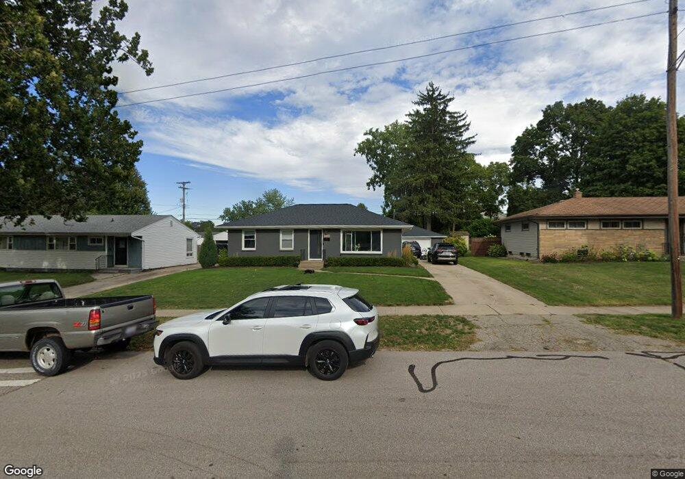
1936 Carlton Ave NE Grand Rapids, MI 49505
North East Citizens Action NeighborhoodEstimated Value: $271,000 - $298,000
--
Bed
--
Bath
1,040
Sq Ft
$272/Sq Ft
Est. Value
About This Home
This home is located at 1936 Carlton Ave NE, Grand Rapids, MI 49505 and is currently estimated at $282,719, approximately $271 per square foot. 1936 Carlton Ave NE is a home located in Kent County with nearby schools including Riverside Middle School, Union High School, and Lighthouse Academy - Waalkes Campus.
Ownership History
Date
Name
Owned For
Owner Type
Purchase Details
Closed on
Sep 25, 2018
Sold by
Visockis Edmunds V and Visockis Vladislaus
Bought by
Laduke Tim
Current Estimated Value
Home Financials for this Owner
Home Financials are based on the most recent Mortgage that was taken out on this home.
Original Mortgage
$145,000
Outstanding Balance
$126,449
Interest Rate
4.5%
Mortgage Type
Future Advance Clause Open End Mortgage
Estimated Equity
$156,270
Purchase Details
Closed on
Oct 25, 2016
Sold by
Visockis Vladislaus
Bought by
Visockis Vladislaus and Visockis Edmunds
Create a Home Valuation Report for This Property
The Home Valuation Report is an in-depth analysis detailing your home's value as well as a comparison with similar homes in the area
Home Values in the Area
Average Home Value in this Area
Purchase History
| Date | Buyer | Sale Price | Title Company |
|---|---|---|---|
| Laduke Tim | $152,000 | Sun Title Agency I | |
| Visockis Vladislaus | -- | Attorney |
Source: Public Records
Mortgage History
| Date | Status | Borrower | Loan Amount |
|---|---|---|---|
| Open | Laduke Tim | $145,000 |
Source: Public Records
Tax History Compared to Growth
Tax History
| Year | Tax Paid | Tax Assessment Tax Assessment Total Assessment is a certain percentage of the fair market value that is determined by local assessors to be the total taxable value of land and additions on the property. | Land | Improvement |
|---|---|---|---|---|
| 2025 | $2,515 | $122,700 | $0 | $0 |
| 2024 | $2,515 | $113,400 | $0 | $0 |
| 2023 | $2,552 | $97,300 | $0 | $0 |
| 2022 | $2,422 | $84,400 | $0 | $0 |
| 2021 | $2,368 | $79,200 | $0 | $0 |
| 2020 | $2,264 | $75,200 | $0 | $0 |
| 2019 | $1,706 | $67,400 | $0 | $0 |
| 2018 | $1,706 | $60,100 | $0 | $0 |
| 2017 | $1,661 | $56,100 | $0 | $0 |
| 2016 | $1,724 | $50,600 | $0 | $0 |
| 2015 | $1,603 | $50,600 | $0 | $0 |
| 2013 | -- | $48,700 | $0 | $0 |
Source: Public Records
Map
Nearby Homes
- 1335 Knapp St NE
- 2027 Joan Ave NE
- 1739 Waldorn Ave NE
- 2100 Dawson Ave NE
- 1824 Herrick Ave NE
- 1666 Carlton Ave NE
- 1119 Kentwood Dr NE
- 1237 Dale Ct NE
- 1444 Sweet St NE
- 1524 Sweet St NE
- 1452 Carlton Ave NE
- 1848 Emerald Ave NE
- 1455 Ball Ave NE
- 1759 Briarcliff Dr NE
- 921 Eleanor St NE
- 1119 Spencer St NE
- 1825 Meadowfield Dr NE
- 2016 Tall Meadow St NE
- 1757 Westlane Dr NE
- 2037 Tall Meadow St NE Unit 13
- 1944 Carlton Ave NE
- 1950 Carlton Ave NE
- 1943 Carlton Ave NE
- 1965 Benjamin Ave NE
- 1916 Carlton Ave NE
- 1384 Knapp St NE
- 1964 Benjamin Ave NE
- 1362 Knapp St NE
- 1919 Carlton Ave NE
- 1908 Carlton Ave NE
- 1356 Knapp St NE
- 1911 Carlton Ave NE
- 1924 Benjamin Ave NE
- 1933 Benjamin Ave NE
- 1900 Carlton Ave NE
- 1350 Knapp St NE
- 1903 Carlton Ave NE
- 1916 Benjamin Ave NE
- 1440 Knapp St NE
- 1931 Benjamin Ave NE