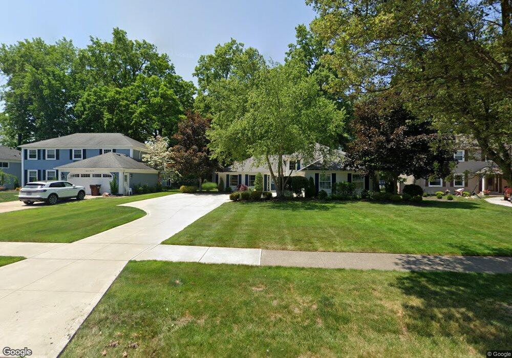
1936 Coes Post Run Westlake, OH 44145
Estimated Value: $464,188 - $513,000
4
Beds
3
Baths
2,690
Sq Ft
$182/Sq Ft
Est. Value
About This Home
This home is located at 1936 Coes Post Run, Westlake, OH 44145 and is currently estimated at $488,797, approximately $181 per square foot. 1936 Coes Post Run is a home located in Cuyahoga County with nearby schools including Dover Intermediate School, Lee Burneson Middle School, and Westlake High School.
Ownership History
Date
Name
Owned For
Owner Type
Purchase Details
Closed on
Apr 6, 2013
Sold by
Vecchione Robert J and Vecchione Mary E
Bought by
Vecchione Mary E
Current Estimated Value
Purchase Details
Closed on
Jul 29, 1992
Sold by
Jereb Fred V
Bought by
Vecchione Robert J
Purchase Details
Closed on
Oct 31, 1988
Bought by
Jereb Fred
Purchase Details
Closed on
Jun 17, 1985
Sold by
Kovacs Albert G and Kovacs Evelyn E
Bought by
National City Bank
Purchase Details
Closed on
Jan 23, 1985
Sold by
Kovacs Evelyn E
Bought by
Kovacs Albert G and Kovacs Evelyn E
Purchase Details
Closed on
Jan 30, 1978
Bought by
Kovacs Evelyn E
Purchase Details
Closed on
Jan 1, 1977
Bought by
Hennie Homes Inc
Create a Home Valuation Report for This Property
The Home Valuation Report is an in-depth analysis detailing your home's value as well as a comparison with similar homes in the area
Home Values in the Area
Average Home Value in this Area
Purchase History
| Date | Buyer | Sale Price | Title Company |
|---|---|---|---|
| Vecchione Mary E | -- | Attorney | |
| Vecchione Robert J | $173,300 | -- | |
| Jereb Fred | $154,000 | -- | |
| National City Bank | $129,000 | -- | |
| Kovacs Albert G | -- | -- | |
| Kovacs Evelyn E | $86,000 | -- | |
| Hennie Homes Inc | -- | -- |
Source: Public Records
Tax History Compared to Growth
Tax History
| Year | Tax Paid | Tax Assessment Tax Assessment Total Assessment is a certain percentage of the fair market value that is determined by local assessors to be the total taxable value of land and additions on the property. | Land | Improvement |
|---|---|---|---|---|
| 2024 | $7,055 | $148,925 | $32,760 | $116,165 |
| 2023 | $6,150 | $110,990 | $26,010 | $84,980 |
| 2022 | $6,052 | $110,990 | $26,010 | $84,980 |
| 2021 | $6,059 | $110,990 | $26,010 | $84,980 |
| 2020 | $6,115 | $102,760 | $24,080 | $78,680 |
| 2019 | $5,930 | $293,600 | $68,800 | $224,800 |
| 2018 | $5,956 | $102,760 | $24,080 | $78,680 |
| 2017 | $5,852 | $94,960 | $23,870 | $71,090 |
| 2016 | $5,821 | $94,960 | $23,870 | $71,090 |
| 2015 | -- | $94,960 | $23,870 | $71,090 |
| 2014 | -- | $84,780 | $21,320 | $63,460 |
Source: Public Records
Map
Nearby Homes
- 1900 Sperrys Forge Trail
- 28744 Woodmill Dr
- 27923 Hilliard Blvd
- 28323 Farrs Garden Path
- 28167 Zinfandel Ct
- Bowman Plan at Hope Pointe Place
- Ashton Plan at Hope Pointe Place
- 1721 Merlot Ln
- 28200 Detroit Rd Unit D3
- 29331 Graystone Dr
- 29379 Detroit Rd
- 29363 Detroit Rd Unit 5
- 28140 Detroit Rd Unit D3
- 0 Hilliard Blvd Unit 5150693
- 0 Hilliard Blvd Unit 5128276
- 1476 Bobby Ln Unit 7
- 28080 Center Ridge Rd
- 2820 N Bay Dr
- 29579 Devonshire Oval
- 28276 Hallberg Dr
- 1944 Coes Post Run
- 1928 Coes Post Run
- 1952 Coes Post Run
- 1922 Coes Post Run
- 1939 Sperrys Forge Trail
- 1947 Sperrys Forge Trail
- 1931 Sperrys Forge Trail
- 1909 Halls Carriage Path
- 1960 Coes Post Run
- 1914 Coes Post Run
- 1935 Coes Post Run
- 1923 Sperrys Forge Trail
- 1943 Coes Post Run
- 1963 Sperrys Forge Trail
- 1951 Coes Post Run
- 1915 Sperrys Forge Trail
- 1915 Sperrys Forge Trail Unit T
- 1901 Halls Carriage Path
- 1968 Coes Post Run
- 1906 Coes Post Run