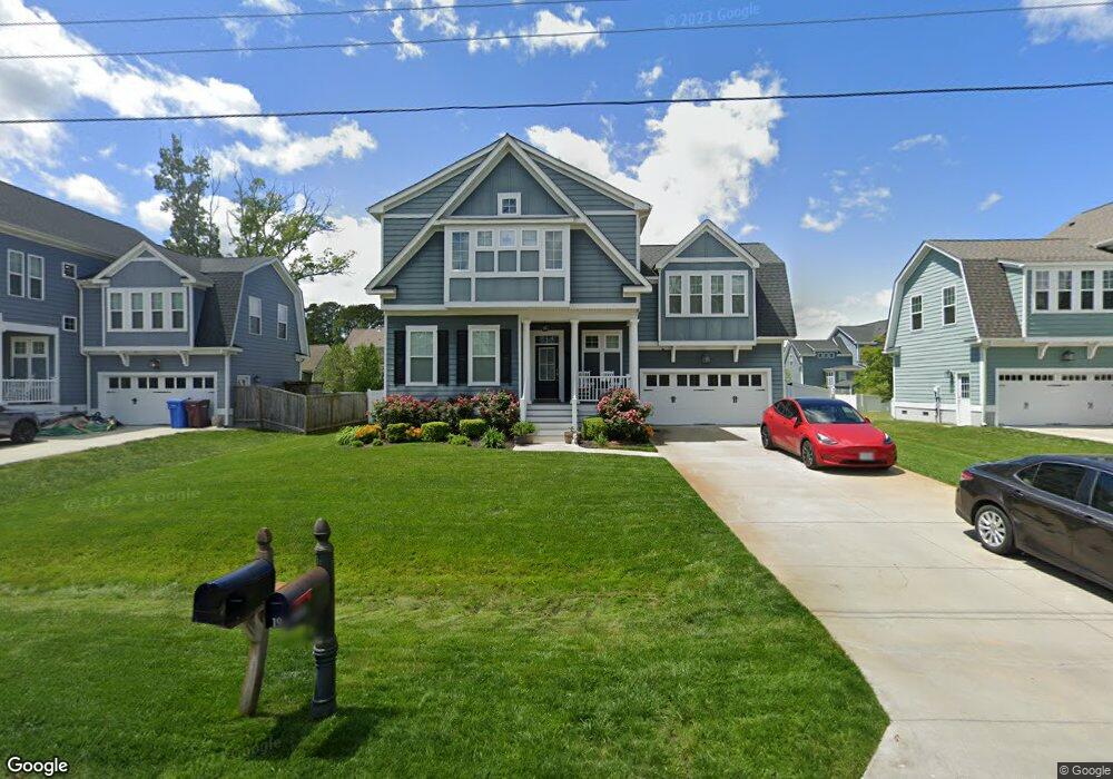
1936 Flintshire Dr Chesapeake, VA 23323
Deep Creek NeighborhoodEstimated Value: $663,000 - $688,000
5
Beds
3
Baths
2,650
Sq Ft
$253/Sq Ft
Est. Value
About This Home
This home is located at 1936 Flintshire Dr, Chesapeake, VA 23323 and is currently estimated at $669,605, approximately $252 per square foot. 1936 Flintshire Dr is a home located in Chesapeake City with nearby schools including Grassfield Elementary School, Hugo A. Owens Middle, and Grassfield High School.
Ownership History
Date
Name
Owned For
Owner Type
Purchase Details
Closed on
Sep 30, 2015
Sold by
Simpkins Reginald D and Simpkins Kimberly R
Bought by
Simpkins Reginald D
Current Estimated Value
Purchase Details
Closed on
May 8, 2014
Sold by
Stephen Alexander Homes Llc
Bought by
Simpkins Reginald D
Home Financials for this Owner
Home Financials are based on the most recent Mortgage that was taken out on this home.
Original Mortgage
$428,526
Interest Rate
4.41%
Mortgage Type
VA
Purchase Details
Closed on
Jun 2, 2004
Sold by
Grant William
Bought by
Stephenson Jennifer
Create a Home Valuation Report for This Property
The Home Valuation Report is an in-depth analysis detailing your home's value as well as a comparison with similar homes in the area
Home Values in the Area
Average Home Value in this Area
Purchase History
| Date | Buyer | Sale Price | Title Company |
|---|---|---|---|
| Simpkins Reginald D | -- | None Available | |
| Simpkins Reginald D | $419,507 | -- | |
| Stephenson Jennifer | $12,000 | -- |
Source: Public Records
Mortgage History
| Date | Status | Borrower | Loan Amount |
|---|---|---|---|
| Previous Owner | Simpkins Reginald D | $428,526 |
Source: Public Records
Tax History
| Year | Tax Paid | Tax Assessment Tax Assessment Total Assessment is a certain percentage of the fair market value that is determined by local assessors to be the total taxable value of land and additions on the property. | Land | Improvement |
|---|---|---|---|---|
| 2025 | $6,051 | $636,900 | $190,000 | $446,900 |
| 2024 | $6,051 | $599,100 | $175,000 | $424,100 |
| 2023 | $5,905 | $584,700 | $145,000 | $439,700 |
| 2022 | $5,377 | $532,400 | $135,000 | $397,400 |
| 2021 | $4,759 | $453,200 | $110,000 | $343,200 |
| 2020 | $4,430 | $421,900 | $105,000 | $316,900 |
| 2019 | $4,368 | $416,000 | $105,000 | $311,000 |
| 2018 | $4,305 | $391,800 | $95,000 | $296,800 |
| 2017 | $4,223 | $402,200 | $105,000 | $297,200 |
| 2016 | $4,166 | $396,800 | $100,000 | $296,800 |
| 2015 | $4,114 | $391,800 | $95,000 | $296,800 |
| 2014 | $3,852 | $366,900 | $90,000 | $276,900 |
Source: Public Records
Map
Nearby Homes
- 1832 Rockwood Dr
- 1836 Rockwood Dr
- 1906 Mccoy Rd
- 1908 Mccoy Rd
- 1916 Mccoy Rd
- 1918 Mccoy Rd
- 1949 Lemonwood Rd
- 1945 Lemonwood Rd
- 2014 Millville Rd
- 1801 Millville Rd
- 2219 Angler Ln
- 1616 Estuary Ct
- 906 Capstan Way
- 908 Capstan Way
- 1808 Aft Way
- 2029 Shipyard Rd
- 1945 Lancing Crest Ln
- 914 Avast Way
- 1920 Lancing Crest Ln
- 1928 Moses Grandy Trail
- 1940 Flintshire Dr
- 1932 Flintshire Dr
- 1945 Flintshire Dr
- 1928 Flintshire Dr
- 1944 Flintshire Dr
- 1929 Reefwood Rd
- 1937 Flintshire Dr
- 1937 Reefwood Rd
- 1925 Reefwood Rd
- 1933 Reefwood Rd
- 1933 Flintshire Dr
- 1948 Flintshire Dr
- 1949 Flintshire Dr
- 1941 Flintshire Dr
- 1924 Flintshire Dr
- 1945 Reefwood Rd
- 1921 Reefwood Rd
- 1929 Flintshire Dr
- LOT 14 Reefwood Rd
- LOT 12 Reefwood Rd
Your Personal Tour Guide
Ask me questions while you tour the home.