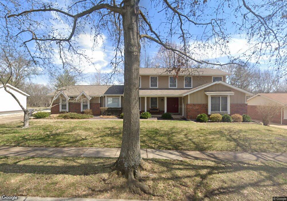
1936 Lanchester Ct Chesterfield, MO 63017
Estimated Value: $641,584 - $744,000
5
Beds
4
Baths
2,951
Sq Ft
$243/Sq Ft
Est. Value
About This Home
This home is located at 1936 Lanchester Ct, Chesterfield, MO 63017 and is currently estimated at $717,146, approximately $243 per square foot. 1936 Lanchester Ct is a home located in St. Louis County with nearby schools including Henry Elementary School, Parkway West Middle School, and Parkway West High School.
Ownership History
Date
Name
Owned For
Owner Type
Purchase Details
Closed on
Jan 16, 2004
Sold by
Hoef John A and Hoef Lydia F
Bought by
Hoef John A and Hoef Lydia
Current Estimated Value
Purchase Details
Closed on
Jan 9, 2003
Sold by
Hoef John A and Hoef Lydia F
Bought by
Hoef John A and Hoef Lydia F
Home Financials for this Owner
Home Financials are based on the most recent Mortgage that was taken out on this home.
Original Mortgage
$135,000
Interest Rate
6%
Purchase Details
Closed on
Feb 22, 2002
Sold by
Hoef John A and Hoef Lydia F
Bought by
Hoef John A and Hoef Lydia
Create a Home Valuation Report for This Property
The Home Valuation Report is an in-depth analysis detailing your home's value as well as a comparison with similar homes in the area
Home Values in the Area
Average Home Value in this Area
Purchase History
| Date | Buyer | Sale Price | Title Company |
|---|---|---|---|
| Hoef John A | -- | -- | |
| Hoef John A | -- | -- | |
| Hoef John A | -- | -- |
Source: Public Records
Mortgage History
| Date | Status | Borrower | Loan Amount |
|---|---|---|---|
| Closed | Hoef John A | $135,000 |
Source: Public Records
Tax History
| Year | Tax Paid | Tax Assessment Tax Assessment Total Assessment is a certain percentage of the fair market value that is determined by local assessors to be the total taxable value of land and additions on the property. | Land | Improvement |
|---|---|---|---|---|
| 2025 | $6,672 | $106,570 | $39,520 | $67,050 |
| 2024 | $6,672 | $100,980 | $27,660 | $73,320 |
| 2023 | $6,399 | $100,980 | $27,660 | $73,320 |
| 2022 | $5,717 | $82,060 | $23,710 | $58,350 |
| 2021 | $5,694 | $82,060 | $23,710 | $58,350 |
| 2020 | $5,894 | $81,610 | $23,240 | $58,370 |
| 2019 | $5,766 | $81,610 | $23,240 | $58,370 |
| 2018 | $5,388 | $70,700 | $23,240 | $47,460 |
| 2017 | $5,241 | $70,700 | $23,240 | $47,460 |
| 2016 | $5,106 | $65,450 | $17,440 | $48,010 |
Source: Public Records
Map
Nearby Homes
- 1948 Dovershire Ct
- 2029 Brook Hill Ln
- 2317 Hank's Close Unit 186 STB
- 1801 Summer Blossom Place
- 14569 Crossway Ct
- 2052 Tramore Ct Unit 34D
- 2455 Clayborn Dr Unit 2455
- 14991 Broadmont Dr
- 502 Iron Lantern Dr
- 724 Clayton Corners Dr
- 14443 Bantry Ln Unit 1
- 14443 Bantry Ln Unit 24
- 103 Calico Ln
- 718 Savannah Crossing Way
- 1620 Chalmers Dr
- 569 Highland Ridge Dr
- 426 Brooktree Dr
- 2323 Manor Grove Dr Unit 5
- 2306 Claymoor Dr
- 15094 Green Circle Dr
- 1944 Lanchester Ct
- 1928 Lanchester Ct
- 1939 Dovershire Ct
- 1947 Dovershire Ct
- 1931 Dovershire Ct
- 1958 Lanchester Ct
- 1941 Lanchester Ct
- 1920 Lanchester Ct
- 1933 Lanchester Ct
- 1949 Lanchester Ct
- 14753 Dovershire Ct
- 1925 Lanchester Ct
- 14764 Chermoore Dr
- 1957 Lanchester Ct
- 1919 Lanchester Ct
- 1940 Dovershire Ct
- 14700 White Lane Ct
- 14779 Chermoore Dr
- 14768 Dovershire Ct
- 1924 Dovershire Ct
Your Personal Tour Guide
Ask me questions while you tour the home.