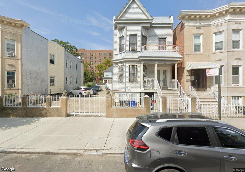
1937 Benedict Ave Bronx, NY 10462
Parkchester NeighborhoodEstimated Value: $1,157,000 - $1,233,000
Studio
--
Bath
3,503
Sq Ft
$340/Sq Ft
Est. Value
About This Home
This home is located at 1937 Benedict Ave, Bronx, NY 10462 and is currently estimated at $1,192,143, approximately $340 per square foot. 1937 Benedict Ave is a home located in Bronx County with nearby schools including P.S. 106 - Parkchester, M.S. 127 - The Castle Hill Middle School, and St Helena School.
Ownership History
Date
Name
Owned For
Owner Type
Purchase Details
Closed on
Mar 31, 2000
Sold by
Reid Robert J and Burke Edward J
Bought by
Carrasco Sergio and Carrasco Lourdes
Current Estimated Value
Home Financials for this Owner
Home Financials are based on the most recent Mortgage that was taken out on this home.
Original Mortgage
$200,600
Outstanding Balance
$68,626
Interest Rate
8.21%
Estimated Equity
$1,123,517
Create a Home Valuation Report for This Property
The Home Valuation Report is an in-depth analysis detailing your home's value as well as a comparison with similar homes in the area
Home Values in the Area
Average Home Value in this Area
Purchase History
| Date | Buyer | Sale Price | Title Company |
|---|---|---|---|
| Carrasco Sergio | $245,000 | The Judicial Title Ins Agenc |
Source: Public Records
Mortgage History
| Date | Status | Borrower | Loan Amount |
|---|---|---|---|
| Open | Carrasco Sergio | $200,600 |
Source: Public Records
Tax History
| Year | Tax Paid | Tax Assessment Tax Assessment Total Assessment is a certain percentage of the fair market value that is determined by local assessors to be the total taxable value of land and additions on the property. | Land | Improvement |
|---|---|---|---|---|
| 2025 | $3,399 | $43,718 | $7,756 | $35,962 |
| 2024 | $3,399 | $41,446 | $8,093 | $33,353 |
| 2023 | $7,476 | $40,057 | $8,924 | $31,133 |
| 2022 | $6,899 | $54,180 | $13,380 | $40,800 |
| 2021 | $7,257 | $46,740 | $13,380 | $33,360 |
| 2020 | $7,053 | $51,600 | $13,380 | $38,220 |
| 2019 | $6,566 | $49,800 | $13,380 | $36,420 |
| 2018 | $6,146 | $33,381 | $9,316 | $24,065 |
| 2017 | $5,786 | $31,551 | $9,854 | $21,697 |
| 2016 | $5,686 | $31,551 | $11,553 | $19,998 |
| 2015 | $3,370 | $30,360 | $11,160 | $19,200 |
| 2014 | $3,370 | $28,782 | $10,925 | $17,857 |
Source: Public Records
Map
Nearby Homes
- 1332 Metropolitan Ave Unit 2A
- 1332 Metropolitan Ave Unit 3H
- 1332 Metropolitan Ave Unit 4K
- 1332 Metropolitan Ave Unit 5G
- 1922 Mcgraw Ave Unit 6I
- 1926 Mcgraw Ave
- 1966 Newbold Ave Unit 108
- 1966 Newbold Ave Unit 1510
- 1966 Newbold Ave Unit 1502
- 1966 Newbold Ave Unit 505
- 1966 Newbold Ave Unit 408
- 1966 Newbold Ave Unit 904
- 1966 Newbold Ave Unit 1109
- 1966 Newbold Ave Unit 308
- 1966 Newbold Ave Unit 303
- 1966 Newbold Ave Unit 405
- 1406 White Plains Rd
- 1470 East Ave Unit 5G
- 2012 Benedict Ave
- 1480 Parkchester Rd
- 1939 Benedict Ave
- 1931 Benedict Ave
- 1941 Benedict Ave
- 1929 Benedict Ave
- 1943 Benedict Ave
- 1936 Mcgraw Ave
- 1927 Benedict Ave
- 1932 Mcgraw Ave
- 1932 Mcgraw Ave Unit Building
- 1940 Mcgraw Ave
- 1925 Benedict Ave
- 1945 Benedict Ave
- 1930 Mcgraw Ave
- 1942 Mcgraw Ave
- 1923 Benedict Ave
- 1944 Mcgraw Ave
- 1944 Mcgraw Ave
- 1949 Benedict Ave
- 1924B Mcgraw Ave Unit 2
- 1936 Benedict Ave
Your Personal Tour Guide
Ask me questions while you tour the home.