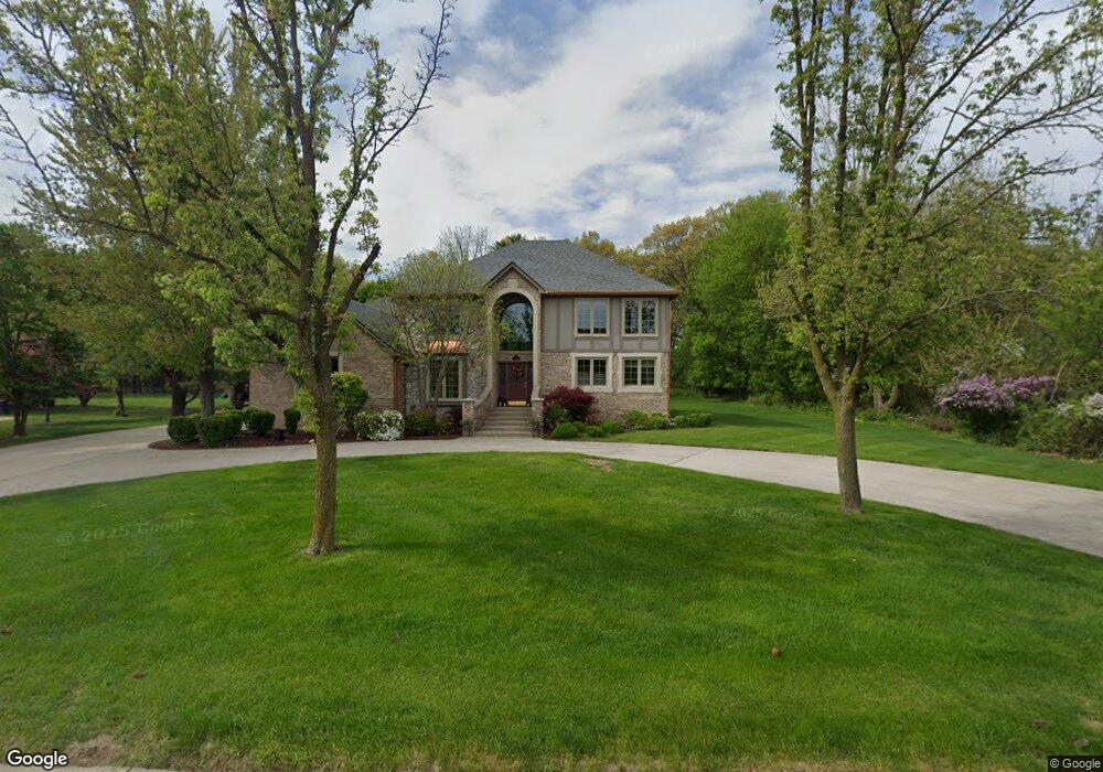
1937 Bloomfield Dr Bloomfield Hills, MI 48302
Estimated Value: $832,000 - $1,563,000
5
Beds
4
Baths
3,857
Sq Ft
$271/Sq Ft
Est. Value
About This Home
This home is located at 1937 Bloomfield Dr, Bloomfield Hills, MI 48302 and is currently estimated at $1,046,326, approximately $271 per square foot. 1937 Bloomfield Dr is a home located in Oakland County with nearby schools including Walt Whitman Elementary School, Pontiac Middle School, and Pontiac High School.
Ownership History
Date
Name
Owned For
Owner Type
Purchase Details
Closed on
Mar 26, 2013
Sold by
Liedr Edward D and Lieder Susan L
Bought by
Lieder Edward D and Edward D Lieder Revocable Trust
Current Estimated Value
Create a Home Valuation Report for This Property
The Home Valuation Report is an in-depth analysis detailing your home's value as well as a comparison with similar homes in the area
Home Values in the Area
Average Home Value in this Area
Purchase History
| Date | Buyer | Sale Price | Title Company |
|---|---|---|---|
| Lieder Edward D | -- | None Available |
Source: Public Records
Tax History Compared to Growth
Tax History
| Year | Tax Paid | Tax Assessment Tax Assessment Total Assessment is a certain percentage of the fair market value that is determined by local assessors to be the total taxable value of land and additions on the property. | Land | Improvement |
|---|---|---|---|---|
| 2024 | $4,271 | $377,650 | $0 | $0 |
| 2023 | $4,075 | $337,790 | $0 | $0 |
| 2022 | $6,956 | $336,770 | $0 | $0 |
| 2021 | $6,796 | $363,490 | $0 | $0 |
| 2020 | $3,751 | $343,420 | $0 | $0 |
| 2019 | $6,661 | $302,940 | $0 | $0 |
| 2018 | $6,542 | $284,620 | $0 | $0 |
| 2017 | $6,447 | $276,070 | $0 | $0 |
| 2016 | $6,445 | $289,850 | $0 | $0 |
| 2015 | -- | $272,340 | $0 | $0 |
| 2014 | -- | $198,220 | $0 | $0 |
| 2011 | -- | $195,020 | $0 | $0 |
Source: Public Records
Map
Nearby Homes
- 1968 Maplewood Ave
- 1947 Maplewood Ave
- 1675 Dell Rose Dr
- 0000 Ward Road Ward Rd
- 1785 Ward Rd
- 2756 Turtle Bluff Dr
- 2717 Turtle Shores Ranch Dr
- 2717 Turtle Shores Dr
- 1700 Hamilton Dr
- 1205 Leinbach Ave
- 1160 Dorchester Ave
- 2171 Klingensmith Rd
- 1061 Dorchester Ave
- 1975 Klingensmith Rd Unit 25
- 2216 Middlebelt Rd
- 2759 Turtle Ridge Dr
- 2230 Middlebelt Rd
- 2779 Turtle Lake Dr
- 2657 Turtle Shores Dr
- 1831 Long Pointe Dr
- 1945 Bloomfield Dr
- 1934 Bloomfield Dr
- 1926 Bloomfield Dr
- 1948 Bloomfield Dr
- 1836 Dell Rose Dr
- 1750 Dell Rose Dr
- 1956 Bloomfield Dr
- 1918 Bloomfield Dr
- 1936 Maplewood Ave
- 1944 Maplewood Ave
- 1946 Dell Rose Dr
- 1950 Maplewood Ave Unit Bldg-Unit
- 1950 Maplewood Ave
- 1964 Bloomfield Dr
- 1958 Maplewood Ave
- 1954 Dell Rose Dr
- 1700 Dell Rose Dr
- 1972 Bloomfield Dr
- 1835 Dell Rose Dr
- 2081 Dell Rose Dr