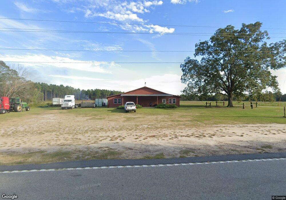
1937 Broxton Hwy Hazlehurst, GA 31539
Estimated Value: $170,000 - $349,000
3
Beds
1
Bath
1,020
Sq Ft
$258/Sq Ft
Est. Value
About This Home
This home is located at 1937 Broxton Hwy, Hazlehurst, GA 31539 and is currently estimated at $263,214, approximately $258 per square foot. 1937 Broxton Hwy is a home located in Jeff Davis County with nearby schools including Jeff Davis Primary School, Jeff Davis Elementary School, and Jeff Davis Middle School.
Ownership History
Date
Name
Owned For
Owner Type
Purchase Details
Closed on
Nov 2, 2022
Sold by
Faulk Harold N Jr Estate
Bought by
Faulk Jennifer Leigh
Current Estimated Value
Purchase Details
Closed on
May 19, 2020
Sold by
Faulk Betty Jo
Bought by
Faulki John Edward
Purchase Details
Closed on
Dec 7, 2012
Sold by
Faulk Harold N
Bought by
Faulk John Edward
Purchase Details
Closed on
Nov 29, 2012
Sold by
Faulk Harold N
Bought by
Stapleton Tammy Lynn
Purchase Details
Closed on
Nov 15, 2012
Sold by
Faulk Harold N
Bought by
Faulk Betty Jo and Faulk Harold N
Purchase Details
Closed on
Sep 10, 1997
Bought by
Faulk Harold N
Purchase Details
Closed on
Jan 1, 1977
Bought by
Faulk N W
Create a Home Valuation Report for This Property
The Home Valuation Report is an in-depth analysis detailing your home's value as well as a comparison with similar homes in the area
Home Values in the Area
Average Home Value in this Area
Purchase History
| Date | Buyer | Sale Price | Title Company |
|---|---|---|---|
| Faulk Jennifer Leigh | -- | -- | |
| Faulki John Edward | -- | -- | |
| Faulk John Edward | -- | -- | |
| Faulk Harold N | -- | -- | |
| Stapleton Tammy Lynn | -- | -- | |
| Faulk Betty Jo | -- | -- | |
| Faulk Harold N | -- | -- | |
| Faulk N W | -- | -- |
Source: Public Records
Tax History Compared to Growth
Tax History
| Year | Tax Paid | Tax Assessment Tax Assessment Total Assessment is a certain percentage of the fair market value that is determined by local assessors to be the total taxable value of land and additions on the property. | Land | Improvement |
|---|---|---|---|---|
| 2024 | $1,893 | $113,976 | $84,240 | $29,736 |
| 2023 | $0 | $74,415 | $57,282 | $17,133 |
| 2022 | $1,331 | $74,415 | $57,282 | $17,133 |
| 2021 | $1,361 | $74,415 | $57,282 | $17,133 |
| 2020 | $1,382 | $93,475 | $76,342 | $17,133 |
| 2019 | $2,545 | $93,475 | $76,342 | $17,133 |
| 2018 | $1,241 | $93,475 | $76,342 | $17,133 |
| 2016 | $1,099 | $91,684 | $76,342 | $15,342 |
| 2015 | -- | $91,684 | $76,342 | $15,342 |
| 2014 | -- | $77,967 | $60,952 | $17,015 |
Source: Public Records
Map
Nearby Homes
- 347 Georgia 107
- 0 No Assigned Address Unit 10505338
- LOTS 5 & 6 N A
- 0 Snipesville Rd Unit 114372
- 0 Snipesville Rd Unit 10619522
- 00 Lots 5 & 6
- LT 16 Loop Rd
- Lot 16 Loop Rd Unit Other
- 663 Rhonda Coleman Rd
- 0 Rhonda Coleman Rd
- 00 N A
- 00 N A Unit N/A
- 279 W H Smith Rd
- 120 Elizabeth Church Rd
- 00 Elizabeth Church Rd
- 93 Burketts Ferry Landing
- 1991 Broxton Hwy
- 21 Rea Hill Rd
- 45 Seebeck Rd
- 2069 Broxton Hwy
- 65 Seebeck Rd
- 3 Eastwood Dr
- 2215 Broxton Hwy
- 70 Seebeck Rd
- 1874 Broxton Hwy
- 58 Cedar Brook Rd
- 82 Rea Hill Rd
- 63 Eastwood Dr
- 0 Sunflower Rd
- 1872 Broxton Hwy
- 1876 Broxton Hwy
- 1868 Broxton Hwy
- 2079 Broxton Hwy
- 2079 Broxton Hwy
- 191 Ah Moody Rd
- 1854 Broxton Hwy