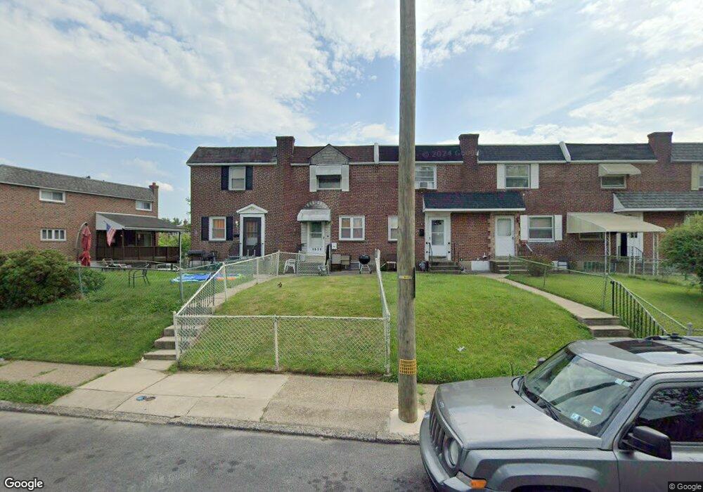
1937 Carter Rd Folcroft, PA 19032
Estimated Value: $181,839 - $207,000
3
Beds
1
Bath
1,088
Sq Ft
$184/Sq Ft
Est. Value
About This Home
This home is located at 1937 Carter Rd, Folcroft, PA 19032 and is currently estimated at $199,710, approximately $183 per square foot. 1937 Carter Rd is a home located in Delaware County with nearby schools including Delcroft School, Academy Park High School, and Liberty Baptist Academy.
Ownership History
Date
Name
Owned For
Owner Type
Purchase Details
Closed on
Jul 9, 2015
Sold by
County Of Delaware
Bought by
Dv Property Solutions
Current Estimated Value
Purchase Details
Closed on
Oct 14, 2004
Sold by
Gilroy Geraldine V
Bought by
Roos Richard D and Carola Susan
Home Financials for this Owner
Home Financials are based on the most recent Mortgage that was taken out on this home.
Original Mortgage
$61,600
Interest Rate
5.71%
Mortgage Type
Fannie Mae Freddie Mac
Create a Home Valuation Report for This Property
The Home Valuation Report is an in-depth analysis detailing your home's value as well as a comparison with similar homes in the area
Home Values in the Area
Average Home Value in this Area
Purchase History
| Date | Buyer | Sale Price | Title Company |
|---|---|---|---|
| Dv Property Solutions | $41,000 | None Available | |
| Roos Richard D | $77,000 | -- |
Source: Public Records
Mortgage History
| Date | Status | Borrower | Loan Amount |
|---|---|---|---|
| Previous Owner | Roos Richard D | $61,600 |
Source: Public Records
Tax History
| Year | Tax Paid | Tax Assessment Tax Assessment Total Assessment is a certain percentage of the fair market value that is determined by local assessors to be the total taxable value of land and additions on the property. | Land | Improvement |
|---|---|---|---|---|
| 2025 | $4,020 | $97,030 | $23,370 | $73,660 |
| 2024 | $4,020 | $97,030 | $23,370 | $73,660 |
| 2023 | $3,908 | $97,030 | $23,370 | $73,660 |
| 2022 | $3,697 | $97,030 | $23,370 | $73,660 |
| 2021 | $5,250 | $97,030 | $23,370 | $73,660 |
| 2020 | $1,519 | $26,442 | $17,900 | $8,542 |
| 2019 | $1,484 | $26,442 | $17,900 | $8,542 |
| 2018 | $1,448 | $26,442 | $0 | $0 |
| 2017 | $1,379 | $26,442 | $0 | $0 |
| 2016 | $148 | $50,850 | $0 | $0 |
| 2015 | $285 | $65,810 | $0 | $0 |
| 2014 | $361 | $65,810 | $0 | $0 |
Source: Public Records
Map
Nearby Homes
- 1984 Carter Rd
- 948 Grant Rd
- 1087 Taylor Dr
- 2003 Heather Rd
- 842 School Ln
- 1053 Taylor Dr
- 753 Bennington Rd
- 887 Taylor Dr
- 2038 Kent Rd
- 1062 Taylor Dr
- 1196 Taylor Dr
- 2019 Delmar Dr
- 992 Taylor Dr
- 1821 Shallcross Ave
- 100 E Glenolden Ave Unit B6
- 100 E Glenolden Ave Unit D17
- 100 E Glenolden Ave Unit D14
- 100 E Glenolden Ave Unit R12
- 100 E Glenolden Ave Unit E21
- 100 E Glenolden Ave Unit T13
- 1941 Carter Rd
- 1939 Carter Rd
- 1945 Carter Rd
- 1947 Carter Rd
- 1949 Carter Rd
- 1931 Carter Rd
- 2076 Heather Rd
- 1953 Carter Rd
- 2074 Heather Rd
- 1929 Carter Rd
- 2078 Heather Rd
- 2072 Heather Rd
- 1927 Carter Rd
- 2070 Heather Rd
- 2080 Heather Rd
- 1951 Carter Rd
- 2068 Heather Rd
- 1925 Carter Rd
- 2082 Heather Rd
- 2066 Heather Rd
Your Personal Tour Guide
Ask me questions while you tour the home.