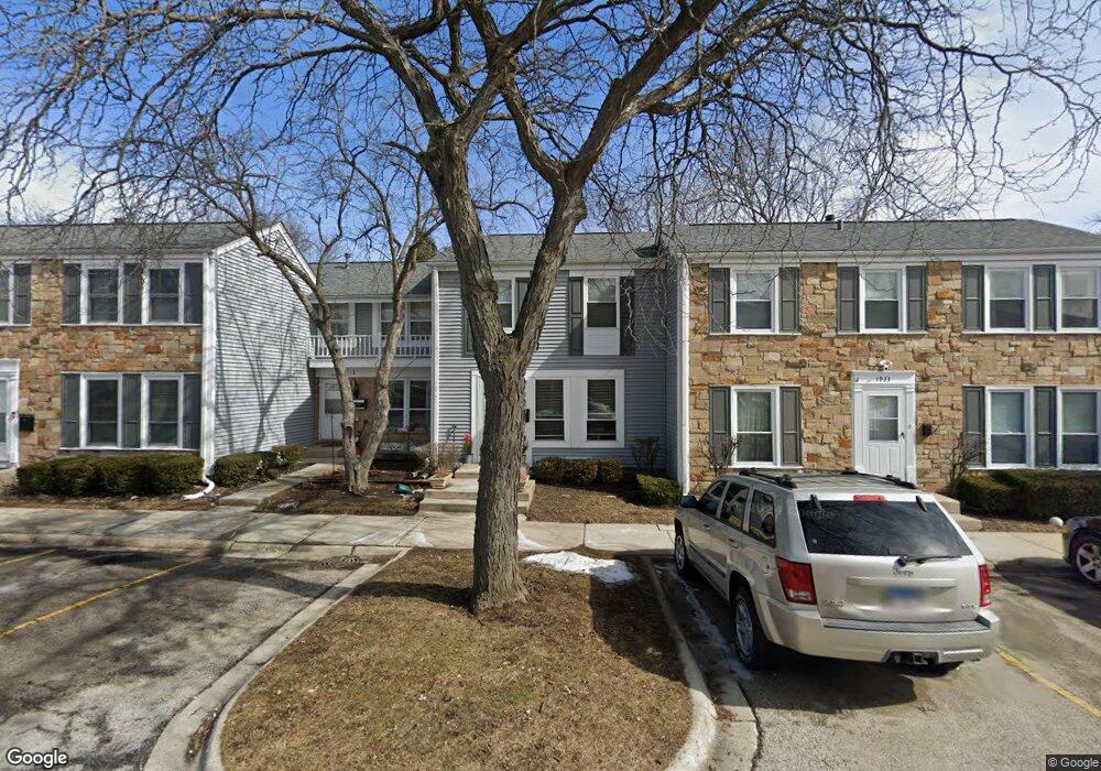
1937 Whitingham Ln Unit 1 Hoffman Estates, IL 60169
South Hoffman Estates NeighborhoodEstimated Value: $223,000 - $272,000
2
Beds
2
Baths
1,220
Sq Ft
$210/Sq Ft
Est. Value
About This Home
This home is located at 1937 Whitingham Ln Unit 1, Hoffman Estates, IL 60169 and is currently estimated at $256,632, approximately $210 per square foot. 1937 Whitingham Ln Unit 1 is a home located in Cook County with nearby schools including John Muir Literacy Academy, Dwight D Eisenhower Junior High School, and Hoffman Estates High School.
Ownership History
Date
Name
Owned For
Owner Type
Purchase Details
Closed on
Nov 15, 2002
Sold by
Havell Donald G and Havell Carol E
Bought by
Opolka Johnna
Current Estimated Value
Home Financials for this Owner
Home Financials are based on the most recent Mortgage that was taken out on this home.
Original Mortgage
$118,750
Interest Rate
6.13%
Purchase Details
Closed on
Jun 29, 1994
Sold by
Potvin James J
Bought by
Havell Donald G and Hohlman Carol E
Home Financials for this Owner
Home Financials are based on the most recent Mortgage that was taken out on this home.
Original Mortgage
$81,748
Interest Rate
8.66%
Mortgage Type
FHA
Create a Home Valuation Report for This Property
The Home Valuation Report is an in-depth analysis detailing your home's value as well as a comparison with similar homes in the area
Home Values in the Area
Average Home Value in this Area
Purchase History
| Date | Buyer | Sale Price | Title Company |
|---|---|---|---|
| Opolka Johnna | $125,000 | Agtf Inc | |
| Havell Donald G | $83,000 | -- |
Source: Public Records
Mortgage History
| Date | Status | Borrower | Loan Amount |
|---|---|---|---|
| Previous Owner | Opolka Johnna | $118,750 | |
| Previous Owner | Havell Donald G | $81,748 |
Source: Public Records
Tax History
| Year | Tax Paid | Tax Assessment Tax Assessment Total Assessment is a certain percentage of the fair market value that is determined by local assessors to be the total taxable value of land and additions on the property. | Land | Improvement |
|---|---|---|---|---|
| 2025 | $4,660 | $22,000 | $2,480 | $19,520 |
| 2024 | $4,660 | $18,500 | $3,000 | $15,500 |
| 2023 | $4,478 | $18,500 | $3,000 | $15,500 |
| 2022 | $4,478 | $18,500 | $3,000 | $15,500 |
| 2021 | $3,410 | $13,507 | $1,953 | $11,554 |
| 2020 | $3,404 | $13,507 | $1,953 | $11,554 |
| 2019 | $3,390 | $15,008 | $1,953 | $13,055 |
| 2018 | $3,631 | $14,571 | $1,705 | $12,866 |
| 2017 | $3,586 | $14,571 | $1,705 | $12,866 |
| 2016 | $3,597 | $14,571 | $1,705 | $12,866 |
| 2015 | $3,403 | $13,219 | $1,488 | $11,731 |
| 2014 | $3,360 | $13,219 | $1,488 | $11,731 |
| 2013 | $3,256 | $13,219 | $1,488 | $11,731 |
Source: Public Records
Map
Nearby Homes
- 2080 Sutherland Place Unit 1
- 1792 Williamsburg Dr
- 2051 Kettering Rd Unit 2
- 1836 Stockton Dr Unit 3312
- 1965 Blackberry Ln Unit 101
- 2021 Kensington Ln Unit 3004
- 2027 Kensington Ln Unit 3001
- 2025 Kensington Ln Unit 3002
- 2023 Kensington Ln Unit 3003
- 2267 Briar Ct Unit 65
- 1985 Leiter Way Unit 1102
- 1797 Queensbury Cir Unit 5764
- 1981 Leiter Way Unit 12005
- 1979 Leiter Way Unit 12004
- 1977 Leiter Way Unit 12003
- 1975 Leiter Way Unit 12002
- 1840 Huntington Blvd Unit BW511
- 1840 Huntington Blvd Unit 203
- 1982 Leiter Way Unit 13004
- 1587 Brookside Dr
- 1933 Whitingham Ln Unit 1
- 1941 Whitingham Ln Unit 1
- 1929 Whitingham Ln Unit 1
- 1945 Whitingham Ln Unit 1
- 1925 Whitingham Ln Unit 1
- 1949 Whitingham Ln Unit 1
- 1921 Whitingham Ln Unit 1921
- 1921 Whitingham Ln Unit 1925
- 1921 Whitingham Ln Unit 1
- 1953 Whitingham Ln Unit 1
- 2086 Danbury Place Unit 1
- 1947 Governors Ln Unit 2
- 1949 Governors Ln Unit 2
- 1949 Governors Ln
- 1936 Whitingham Ln Unit 1
- 2082 Danbury Place
- 1932 Whitingham Ln
- 2078 Danbury Place Unit 1
- 1945 Governors Ln
- 1953 Governors Ln Unit 2
Your Personal Tour Guide
Ask me questions while you tour the home.