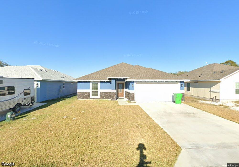
1938 Admiral Ln Aransas Pass, TX 78336
Estimated Value: $273,145 - $304,000
--
Bed
--
Bath
1,578
Sq Ft
$185/Sq Ft
Est. Value
About This Home
This home is located at 1938 Admiral Ln, Aransas Pass, TX 78336 and is currently estimated at $291,786, approximately $184 per square foot. 1938 Admiral Ln is a home with nearby schools including W A Kieberger Elementary School, Charlie Marshall Elementary School, and A.C. Blunt Middle School.
Ownership History
Date
Name
Owned For
Owner Type
Purchase Details
Closed on
Jan 12, 2021
Sold by
Sunray Enterprises Inc
Bought by
Glover Robert Zain
Current Estimated Value
Home Financials for this Owner
Home Financials are based on the most recent Mortgage that was taken out on this home.
Original Mortgage
$197,500
Outstanding Balance
$176,269
Interest Rate
2.71%
Mortgage Type
New Conventional
Estimated Equity
$115,517
Purchase Details
Closed on
Jan 12, 2020
Sold by
Freedom Homes and Sunray Enterprises Inc
Bought by
Glover Robert Zain
Home Financials for this Owner
Home Financials are based on the most recent Mortgage that was taken out on this home.
Original Mortgage
$197,500
Interest Rate
2.71%
Mortgage Type
New Conventional
Create a Home Valuation Report for This Property
The Home Valuation Report is an in-depth analysis detailing your home's value as well as a comparison with similar homes in the area
Home Values in the Area
Average Home Value in this Area
Purchase History
| Date | Buyer | Sale Price | Title Company |
|---|---|---|---|
| Glover Robert Zain | -- | Stewart Title | |
| Glover Robert Zain | -- | Stewart Title |
Source: Public Records
Mortgage History
| Date | Status | Borrower | Loan Amount |
|---|---|---|---|
| Open | Glover Robert Zain | $197,500 | |
| Previous Owner | Glover Robert Zain | $197,500 |
Source: Public Records
Tax History Compared to Growth
Tax History
| Year | Tax Paid | Tax Assessment Tax Assessment Total Assessment is a certain percentage of the fair market value that is determined by local assessors to be the total taxable value of land and additions on the property. | Land | Improvement |
|---|---|---|---|---|
| 2025 | $5,006 | $336,653 | -- | -- |
| 2024 | $5,006 | $306,048 | -- | -- |
| 2023 | $5,006 | $278,225 | $0 | $0 |
| 2022 | $5,810 | $252,932 | $46,497 | $206,435 |
| 2021 | $5,777 | $234,163 | $46,497 | $187,666 |
| 2020 | $642 | $25,390 | $25,390 | $0 |
| 2019 | $366 | $13,457 | $13,457 | $0 |
Source: Public Records
Map
Nearby Homes
- 1933 Admiral Ln
- 1986 Admiral Ln
- 2050 Admiral Ln
- 707 Starboard Ct
- 2076 S Saunders St
- 1003 W Rhodes Ave
- 805 Rhodes Ave
- 781 Rhodes Ave
- 960 W Rhodes Ave
- 1940 S Commercial St
- 2222 State Highway 361
- 822 W Beasley Ave
- 820 W Beasley Ave
- 1728 Morgan
- 1214 Rhodes Ave
- 2402 Fm 361
- 000 Rhodes Ave Unit Corner of Rhodes & A
- 2280 Farm To Market Road 2725
- 1513 Lisa Ann Dr
- 109 Misty Ln
- 1946 Admiral Ln
- 1930 Admiral Ln
- 1954 Admiral Ln
- 1922 Admiral Ln
- 1941 Admiral Ln
- 1949 Admiral Ln
- 1914 Admiral Ln
- 1957 Admiral Ln
- 1925 Admiral Ln
- 1965 Admiral Ln
- 1970 Admiral Ln
- 1917 Admiral Ln
- 1906 Admiral Ln
- 1973 Admiral Ln
- 1978 Admiral Ln
- 1909 Admiral Ln
- 1981 Admiral Ln
- 1989 Admiral Ln
- 1994 Admiral Ln
- 1997 Admiral Ln