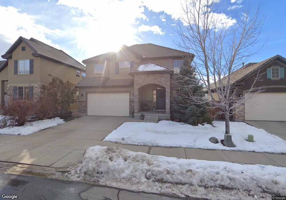
1938 Brookings Dr Draper, UT 84020
Estimated Value: $613,354 - $684,000
3
Beds
3
Baths
3,053
Sq Ft
$213/Sq Ft
Est. Value
About This Home
This home is located at 1938 Brookings Dr, Draper, UT 84020 and is currently estimated at $650,451, approximately $213 per square foot. 1938 Brookings Dr is a home located in Utah County with nearby schools including Ridgeline Elementary School, Timberline Middle School, and Lone Peak High School.
Ownership History
Date
Name
Owned For
Owner Type
Purchase Details
Closed on
Feb 11, 2010
Sold by
Anderson Jonathan C and Anderson Curtis
Bought by
Woodard Christopher B and Woodard Rebecca
Current Estimated Value
Home Financials for this Owner
Home Financials are based on the most recent Mortgage that was taken out on this home.
Original Mortgage
$224,161
Outstanding Balance
$148,357
Interest Rate
5.03%
Mortgage Type
VA
Estimated Equity
$502,094
Purchase Details
Closed on
Apr 13, 2007
Sold by
Richmond American Homes Of Utah Inc
Bought by
Anderson Jonathan C and Anderson Curtis
Home Financials for this Owner
Home Financials are based on the most recent Mortgage that was taken out on this home.
Original Mortgage
$335,550
Interest Rate
9.87%
Mortgage Type
Balloon
Create a Home Valuation Report for This Property
The Home Valuation Report is an in-depth analysis detailing your home's value as well as a comparison with similar homes in the area
Home Values in the Area
Average Home Value in this Area
Purchase History
| Date | Buyer | Sale Price | Title Company |
|---|---|---|---|
| Woodard Christopher B | -- | Title West Orem | |
| Anderson Jonathan C | -- | First American Title Unio |
Source: Public Records
Mortgage History
| Date | Status | Borrower | Loan Amount |
|---|---|---|---|
| Open | Woodard Christopher B | $224,161 | |
| Previous Owner | Anderson Jonathan C | $335,550 |
Source: Public Records
Tax History
| Year | Tax Paid | Tax Assessment Tax Assessment Total Assessment is a certain percentage of the fair market value that is determined by local assessors to be the total taxable value of land and additions on the property. | Land | Improvement |
|---|---|---|---|---|
| 2025 | $2,665 | $303,435 | -- | -- |
| 2024 | $2,665 | $279,345 | $0 | $0 |
| 2023 | $2,565 | $289,740 | $0 | $0 |
| 2022 | $2,903 | $319,880 | $0 | $0 |
| 2021 | $2,443 | $421,700 | $134,900 | $286,800 |
| 2020 | $2,341 | $394,700 | $107,900 | $286,800 |
| 2019 | $2,059 | $360,100 | $107,900 | $252,200 |
| 2018 | $1,982 | $329,100 | $99,600 | $229,500 |
| 2017 | $1,894 | $167,310 | $0 | $0 |
| 2016 | $1,780 | $147,400 | $0 | $0 |
| 2015 | $1,816 | $141,735 | $0 | $0 |
| 2014 | $1,552 | $126,665 | $0 | $0 |
Source: Public Records
Map
Nearby Homes
- 1944 Fielding Hill Ln
- 16065 Timber Brook Dr E
- 16073 Fielding Hill Ln
- 16072 S Fielding Hill Ln E Unit 1001
- 2043 E Brookings Dr
- 2203 E Fair Winns Ln
- 15724 Rolling Bluff Dr
- 2116 Falcon Ridge Dr
- 15574 S Mercer Ct Unit 502
- 246 E Levengrove Dr Unit 1066
- 15219 Eagle Crest Dr Unit 141
- 415 E Levengrove Dr Unit 1144
- 421 E Levengrove Dr Unit 1145
- 367 E Levengrove Dr Unit 1138
- 353 E Levengrove Dr Unit 1135
- 409 E Levengrove Dr Unit 1143
- 300 E Levengrove Dr Unit 232
- 297 E Levengrove Dr Unit 227
- 1871 E Vista Ridge Ct
- 2159 Bald Eagle Ct
- 1942 E Brookings Dr
- 1942 Brookings Dr
- 1934 Brookings Dr
- 1934 E Brookings Dr
- 1948 E Brookings Dr
- 1948 Brookings Dr
- 1939 Fielding Hill Ln
- 1943 E Fielding Hill Ln
- 1943 Fielding Hill Ln
- 1935 E Fielding Hill Ln
- 1935 Fielding Hill Ln
- 1939 E Brookings Dr
- 1952 E Brookings Dr
- 1947 Fielding Hill Ln
- 1952 Brookings Dr
- 1935 Brookings Dr
- 1939 Brookings Dr S
- 1943 Brookings Dr
- 1943 E Brookings Dr
- 1935 E Brookings Dr
Your Personal Tour Guide
Ask me questions while you tour the home.