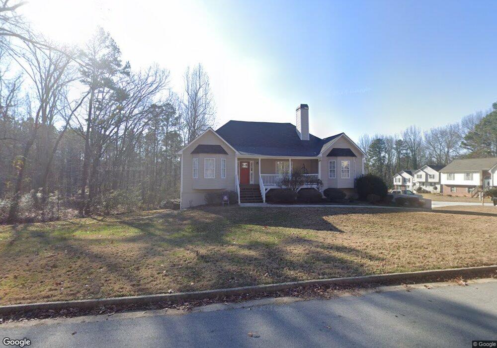
1938 David Dr Unit 2 Douglasville, GA 30135
Lithia Springs NeighborhoodEstimated Value: $282,000 - $329,000
3
Beds
2
Baths
1,828
Sq Ft
$167/Sq Ft
Est. Value
About This Home
This home is located at 1938 David Dr Unit 2, Douglasville, GA 30135 and is currently estimated at $306,148, approximately $167 per square foot. 1938 David Dr Unit 2 is a home located in Douglas County with nearby schools including Mt. Carmel Elementary School, Chestnut Log Middle School, and Lithia Springs Comprehensive High School.
Ownership History
Date
Name
Owned For
Owner Type
Purchase Details
Closed on
Aug 31, 2021
Sold by
Sfr Xii Atl Owener 1 Lp
Bought by
Sfr Xii Atl Owner 2 Lp
Current Estimated Value
Purchase Details
Closed on
Aug 27, 2021
Sold by
A Georgia Llc
Bought by
A Delaware Limited Partnership
Purchase Details
Closed on
Aug 16, 2021
Sold by
Sfr Xii Atl Owner 1 Lp
Bought by
Sfr Xii Atl Owner 2 Lp
Purchase Details
Closed on
Aug 14, 2021
Sold by
Sfr Xii Atl Owner 1 Lp
Bought by
Sfr Xii Atl Owner 2 Lp
Purchase Details
Closed on
Jun 18, 2021
Sold by
The Wyatt Grp Corp
Bought by
Sfr Xii Atl Owner 1 Lp
Purchase Details
Closed on
Jun 17, 2021
Sold by
Yarbrough Joel
Bought by
The Wyatt Grp Corp
Purchase Details
Closed on
Feb 15, 2002
Sold by
K & A Enterprises Inc
Bought by
Yarbrough Joel M
Home Financials for this Owner
Home Financials are based on the most recent Mortgage that was taken out on this home.
Original Mortgage
$143,200
Interest Rate
6.8%
Mortgage Type
FHA
Create a Home Valuation Report for This Property
The Home Valuation Report is an in-depth analysis detailing your home's value as well as a comparison with similar homes in the area
Home Values in the Area
Average Home Value in this Area
Purchase History
| Date | Buyer | Sale Price | Title Company |
|---|---|---|---|
| Sfr Xii Atl Owner 2 Lp | -- | New Title Company Name | |
| Sfr Xii Atl Owner 2 Lp | -- | None Listed On Document | |
| A Delaware Limited Partnership | $207,100 | None Listed On Document | |
| Sfr Xii Atl Owner 2 Lp | -- | None Listed On Document | |
| Sfr Xii Atl Owner 2 Lp | -- | None Listed On Document | |
| Sfr Xii Atl Owner 1 Lp | $201,200 | -- | |
| The Wyatt Grp Corp | $182,000 | -- | |
| Yarbrough Joel M | $145,500 | -- |
Source: Public Records
Mortgage History
| Date | Status | Borrower | Loan Amount |
|---|---|---|---|
| Previous Owner | Yarbrough Joel M | $143,200 |
Source: Public Records
Tax History Compared to Growth
Tax History
| Year | Tax Paid | Tax Assessment Tax Assessment Total Assessment is a certain percentage of the fair market value that is determined by local assessors to be the total taxable value of land and additions on the property. | Land | Improvement |
|---|---|---|---|---|
| 2024 | $4,159 | $130,120 | $21,440 | $108,680 |
| 2023 | $4,159 | $130,120 | $21,440 | $108,680 |
| 2022 | $2,686 | $92,920 | $16,000 | $76,920 |
| 2021 | $2,717 | $81,320 | $16,800 | $64,520 |
| 2020 | $2,338 | $68,800 | $9,720 | $59,080 |
| 2019 | $2,114 | $66,480 | $9,720 | $56,760 |
| 2018 | $2,073 | $64,840 | $9,720 | $55,120 |
| 2017 | $1,902 | $58,200 | $9,720 | $48,480 |
| 2016 | $1,857 | $55,800 | $9,720 | $46,080 |
| 2015 | $1,842 | $54,200 | $9,720 | $44,480 |
| 2014 | $1,461 | $41,800 | $8,160 | $33,640 |
| 2013 | -- | $49,200 | $9,640 | $39,560 |
Source: Public Records
Map
Nearby Homes
- 1938 David Dr
- 1948 David Dr Unit A
- 1948 David Dr Unit 2
- 1948 David Dr Unit 1948
- 1948 David Dr
- 3555 Amanda Way
- 0 Amanda Way
- 1929 David Dr
- 1923 David Dr
- 1945 David Dr
- 1941 David Dr
- 1958 David Dr
- 1907 David Dr
- 3549 Amanda Way
- 1933 David Dr Unit 2
- 1953 David Dr Unit 2
- 1937 David Dr
- 1908 David Dr
- 1957 David Dr
- 1877 Kathy Ct