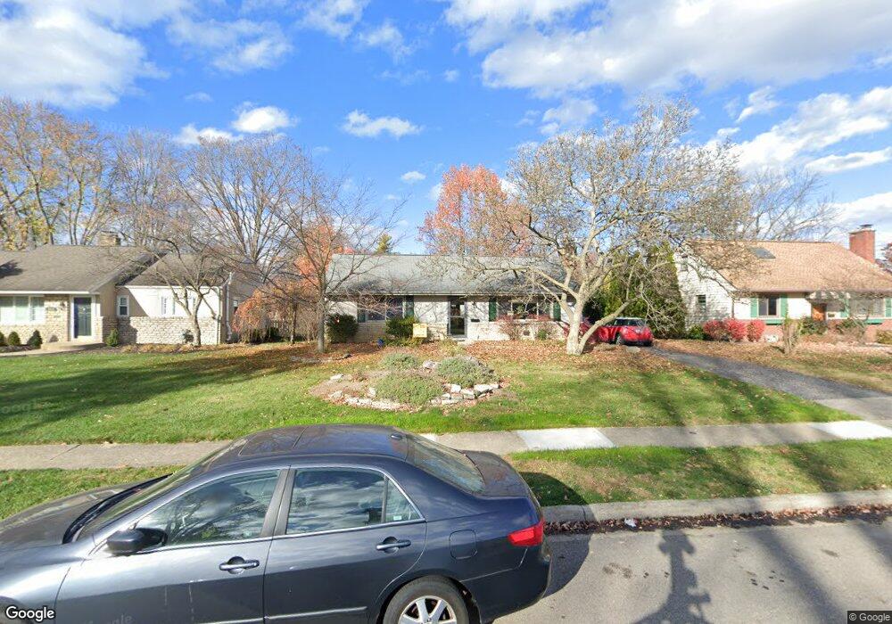
1938 Jervis Rd Columbus, OH 43221
Estimated Value: $376,000 - $501,000
3
Beds
2
Baths
1,134
Sq Ft
$375/Sq Ft
Est. Value
About This Home
This home is located at 1938 Jervis Rd, Columbus, OH 43221 and is currently estimated at $424,925, approximately $374 per square foot. 1938 Jervis Rd is a home located in Franklin County with nearby schools including Tremont Elementary School, Jones Middle School, and Upper Arlington High School.
Ownership History
Date
Name
Owned For
Owner Type
Purchase Details
Closed on
Jun 1, 2017
Sold by
Dyer Duff F and Dyer Julia A
Bought by
Dyer Duff F and Dyer Julia A
Current Estimated Value
Purchase Details
Closed on
Oct 21, 2005
Sold by
Binns Crystal A and Binns Robert
Bought by
Dyer Duff F and Dyer Julia A
Purchase Details
Closed on
Jun 26, 2001
Sold by
Dixon Eugene K and Dixon Evelee C
Bought by
Binns Crystal A
Purchase Details
Closed on
Dec 9, 1992
Bought by
Dixon Eugene K and Dixon Evelee C
Purchase Details
Closed on
Sep 6, 1990
Create a Home Valuation Report for This Property
The Home Valuation Report is an in-depth analysis detailing your home's value as well as a comparison with similar homes in the area
Home Values in the Area
Average Home Value in this Area
Purchase History
| Date | Buyer | Sale Price | Title Company |
|---|---|---|---|
| Dyer Duff F | -- | None Available | |
| Dyer Duff F | -- | -- | |
| Binns Crystal A | $90,000 | -- | |
| Dixon Eugene K | $90,000 | -- | |
| -- | $68,000 | -- |
Source: Public Records
Tax History Compared to Growth
Tax History
| Year | Tax Paid | Tax Assessment Tax Assessment Total Assessment is a certain percentage of the fair market value that is determined by local assessors to be the total taxable value of land and additions on the property. | Land | Improvement |
|---|---|---|---|---|
| 2024 | $6,177 | $106,690 | $48,200 | $58,490 |
| 2023 | $6,100 | $106,690 | $48,200 | $58,490 |
| 2022 | $5,610 | $80,290 | $33,250 | $47,040 |
| 2021 | $4,967 | $80,290 | $33,250 | $47,040 |
| 2020 | $4,923 | $80,290 | $33,250 | $47,040 |
| 2019 | $4,648 | $67,030 | $33,250 | $33,780 |
| 2018 | $4,775 | $67,030 | $33,250 | $33,780 |
| 2017 | $4,772 | $67,030 | $33,250 | $33,780 |
| 2016 | $4,932 | $74,590 | $31,120 | $43,470 |
| 2015 | $4,928 | $74,590 | $31,120 | $43,470 |
| 2014 | $4,933 | $74,590 | $31,120 | $43,470 |
| 2013 | $2,355 | $67,795 | $28,280 | $39,515 |
Source: Public Records
Map
Nearby Homes
- 3106 Somerford Rd
- 2047 Langham Rd
- 3015 Welsford Rd
- 3175 Tremont Rd Unit 504
- 3175 Tremont Rd Unit 313
- 1842 Ridgecliff Rd
- 3296 Leighton Rd
- 2227 Zollinger Rd
- 1743 Ardleigh Rd Unit 1743
- 3161 Avalon Rd
- 2979 Avalon Rd
- 2225 Swansea Rd
- 2370 Zollinger Rd
- 2583 Wexford Rd
- 3509 Redding Rd
- 3156 Mt Holyoke Rd
- 3444 Sunningdale Way
- 2438 Sherwood Villa Unit 5
- 3163 S Dorchester Rd
- 3701 Reed Rd
- 1930 Jervis Rd
- 1946 Jervis Rd
- 1933 Zollinger Rd
- 1925 Zollinger Rd
- 1956 Jervis Rd
- 1943 Zollinger Rd
- 1920 Jervis Rd
- 1943 Jervis Rd
- 3015 Tremont Rd
- 1951 Jervis Rd
- 1951 Zollinger Rd
- 1966 Jervis Rd
- 1959 Jervis Rd
- 1959 Zollinger Rd
- 3055 Tremont Rd
- 1967 Jervis Rd
- 1976 Jervis Rd
- 1954 Inchcliff Rd
- 1967 Zollinger Rd
- 3010 Tremont Rd