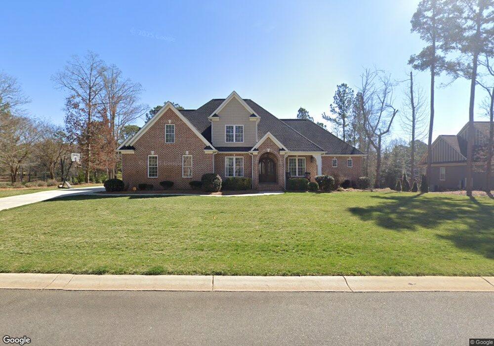
1938 Landry Ln Rock Hill, SC 29732
Estimated Value: $810,000 - $1,161,000
--
Bed
--
Bath
4,046
Sq Ft
$228/Sq Ft
Est. Value
About This Home
This home is located at 1938 Landry Ln, Rock Hill, SC 29732 and is currently estimated at $921,585, approximately $227 per square foot. 1938 Landry Ln is a home with nearby schools including Rawlinson Road Middle School and Northwestern High School.
Ownership History
Date
Name
Owned For
Owner Type
Purchase Details
Closed on
Jul 21, 2014
Sold by
Edens Eddy Harold Nelson and Edens Eddy Patricia
Bought by
Goodner Michael C and Goodner Shelly Marie A
Current Estimated Value
Home Financials for this Owner
Home Financials are based on the most recent Mortgage that was taken out on this home.
Original Mortgage
$437,164
Outstanding Balance
$331,710
Interest Rate
3.6%
Mortgage Type
Adjustable Rate Mortgage/ARM
Estimated Equity
$589,875
Purchase Details
Closed on
Feb 10, 2009
Sold by
Edens Eddy Harold Nelson and Edens Eddy Patricia
Bought by
Meadow Lakes Ii Homeowners Association I
Purchase Details
Closed on
Oct 23, 2002
Sold by
Meadow Lakes Partners
Bought by
Edens Eddy Harold Nelson and Edens Eddy Patricia
Create a Home Valuation Report for This Property
The Home Valuation Report is an in-depth analysis detailing your home's value as well as a comparison with similar homes in the area
Home Values in the Area
Average Home Value in this Area
Purchase History
| Date | Buyer | Sale Price | Title Company |
|---|---|---|---|
| Goodner Michael C | $68,000 | -- | |
| Meadow Lakes Ii Homeowners Association I | -- | -- | |
| Edens Eddy Harold Nelson | $81,000 | -- |
Source: Public Records
Mortgage History
| Date | Status | Borrower | Loan Amount |
|---|---|---|---|
| Open | Goodner Michael C | $437,164 |
Source: Public Records
Tax History Compared to Growth
Tax History
| Year | Tax Paid | Tax Assessment Tax Assessment Total Assessment is a certain percentage of the fair market value that is determined by local assessors to be the total taxable value of land and additions on the property. | Land | Improvement |
|---|---|---|---|---|
| 2024 | $4,723 | $21,528 | $3,909 | $17,619 |
| 2023 | $4,736 | $21,528 | $3,909 | $17,619 |
| 2022 | $4,768 | $21,528 | $3,909 | $17,619 |
| 2021 | -- | $21,528 | $3,909 | $17,619 |
| 2020 | $4,779 | $21,528 | $0 | $0 |
| 2019 | $4,287 | $18,720 | $0 | $0 |
| 2018 | $4,281 | $18,720 | $0 | $0 |
| 2017 | $4,124 | $18,720 | $0 | $0 |
| 2016 | $11,111 | $28,080 | $0 | $0 |
| 2014 | $2,147 | $5,700 | $5,700 | $0 |
| 2013 | $2,147 | $5,658 | $5,658 | $0 |
Source: Public Records
Map
Nearby Homes
- 1594 Summit View Dr
- 2069 Landry Ln Unit 233
- 1593 Worthington Crossing
- 2076 Landry Ln Unit 232
- 1189 Quiet Acres Rd
- 2765 Dogwood Cir
- 1548 Summit View Dr
- 1183 Quiet Acres Rd
- 1487 The Crossing
- 2615 Oakhurst Dr
- 1122 Wendy Rd
- 1768 Williamsburg Dr
- 985 Montgomery Dr
- 609 Rosemore Place
- 1939 Hendricks St
- 1925 Hendricks St
- 1648 Williamsburg Dr
- 2085 Fordhill St
- 829 Rawlinson Rd
- 1664 Dresden Dr
- 1948 Landry Ln
- 1939 Landry Ln
- 1929 Landry Ln
- 1949 Landry Ln
- Lot 267 Landry Ln
- Lot 264 Landry Ln
- 1928 Landry Ln
- 1958 Landry Ln
- 1919 Landry Ln
- 1909 Landry Ln
- 1969 Landry Ln
- 1938 Farrow Dr
- 1968 Landry Ln
- 1946 Farrow Dr
- 1839 Jack White Dr
- 1930 Farrow Dr
- 1956 Farrow Dr
- 1966 Farrow Dr
- 1920 Farrow Dr
- 1979 Landry Ln