19383 U S 30 Carroll, IA 51401
Estimated payment $3,511/month
About This Lot
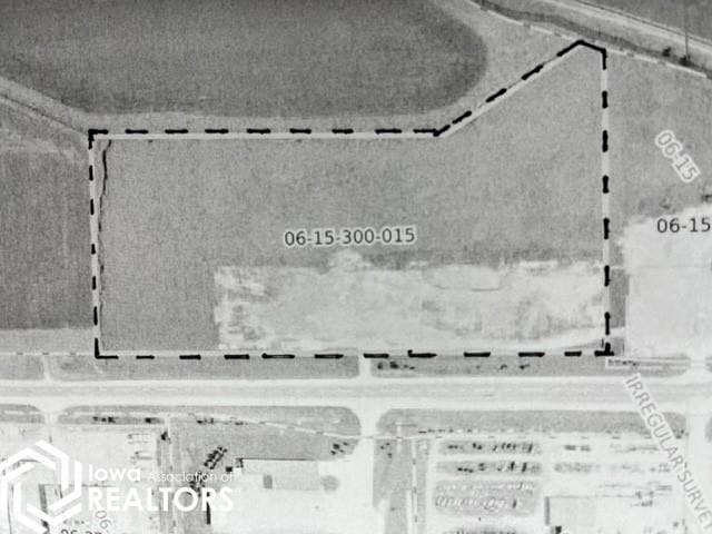
17.33 Acre parcel on the west edge of Carroll & north side of Highway 30. The top 8 acres M/L are flat & have been used as a portable asphalt plant. The west edge & north edge along the waterway are in CRP.
Map
Property Details
Property Type
Land
Lot Details
0
Listing Details
- Property Type: Land
- Road Frontage Type: Highway
- Co List Office Mls Id: NOC28082
- Inclusions: Highway 30 access
- Special Features: None
- Property Sub Type: LotsLands
Interior Features
- Living Area Units: Square Feet
Condo/Co-op/Association
- Association Name: WCIR
Lot Info
- Lot Dimensions: ***
- Lot Size Units: Acres
Tax Info
- Tax Year: 2022
Home Values in the Area
Average Home Value in this Area
Property History
| Date | Event | Price | List to Sale | Price per Sq Ft |
|---|---|---|---|---|
| 10/06/2025 10/06/25 | For Sale | $559,900 | 0.0% | -- |
| 09/22/2025 09/22/25 | Off Market | $559,900 | -- | -- |
| 02/23/2024 02/23/24 | Price Changed | $559,900 | -6.5% | -- |
| 09/18/2023 09/18/23 | Price Changed | $599,000 | -2.6% | -- |
| 03/21/2023 03/21/23 | For Sale | $615,000 | -- | -- |
Source: NoCoast MLS
MLS Number: NOC6306401
Disclaimer: Certain information contained herein is derived from information provided by parties other than Homes.com. All information provided is deemed reliable, but is not guaranteed to be accurate and should be independently verified.
![]() IDX information is provided exclusively for personal, non-commercial use, and may not be used for any purpose other than to identify prospective properties consumers may be interested in purchasing.
IDX information is provided exclusively for personal, non-commercial use, and may not be used for any purpose other than to identify prospective properties consumers may be interested in purchasing.
Information is deemed reliable but not guaranteed.
- 727 N Adams St
- 332 N Crawford St
- 0 Deer Creek Ln Unit 6302348
- 807 N Court St
- 1015 N Adams St
- 804 N Clark St
- 120 E 1st St Unit 2
- 926 N Court St
- 619 W 2nd St
- 1036 N Crawford St
- 121 S West St
- 907 Salinger Ave
- 1102 N Main St
- 1108 N Main St
- 226 N East St
- 318 W 13th St
- 1026 N Clark St
- 226 W 13th St
- 1320 N Adams St
- 0 E 10th St Unit 5423085
