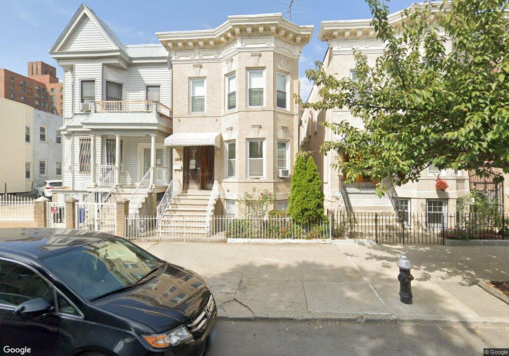
1939 Benedict Ave Bronx, NY 10462
Parkchester NeighborhoodEstimated Value: $1,088,000 - $1,282,000
--
Bed
--
Bath
3,708
Sq Ft
$319/Sq Ft
Est. Value
About This Home
This home is located at 1939 Benedict Ave, Bronx, NY 10462 and is currently estimated at $1,181,333, approximately $318 per square foot. 1939 Benedict Ave is a home located in Bronx County with nearby schools including P.S. 106 - Parkchester, M.S. 127 - The Castle Hill Middle School, and St Helena School.
Ownership History
Date
Name
Owned For
Owner Type
Purchase Details
Closed on
Sep 23, 2024
Sold by
Rodriguez Jacqueline
Bought by
Jacqueline Rodriguez Revocable Trust and Rodriguez Trustee Jacqueline
Current Estimated Value
Purchase Details
Closed on
Nov 1, 1999
Sold by
Rodriguez Jacqueline and Rios Margarita
Bought by
Rodriguez Jacqueline
Purchase Details
Closed on
Aug 22, 1997
Sold by
Lennon Patrick and Lennon Mary Elizabeth
Bought by
Rodriguez Jackie and Rios Margarita
Home Financials for this Owner
Home Financials are based on the most recent Mortgage that was taken out on this home.
Original Mortgage
$209,600
Interest Rate
7.14%
Mortgage Type
FHA
Create a Home Valuation Report for This Property
The Home Valuation Report is an in-depth analysis detailing your home's value as well as a comparison with similar homes in the area
Home Values in the Area
Average Home Value in this Area
Purchase History
| Date | Buyer | Sale Price | Title Company |
|---|---|---|---|
| Jacqueline Rodriguez Revocable Trust | -- | -- | |
| Rodriguez Jacqueline | -- | -- | |
| Rodriguez Jacqueline | -- | -- | |
| Rodriguez Jackie | $220,000 | -- | |
| Rodriguez Jackie | $220,000 | -- |
Source: Public Records
Mortgage History
| Date | Status | Borrower | Loan Amount |
|---|---|---|---|
| Previous Owner | Rodriguez Jackie | $209,600 |
Source: Public Records
Tax History Compared to Growth
Tax History
| Year | Tax Paid | Tax Assessment Tax Assessment Total Assessment is a certain percentage of the fair market value that is determined by local assessors to be the total taxable value of land and additions on the property. | Land | Improvement |
|---|---|---|---|---|
| 2025 | $7,424 | $40,663 | $6,427 | $34,236 |
| 2024 | $7,424 | $38,362 | $6,553 | $31,809 |
| 2023 | $7,507 | $38,362 | $6,580 | $31,782 |
| 2022 | $7,223 | $49,380 | $9,900 | $39,480 |
| 2021 | $7,256 | $46,800 | $9,900 | $36,900 |
| 2020 | $6,877 | $50,100 | $9,900 | $40,200 |
| 2019 | $6,395 | $40,380 | $9,900 | $30,480 |
| 2018 | $6,219 | $31,968 | $8,115 | $23,853 |
| 2017 | $6,091 | $31,351 | $8,303 | $23,048 |
| 2016 | $5,674 | $29,932 | $8,619 | $21,313 |
| 2015 | $3,347 | $28,238 | $9,118 | $19,120 |
| 2014 | $3,347 | $26,640 | $9,300 | $17,340 |
Source: Public Records
Map
Nearby Homes
- 1926 Mcgraw Ave
- 1949 Mcgraw Ave Unit 7F
- 1935 Mcgraw Ave Unit 7C
- 1332 Metropolitan Ave Unit 6A
- 1332 Metropolitan Ave Unit 2A
- 1332 Metropolitan Ave Unit 2H
- 1332 Metropolitan Ave Unit 3H
- 1922 Mcgraw Ave Unit 6I
- 1922 Mcgraw Ave Unit 1H
- 1314 Virginia Ave Unit 6F
- 1314 Virginia Ave Unit 6G
- 1314 Virginia Ave Unit 5A
- 1521 Unionport Rd Unit 11G
- 2049 Mcgraw Ave Unit 6H
- 1470 East Ave Unit 5G
- 1966 Newbold Ave Unit 104
- 1966 Newbold Ave Unit 108
- 1966 Newbold Ave Unit 1510
- 1966 Newbold Ave Unit 405
- 1966 Newbold Ave Unit 308
- 1941 Benedict Ave
- 1937 Benedict Ave
- 1943 Benedict Ave
- 1931 Benedict Ave
- 1945 Benedict Ave
- 1940 Mcgraw Ave
- 1936 Mcgraw Ave
- 1929 Benedict Ave
- 1942 Mcgraw Ave
- 1949 Benedict Ave
- 1932 Mcgraw Ave
- 1932 Mcgraw Ave Unit Building
- 1944 Mcgraw Ave
- 1944 Mcgraw Ave
- 1927 Benedict Ave
- 1946 Mcgraw Ave
- 1946 Mcgraw Ave
- 1946 Mcgraw Ave
- 1930 Mcgraw Ave
- 1925 Benedict Ave