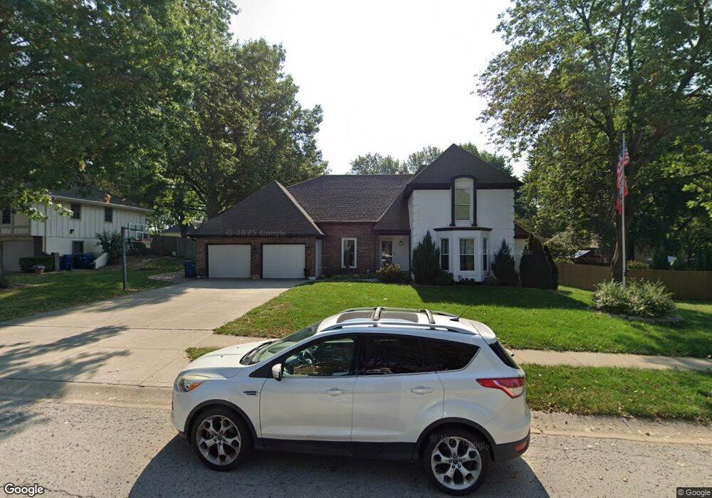
1939 Clay Dr Liberty, MO 64068
Estimated Value: $475,847 - $503,000
4
Beds
4
Baths
3,089
Sq Ft
$157/Sq Ft
Est. Value
About This Home
This home is located at 1939 Clay Dr, Liberty, MO 64068 and is currently estimated at $485,962, approximately $157 per square foot. 1939 Clay Dr is a home located in Clay County with nearby schools including Alexander Doniphan Elementary School, Discovery Middle School, and Liberty High School.
Ownership History
Date
Name
Owned For
Owner Type
Purchase Details
Closed on
Nov 22, 2013
Sold by
Wilson David A and Seaboyer Mary
Bought by
Broome Susan S
Current Estimated Value
Home Financials for this Owner
Home Financials are based on the most recent Mortgage that was taken out on this home.
Original Mortgage
$173,200
Outstanding Balance
$129,725
Interest Rate
4.34%
Mortgage Type
New Conventional
Estimated Equity
$356,237
Purchase Details
Closed on
May 15, 2009
Sold by
Broome Susan S and Broome Anthony J
Bought by
Wilson David A
Purchase Details
Closed on
Jun 28, 2007
Sold by
West Jay W and West Kristi J
Bought by
Wilson David A and Broome Susan S
Home Financials for this Owner
Home Financials are based on the most recent Mortgage that was taken out on this home.
Original Mortgage
$180,000
Interest Rate
6.19%
Mortgage Type
Purchase Money Mortgage
Purchase Details
Closed on
Dec 1, 1999
Sold by
Chasteeen Duffey Co
Bought by
West Jay W and West Kristi J
Home Financials for this Owner
Home Financials are based on the most recent Mortgage that was taken out on this home.
Original Mortgage
$149,400
Interest Rate
8.5%
Purchase Details
Closed on
Jan 2, 1997
Sold by
Withrow Gary Ray and Withrow June Ann
Bought by
Crooks Danny L and Crooks Peggy S
Home Financials for this Owner
Home Financials are based on the most recent Mortgage that was taken out on this home.
Original Mortgage
$127,900
Interest Rate
7.54%
Create a Home Valuation Report for This Property
The Home Valuation Report is an in-depth analysis detailing your home's value as well as a comparison with similar homes in the area
Home Values in the Area
Average Home Value in this Area
Purchase History
| Date | Buyer | Sale Price | Title Company |
|---|---|---|---|
| Broome Susan S | -- | Stewart Title Company | |
| Wilson David A | -- | None Available | |
| Wilson David A | -- | Chicago Title Insurance Co | |
| West Jay W | -- | United Title Company | |
| Crooks Danny L | -- | -- |
Source: Public Records
Mortgage History
| Date | Status | Borrower | Loan Amount |
|---|---|---|---|
| Open | Broome Susan S | $173,200 | |
| Previous Owner | Wilson David A | $180,000 | |
| Previous Owner | West Jay W | $149,400 | |
| Previous Owner | Crooks Danny L | $127,900 |
Source: Public Records
Tax History Compared to Growth
Tax History
| Year | Tax Paid | Tax Assessment Tax Assessment Total Assessment is a certain percentage of the fair market value that is determined by local assessors to be the total taxable value of land and additions on the property. | Land | Improvement |
|---|---|---|---|---|
| 2025 | $5,356 | $80,010 | -- | -- |
| 2024 | $5,356 | $69,640 | -- | -- |
| 2023 | $5,447 | $69,640 | $0 | $0 |
| 2022 | $4,902 | $61,880 | $0 | $0 |
| 2021 | $4,864 | $61,883 | $7,220 | $54,663 |
| 2020 | $4,358 | $52,060 | $6,840 | $45,220 |
| 2019 | $4,357 | $52,060 | $6,840 | $45,220 |
| 2018 | $4,047 | $47,480 | $0 | $0 |
| 2017 | $3,335 | $47,480 | $4,180 | $43,300 |
| 2016 | $3,335 | $39,500 | $4,180 | $35,320 |
| 2015 | $3,336 | $39,500 | $4,180 | $35,320 |
| 2014 | $3,253 | $38,210 | $4,750 | $33,460 |
Source: Public Records
Map
Nearby Homes
- 1507 Amesbury Ave
- 1323 Amesbury Ave
- 509 Belmont St
- 1733 Welleslay Ln
- 415 Monterey Ave
- 420 Belmont St
- 1124 Amesbury Ave
- 1218 Canterbury Ln
- 1537 Canterbury Ln
- 918 Amesbury Ave
- 2116 Winding Woods Dr
- 862 Amesbury Ave
- Lot 2 Bent Oaks Dr
- 1327 Easton Ct
- Lot 2A Oak Crest Dr
- 1304 Wellington Way
- 1331 Park Ln
- 716 Bristol Ct
- 1317 Park Ln
- 1205 Blackberry Dr
- 1933 Clay Dr
- 1942 Larkspur Dr
- 1948 Larkspur Dr
- 1927 Clay Dr
- 1936 Clay Dr
- 1936 Larkspur Dr
- 1940 Clay Dr
- 1932 Clay Dr
- 1944 Clay Dr
- 1914 Snowdrop Cir
- 1921 Clay Dr
- 1930 Larkspur Dr
- 1805 Garden Dr
- 1804 Garden Dr
- 1943 Larkspur Dr
- 1949 Larkspur Dr
- 1937 Larkspur Dr
- 1924 Larkspur Dr
- 1915 Clay Dr
- 2000 Clay Dr