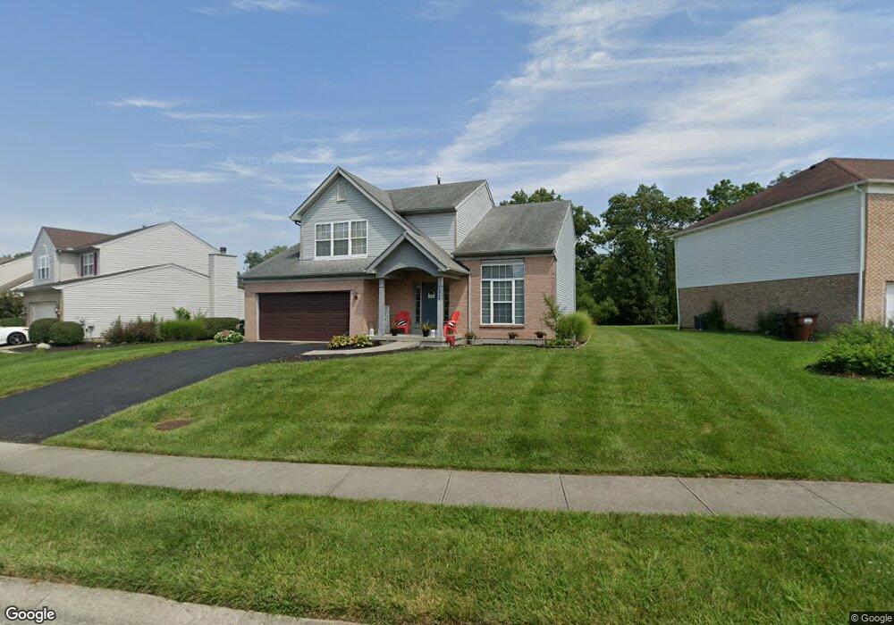
1939 Crest Rd Cincinnati, OH 45240
Estimated Value: $298,000 - $374,000
4
Beds
3
Baths
1,888
Sq Ft
$176/Sq Ft
Est. Value
About This Home
This home is located at 1939 Crest Rd, Cincinnati, OH 45240 and is currently estimated at $333,021, approximately $176 per square foot. 1939 Crest Rd is a home located in Hamilton County with nearby schools including Pleasant Run Elementary School, Pleasant Run Middle School, and Northwest High School.
Ownership History
Date
Name
Owned For
Owner Type
Purchase Details
Closed on
Sep 2, 2024
Sold by
Davis Kamira M and Davis Walter
Bought by
Davis Kamira M
Current Estimated Value
Purchase Details
Closed on
Apr 29, 2009
Sold by
U S Bank National Association
Bought by
Davis Walter and Davis Kamira M
Home Financials for this Owner
Home Financials are based on the most recent Mortgage that was taken out on this home.
Original Mortgage
$136,231
Interest Rate
4.94%
Mortgage Type
FHA
Purchase Details
Closed on
Dec 24, 2008
Sold by
Ferguson Michael A and Ferguson Michael
Bought by
U S Bank National Association
Purchase Details
Closed on
Feb 25, 2005
Sold by
Ferguson Michael and Ferguson Felicia
Bought by
Ferguson Michael A and Ferguson Felecia F
Purchase Details
Closed on
Mar 11, 2004
Sold by
Owens Michael and Owens Constance R
Bought by
Ferguson Michael and Ferguson Felicia
Home Financials for this Owner
Home Financials are based on the most recent Mortgage that was taken out on this home.
Original Mortgage
$145,600
Interest Rate
5.65%
Mortgage Type
Unknown
Purchase Details
Closed on
Jul 25, 1997
Sold by
Wells Debera D
Bought by
Owens Michael and Owens Constance R
Home Financials for this Owner
Home Financials are based on the most recent Mortgage that was taken out on this home.
Original Mortgage
$134,910
Interest Rate
7.81%
Purchase Details
Closed on
Apr 24, 1996
Sold by
Zaring Homes Inc
Bought by
Wells Dobera D
Home Financials for this Owner
Home Financials are based on the most recent Mortgage that was taken out on this home.
Original Mortgage
$140,300
Interest Rate
7.78%
Create a Home Valuation Report for This Property
The Home Valuation Report is an in-depth analysis detailing your home's value as well as a comparison with similar homes in the area
Home Values in the Area
Average Home Value in this Area
Purchase History
| Date | Buyer | Sale Price | Title Company |
|---|---|---|---|
| Davis Kamira M | -- | None Listed On Document | |
| Davis Walter | $130,000 | Platinum Title Services | |
| U S Bank National Association | $102,000 | None Available | |
| Ferguson Michael A | -- | Alliance Title Company | |
| Ferguson Michael | $182,000 | -- | |
| Owens Michael | $149,900 | -- | |
| Wells Dobera D | $147,800 | -- |
Source: Public Records
Mortgage History
| Date | Status | Borrower | Loan Amount |
|---|---|---|---|
| Previous Owner | Davis Walter | $136,231 | |
| Previous Owner | Ferguson Michael | $145,600 | |
| Previous Owner | Owens Michael | $134,910 | |
| Previous Owner | Wells Dobera D | $140,300 |
Source: Public Records
Tax History Compared to Growth
Tax History
| Year | Tax Paid | Tax Assessment Tax Assessment Total Assessment is a certain percentage of the fair market value that is determined by local assessors to be the total taxable value of land and additions on the property. | Land | Improvement |
|---|---|---|---|---|
| 2024 | $4,039 | $79,037 | $15,400 | $63,637 |
| 2023 | $4,062 | $79,037 | $15,400 | $63,637 |
| 2022 | $3,974 | $62,888 | $13,188 | $49,700 |
| 2021 | $3,941 | $62,888 | $13,188 | $49,700 |
| 2020 | $3,980 | $62,888 | $13,188 | $49,700 |
| 2019 | $3,714 | $52,406 | $10,990 | $41,416 |
| 2018 | $3,331 | $52,406 | $10,990 | $41,416 |
| 2017 | $3,157 | $52,406 | $10,990 | $41,416 |
| 2016 | $2,849 | $46,410 | $11,781 | $34,629 |
| 2015 | $2,914 | $46,410 | $11,781 | $34,629 |
| 2014 | $2,652 | $46,410 | $11,781 | $34,629 |
| 2013 | $2,611 | $45,500 | $11,550 | $33,950 |
Source: Public Records
Map
Nearby Homes
- 2188 Broadhurst Ave
- 2465 Owlcrest Dr
- 1863 W Kemper Rd
- 11478 Ramondi Place
- 12052 Doe Run Ct
- 1923 Centerbrook Ct
- 11728 Elkwood Dr
- 1810 W Kemper Rd
- 12057 Brookway Dr
- 11565 Regency Square Ct
- 12080 Regency Run Ct Unit 4
- 11995 Wincanton Dr
- 2545 Haverknoll Dr
- 2617 Haverknoll Dr
- 12120 Regency Run Ct
- 11825 Cedarcreek Dr
- 2531 Retford Dr
- 11872 Elmgrove Cir
- 11666 Elkwood Dr
- 12181 Regency Run Ct