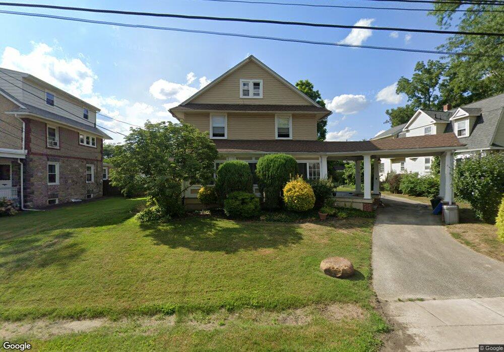
1939 Forrest Ave Morton, PA 19070
Estimated Value: $401,443 - $455,000
4
Beds
2
Baths
2,088
Sq Ft
$206/Sq Ft
Est. Value
About This Home
This home is located at 1939 Forrest Ave, Morton, PA 19070 and is currently estimated at $430,361, approximately $206 per square foot. 1939 Forrest Ave is a home located in Delaware County with nearby schools including Amosland El School, Ridley Middle School, and Ridley High School.
Ownership History
Date
Name
Owned For
Owner Type
Purchase Details
Closed on
Dec 14, 2007
Sold by
Houston James J
Bought by
Sapega Sally N
Current Estimated Value
Purchase Details
Closed on
Oct 29, 2004
Sold by
Dick Paul J and Dick Sharon
Bought by
Houston James J
Home Financials for this Owner
Home Financials are based on the most recent Mortgage that was taken out on this home.
Original Mortgage
$184,000
Interest Rate
5.71%
Mortgage Type
Fannie Mae Freddie Mac
Purchase Details
Closed on
Jan 29, 2004
Sold by
Hunn Jeanne K
Bought by
Dick Paul J and Dick Sharon
Create a Home Valuation Report for This Property
The Home Valuation Report is an in-depth analysis detailing your home's value as well as a comparison with similar homes in the area
Home Values in the Area
Average Home Value in this Area
Purchase History
| Date | Buyer | Sale Price | Title Company |
|---|---|---|---|
| Sapega Sally N | $257,500 | None Available | |
| Houston James J | $230,000 | -- | |
| Dick Paul J | $100,000 | Fidelity Natl Title Ins Co |
Source: Public Records
Mortgage History
| Date | Status | Borrower | Loan Amount |
|---|---|---|---|
| Previous Owner | Houston James J | $184,000 |
Source: Public Records
Tax History
| Year | Tax Paid | Tax Assessment Tax Assessment Total Assessment is a certain percentage of the fair market value that is determined by local assessors to be the total taxable value of land and additions on the property. | Land | Improvement |
|---|---|---|---|---|
| 2025 | $7,666 | $220,770 | $62,690 | $158,080 |
| 2024 | $7,666 | $220,770 | $62,690 | $158,080 |
| 2023 | $7,332 | $220,770 | $62,690 | $158,080 |
| 2022 | $7,097 | $220,770 | $62,690 | $158,080 |
| 2021 | $10,986 | $220,770 | $62,690 | $158,080 |
| 2020 | $6,111 | $108,180 | $37,620 | $70,560 |
| 2019 | $5,999 | $108,180 | $37,620 | $70,560 |
| 2018 | $5,925 | $108,180 | $0 | $0 |
| 2017 | $5,925 | $108,180 | $0 | $0 |
| 2016 | $594 | $108,180 | $0 | $0 |
| 2015 | $606 | $108,180 | $0 | $0 |
| 2014 | $606 | $108,180 | $0 | $0 |
Source: Public Records
Map
Nearby Homes
- 21 Faraday Ct
- 1015 Mitchell Ave
- 2143 Haig Ave
- 2 Yale Ave
- 7 & 0 Woodland Ave
- 720 Kedron Ave
- 111 Broad St
- 202-203 Sycamore Ave
- 507 School St
- 216-218 President Ave
- 2323 Mole Rd
- 201 W Sylvan Ave
- 2158 6th Ave
- 880 Quaint St
- 2379 Mole Rd
- 978 Westfield Rd
- 1226 Redwood Ave
- 933 Greenbriar Ln
- 1002 11th Ave
- 114 Providence Rd
- 1943 Forrest Ave
- 1933 Forrest Ave
- 1932 Franklin Ave
- 1949 Forrest Ave
- 1934 Forrest Ave
- 1938 Forrest Ave
- 1942 Forrest Ave
- 1930 Forrest Ave
- 1928 Franklin Ave
- 1946 Forrest Ave
- 1926 Forrest Ave
- 1923 Forrest Ave
- 1916 Franklin Ave
- 947 Amosland Rd
- 1922 Forrest Ave
- 1912 Franklin Ave
- 1937 Franklin Ave
- 1916 Forrest Ave
- 1921 Forrest Ave
- 960 Amosland Rd
Your Personal Tour Guide
Ask me questions while you tour the home.