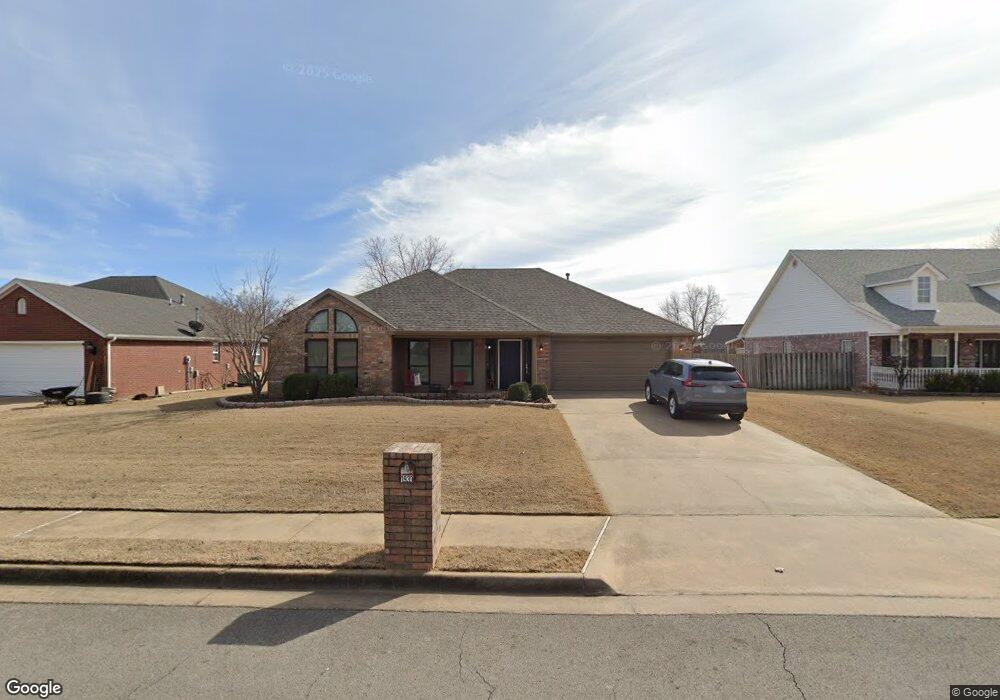
1939 Lancaster Dr Springdale, AR 72762
Estimated Value: $392,190 - $410,000
--
Bed
2
Baths
2,018
Sq Ft
$199/Sq Ft
Est. Value
About This Home
This home is located at 1939 Lancaster Dr, Springdale, AR 72762 and is currently estimated at $401,798, approximately $199 per square foot. 1939 Lancaster Dr is a home located in Benton County with nearby schools including Hunt Elementary School, Central Junior High School, and Hellstern Middle School.
Ownership History
Date
Name
Owned For
Owner Type
Purchase Details
Closed on
Jul 28, 2015
Sold by
Bright Trisha Danyelle and Smith Trisha Danyelle
Bought by
Smith Alan and Smith Trisha Danyelle
Current Estimated Value
Purchase Details
Closed on
Jan 2, 2013
Sold by
Bright Jody A
Bought by
Bright Trisha Danyelle
Home Financials for this Owner
Home Financials are based on the most recent Mortgage that was taken out on this home.
Original Mortgage
$98,000
Outstanding Balance
$67,802
Interest Rate
3.34%
Mortgage Type
New Conventional
Estimated Equity
$333,996
Purchase Details
Closed on
Jul 7, 2003
Bought by
Bright
Purchase Details
Closed on
Sep 2, 1999
Bought by
Reeves
Purchase Details
Closed on
Feb 8, 1999
Bought by
Pinkley
Purchase Details
Closed on
Oct 27, 1993
Bought by
Pinkley C
Create a Home Valuation Report for This Property
The Home Valuation Report is an in-depth analysis detailing your home's value as well as a comparison with similar homes in the area
Home Values in the Area
Average Home Value in this Area
Purchase History
| Date | Buyer | Sale Price | Title Company |
|---|---|---|---|
| Smith Alan | -- | Attorney | |
| Bright Trisha Danyelle | -- | Waco | |
| Bright | $163,000 | -- | |
| Reeves | $121,000 | -- | |
| Pinkley | $23,000 | -- | |
| Pinkley C | -- | -- |
Source: Public Records
Mortgage History
| Date | Status | Borrower | Loan Amount |
|---|---|---|---|
| Open | Bright Trisha Danyelle | $98,000 |
Source: Public Records
Tax History Compared to Growth
Tax History
| Year | Tax Paid | Tax Assessment Tax Assessment Total Assessment is a certain percentage of the fair market value that is determined by local assessors to be the total taxable value of land and additions on the property. | Land | Improvement |
|---|---|---|---|---|
| 2025 | $2,613 | $75,758 | $24,000 | $51,758 |
| 2024 | $2,551 | $75,758 | $24,000 | $51,758 |
| 2023 | $2,429 | $48,770 | $15,200 | $33,570 |
| 2022 | $1,953 | $48,770 | $15,200 | $33,570 |
| 2021 | $1,839 | $48,770 | $15,200 | $33,570 |
| 2020 | $1,738 | $39,640 | $9,600 | $30,040 |
| 2019 | $1,738 | $39,640 | $9,600 | $30,040 |
| 2018 | $1,763 | $39,640 | $9,600 | $30,040 |
| 2017 | $1,634 | $39,640 | $9,600 | $30,040 |
| 2016 | $1,634 | $39,640 | $9,600 | $30,040 |
| 2015 | $1,890 | $35,460 | $6,800 | $28,660 |
| 2014 | $1,540 | $35,460 | $6,800 | $28,660 |
Source: Public Records
Map
Nearby Homes
- 2122 Wagon Wheel Rd
- 4654 Carriage Ln
- 1859 Lancaster Dr
- 4661 Carriage Ln
- 4210 Essex Cove
- 1072 Lexington Cir
- 5335 Callahan Mountain Rd
- 3986 Saulsbury St
- 0 Graham Rd
- 1376 Lexington Cir
- 3800 Tanglewood Dr
- 5292 N Graham Rd
- 1308 W Stultz Rd
- 3497 Eaglecrest Cir
- 3450 Pasofino Loop
- 5315 Walden St
- 3850 Barton Spring St
- 2680 Charismatic
- 1483 Leesburg Ave
- 3038 Cherry Knoll Cir
- 1921 Lancaster Dr
- 1955 Lancaster Dr
- 4356 Essex Cove
- 4378 Essex Cove
- 1907 Lancaster Dr
- 1934 Lancaster Dr
- 1967 Lancaster Dr
- 1952 Lancaster Dr
- 4410 Essex Cove
- 1918 Lancaster Dr
- 4344 Essex Cove
- 1891 Lancaster Dr
- 1973 Lancaster Dr
- 1900 Lancaster Dr
- 4452 Essex Cove
- 1875 Lancaster Dr
- 4317 Essex Cove
- 1882 Lancaster Dr
- 4322 Essex Cove