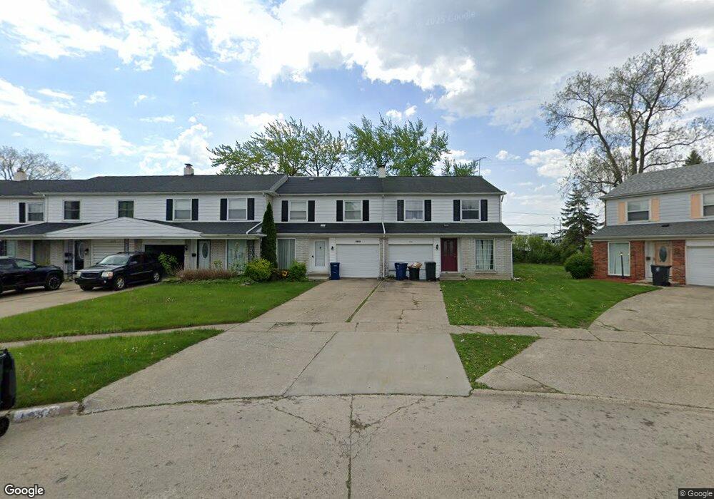
1939 Laurel Oak Dr Flint, MI 48507
Westgate NeighborhoodEstimated Value: $100,694 - $123,000
3
Beds
2
Baths
1,760
Sq Ft
$64/Sq Ft
Est. Value
About This Home
This home is located at 1939 Laurel Oak Dr, Flint, MI 48507 and is currently estimated at $113,174, approximately $64 per square foot. 1939 Laurel Oak Dr is a home located in Genesee County with nearby schools including Neithercut Elementary School, Flint Southwestern Classical Academy, and International Academy of Flint (K-12).
Ownership History
Date
Name
Owned For
Owner Type
Purchase Details
Closed on
Mar 8, 2019
Sold by
Winfield Arlene
Bought by
Selmond Homes Llc
Current Estimated Value
Purchase Details
Closed on
Nov 7, 2018
Sold by
U S Bank Na
Bought by
Winfield Arlene Lenita
Purchase Details
Closed on
Mar 21, 2018
Sold by
Real Katrina and Mortgage Electronic Registrati
Bought by
Us Bank Na and Strcutured Asset Securities Coporation M
Create a Home Valuation Report for This Property
The Home Valuation Report is an in-depth analysis detailing your home's value as well as a comparison with similar homes in the area
Home Values in the Area
Average Home Value in this Area
Purchase History
| Date | Buyer | Sale Price | Title Company |
|---|---|---|---|
| Selmond Homes Llc | -- | None Available | |
| Winfield Arlene Lenita | $17,000 | Boston National Title Agency | |
| Us Bank Na | $22,500 | None Available |
Source: Public Records
Tax History Compared to Growth
Tax History
| Year | Tax Paid | Tax Assessment Tax Assessment Total Assessment is a certain percentage of the fair market value that is determined by local assessors to be the total taxable value of land and additions on the property. | Land | Improvement |
|---|---|---|---|---|
| 2025 | $1,459 | $46,800 | $0 | $0 |
| 2024 | $1,344 | $44,200 | $0 | $0 |
| 2023 | $1,308 | $37,700 | $0 | $0 |
| 2022 | $0 | $28,800 | $0 | $0 |
| 2021 | $1,330 | $23,400 | $0 | $0 |
| 2020 | $1,216 | $21,200 | $0 | $0 |
| 2019 | $1,183 | $14,200 | $0 | $0 |
| 2018 | $965 | $14,400 | $0 | $0 |
| 2017 | $966 | $0 | $0 | $0 |
| 2016 | $1,063 | $0 | $0 | $0 |
| 2015 | -- | $0 | $0 | $0 |
| 2014 | -- | $0 | $0 | $0 |
| 2012 | -- | $21,400 | $0 | $0 |
Source: Public Records
Map
Nearby Homes
- 1933 Greenbriar Ln
- 1902 Rockcreek Ln
- 1905 Greenbriar Ln
- 4107 Park Forest Dr
- 1818 Rockcreek Ln
- 4020 Park Forest Dr
- 1409 Lynton Ave
- 4101 Greenbrook Ln
- Lot 57 Walnut Creek Dr
- 2107 Stoney Brook Ct
- 4518 Huckleberry Ln
- 1826 Greenbrook Ln
- 1902 Crestbrook Ln
- 1247 Catalina Dr
- 1741 Carmanbrook Pkwy
- 1508 W Bristol Rd
- 1607 Mulberry Ln
- 1814 Carmanbrook Pkwy
- 1416 Blackberry Ln
- 1418 Blueberry Ln
- 1937 Laurel Oak Dr
- 1941 Laurel Oak Dr
- 1935 Laurel Oak Dr
- 1933 Laurel Oak Dr
- 1945 Laurel Oak Dr Unit Bldg-Unit
- 1945 Laurel Oak Dr
- 1917 Laurel Oak Dr
- 1955 Laurel Oak Dr
- 1943 Laurel Oak Dr
- 1947 Laurel Oak Dr
- 1915 Laurel Oak Dr
- 1949 Laurel Oak Dr
- 1951 Laurel Oak Dr Unit Bldg-Unit
- 1951 Laurel Oak Dr
- 1913 Laurel Oak Dr
- 1931 Laurel Oak Dr
- 1953 Laurel Oak Dr
- 1911 Laurel Oak Dr
- 1936 Laurel Oak Dr
- 1957 Laurel Oak Dr
