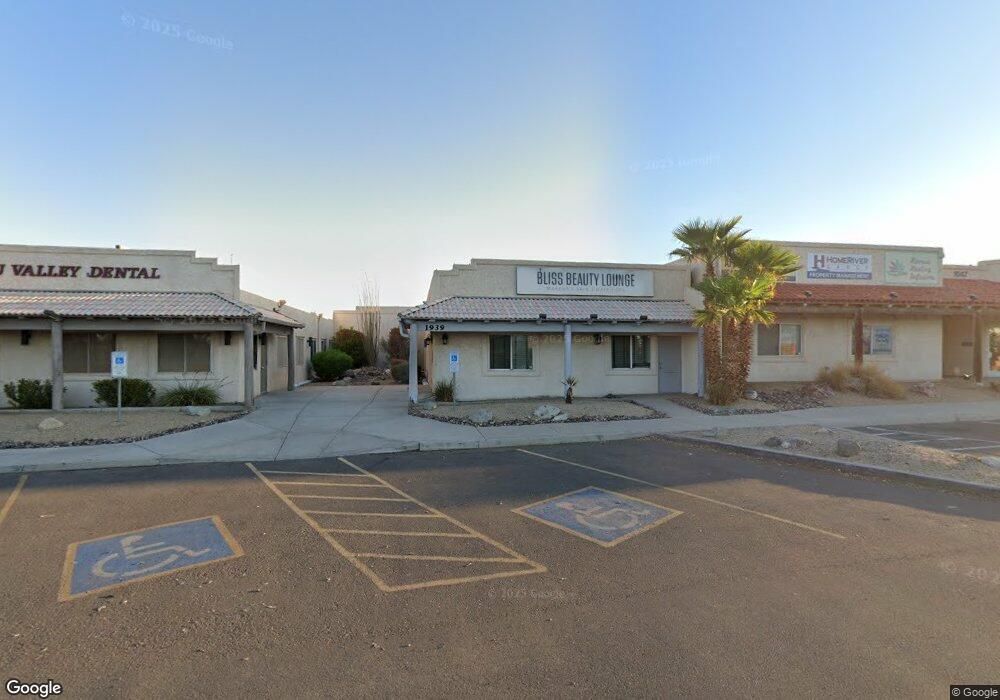
1939 Mcculloch Blvd N Lake Havasu City, AZ 86403
Estimated Value: $922,005
--
Bed
--
Bath
2,581
Sq Ft
$357/Sq Ft
Est. Value
About This Home
This home is located at 1939 Mcculloch Blvd N, Lake Havasu City, AZ 86403 and is currently estimated at $922,005, approximately $357 per square foot. 1939 Mcculloch Blvd N is a home located in Mohave County with nearby schools including Smoketree Elementary School, Thunderbolt Middle School, and Lake Havasu High School.
Ownership History
Date
Name
Owned For
Owner Type
Purchase Details
Closed on
Feb 8, 2008
Sold by
Sorkin Edouard and Sorkin Yuliya
Bought by
Sorcol Llc
Current Estimated Value
Purchase Details
Closed on
Aug 16, 2004
Sold by
Wanzek Linda
Bought by
Wanzek David J
Purchase Details
Closed on
Aug 13, 2004
Sold by
Wanzek David and Gilje John
Bought by
Sorkin Edouard and Sorkin Yuliya
Create a Home Valuation Report for This Property
The Home Valuation Report is an in-depth analysis detailing your home's value as well as a comparison with similar homes in the area
Home Values in the Area
Average Home Value in this Area
Purchase History
| Date | Buyer | Sale Price | Title Company |
|---|---|---|---|
| Sorcol Llc | -- | First American Title Insuran | |
| Wanzek David J | -- | First American Title Ins Co | |
| Wanzek David J | $303,500 | First American Title Ins Co | |
| Sorkin Edouard | $420,000 | First American Title Ins Co |
Source: Public Records
Tax History Compared to Growth
Tax History
| Year | Tax Paid | Tax Assessment Tax Assessment Total Assessment is a certain percentage of the fair market value that is determined by local assessors to be the total taxable value of land and additions on the property. | Land | Improvement |
|---|---|---|---|---|
| 2026 | -- | -- | -- | -- |
| 2025 | $4,296 | $74,320 | $0 | $0 |
| 2024 | $4,296 | $63,057 | $0 | $0 |
| 2023 | $4,296 | $48,457 | $0 | $0 |
| 2022 | $4,484 | $46,121 | $0 | $0 |
| 2021 | $4,833 | $49,028 | $0 | $0 |
| 2019 | $5,076 | $49,544 | $0 | $0 |
| 2018 | $5,578 | $55,239 | $0 | $0 |
| 2017 | $5,532 | $57,239 | $0 | $0 |
| 2016 | $5,079 | $53,176 | $0 | $0 |
| 2015 | $4,971 | $47,933 | $0 | $0 |
Source: Public Records
Map
Nearby Homes
- 1957 Mesquite Ave Unit 23B
- 1957 Mesquite Ave Unit 46A
- 1989 Mesquite Ave Unit 74
- 1989 Mesquite Ave Unit 32
- 1989 Mesquite Ave Unit 17
- 1989 Mesquite Ave Unit 46
- 1989 Mesquite Ave Unit 2
- 1989 Mesquite Ave Unit 29
- 0000 Sunrise Plan On Your Lot
- 1910 Swanson Ave Unit A22
- 1910 Swanson Ave Unit B11
- 1910 Swanson Ave Unit B19
- 1926 Swanson Ave
- 1806 Swanson Ave Unit 205
- 1806 Swanson Ave Unit 103
- 1806 Swanson Ave Unit 226
- 1806 Swanson Ave Unit 108
- 2094 Mesquite Ave Unit 113
- 2094 Mesquite Ave Unit 126
- 2085 Mesquite Ave Unit 64
- 1939 Mcculloch Blvd N Unit A
- 1947 Mcculloch Blvd N Unit 105
- 1947 Mcculloch Blvd N
- 1947 Mcculloch Blvd N Unit 104/105
- 1947 Mcculloch Blvd N Unit 105/106
- 1947 Mcculloch Blvd N Unit 104-106
- 1947 Mcculloch Blvd N Unit 101
- 1947 Mcculloch Blvd N Unit 106
- 1947 Mcculloch Blvd N Unit 103
- 1947 Mcculloch Blvd N Unit 102
- 1947 Mcculloch Blvd N Unit 104
- 1955 Mcculloch Blvd N
- 1955 Mcculloch Blvd N Unit 100
- 1923 Mcculloch Blvd N
- 1923 Mcculloch Blvd N
- 1952 Mesquite Ave Unit 2
- 1944 Mesquite Ave
- 1948 Mesquite Ave
- 1948 Mesquite Ave Unit 103
- 1948 Mesquite Ave Unit 102