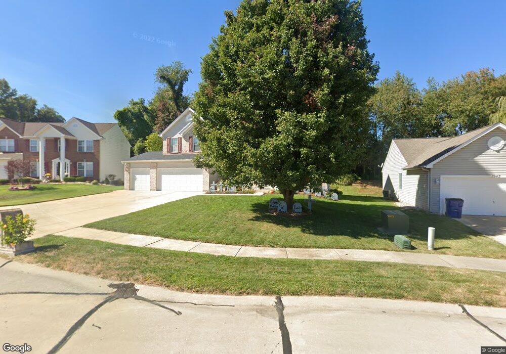
1939 Meadow Trails Dr Florissant, MO 63031
Estimated Value: $378,321 - $440,000
4
Beds
4
Baths
2,860
Sq Ft
$141/Sq Ft
Est. Value
About This Home
This home is located at 1939 Meadow Trails Dr, Florissant, MO 63031 and is currently estimated at $403,330, approximately $141 per square foot. 1939 Meadow Trails Dr is a home located in St. Louis County with nearby schools including Cold Water Elementary School, North Middle School, and Hazelwood Central High School.
Ownership History
Date
Name
Owned For
Owner Type
Purchase Details
Closed on
Apr 22, 2005
Sold by
Vanthomas Ty T and Van Thomas Kristin A
Bought by
Standish Patrick H and Standish Rebecca L
Current Estimated Value
Home Financials for this Owner
Home Financials are based on the most recent Mortgage that was taken out on this home.
Original Mortgage
$252,800
Outstanding Balance
$131,724
Interest Rate
5.93%
Mortgage Type
Fannie Mae Freddie Mac
Estimated Equity
$271,606
Purchase Details
Closed on
May 3, 2002
Sold by
Rolwes Company Inc
Bought by
Vanthomas Ty T and Vanthomas Kristin A
Home Financials for this Owner
Home Financials are based on the most recent Mortgage that was taken out on this home.
Original Mortgage
$200,690
Interest Rate
7.11%
Purchase Details
Closed on
Jan 28, 2002
Sold by
L A D Properties Llc
Bought by
Rowles Company Inc
Create a Home Valuation Report for This Property
The Home Valuation Report is an in-depth analysis detailing your home's value as well as a comparison with similar homes in the area
Home Values in the Area
Average Home Value in this Area
Purchase History
| Date | Buyer | Sale Price | Title Company |
|---|---|---|---|
| Standish Patrick H | $316,000 | -- | |
| Vanthomas Ty T | $250,863 | -- | |
| Rowles Company Inc | $167,500 | -- |
Source: Public Records
Mortgage History
| Date | Status | Borrower | Loan Amount |
|---|---|---|---|
| Open | Standish Patrick H | $252,800 | |
| Previous Owner | Vanthomas Ty T | $200,690 | |
| Closed | Standish Patrick H | $63,200 |
Source: Public Records
Tax History Compared to Growth
Tax History
| Year | Tax Paid | Tax Assessment Tax Assessment Total Assessment is a certain percentage of the fair market value that is determined by local assessors to be the total taxable value of land and additions on the property. | Land | Improvement |
|---|---|---|---|---|
| 2025 | $5,086 | $71,730 | $8,930 | $62,800 |
| 2024 | $5,086 | $58,950 | $4,120 | $54,830 |
| 2023 | $5,079 | $58,950 | $4,120 | $54,830 |
| 2022 | $5,258 | $54,420 | $5,360 | $49,060 |
| 2021 | $5,182 | $54,420 | $5,360 | $49,060 |
| 2020 | $5,019 | $49,080 | $6,250 | $42,830 |
| 2019 | $4,984 | $49,080 | $6,250 | $42,830 |
| 2018 | $5,105 | $46,250 | $5,360 | $40,890 |
| 2017 | $5,099 | $46,250 | $5,360 | $40,890 |
| 2016 | $4,961 | $44,380 | $7,140 | $37,240 |
| 2015 | $4,779 | $44,380 | $7,140 | $37,240 |
| 2014 | $4,070 | $38,930 | $6,690 | $32,240 |
Source: Public Records
Map
Nearby Homes
- 1807 Kilmory Dr
- 1638 Matlock Dr
- 16787 River Stone Dr
- 16804 River Stone Dr
- 3645 Woodman Dr
- 1455 Burnside Ct
- 3035 Matlock Dr
- 2 Berwick at Riverstone
- 1641 Sherwood Forest Dr
- 3819 Sonora Stone Dr
- 3660 Woodman Dr
- 3828 Sonora Stone Dr
- 2 Maple at Riverstone
- 1522 Sherwood Forest Dr
- 2 Ashford at Riverstone
- 2 Aspen II at Riverstone
- 3840 Sonora Stone Dr
- 3839 Sonora Stone Dr
- 2 Aspen at Riverstone
- 3844 Rapids Dr
- 1943 Meadow Trails Dr
- 1935 Meadow Trails Dr
- 1947 Meadow Trails Dr
- 1942 Meadow Trails Dr
- 1931 Meadow Trails Dr
- 1926 Meadow Trails Dr
- 1927 Meadow Trails Dr
- 1962 Meadow Trails Dr
- 1951 Meadow Trails Dr
- 1891 Chateau Du Mont Dr
- 1923 Meadow Trails Dr
- 1918 Meadow Trails Dr
- 1866 Kilmory Dr
- 1955 Meadow Trails Dr
- 1966 Meadow Trails Dr
- 1959 Meadow Trails Dr
- 1919 Meadow Trails Dr
- 1862 Kilmory Dr
- 1887 Chateau Du Mont Dr
- 1914 Meadow Trails Dr
