Estimated Value: $623,000 - $716,000
3
Beds
3
Baths
3,037
Sq Ft
$222/Sq Ft
Est. Value
About This Home
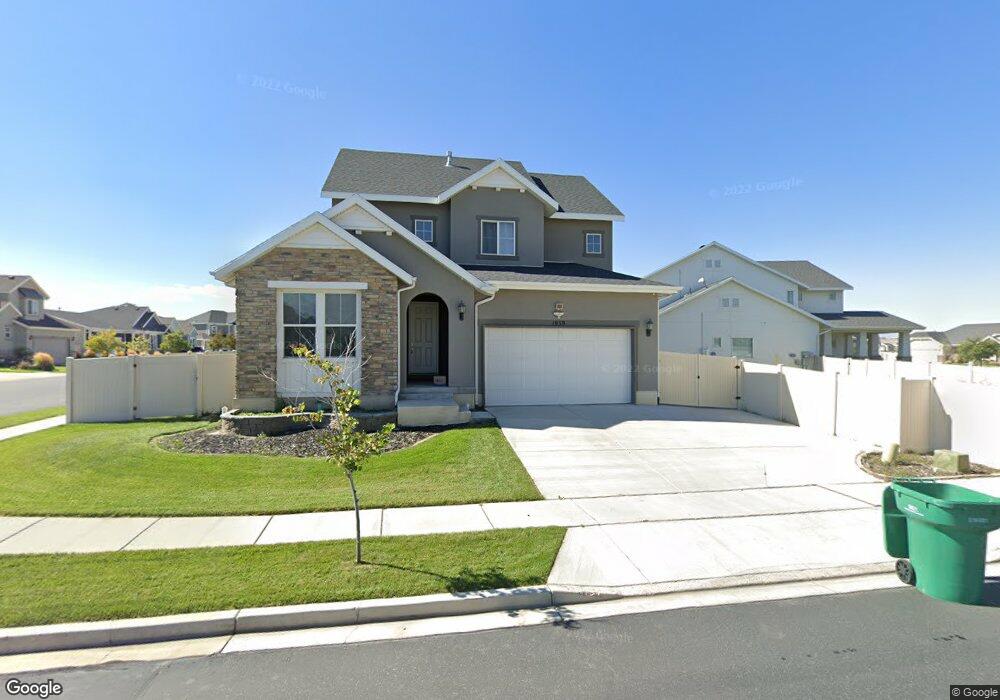
This home is located at 1939 N 2540 W, Lehi, UT 84043 and is currently estimated at $675,027, approximately $222 per square foot. 1939 N 2540 W is a home located in Utah County with nearby schools including North Point Elementary School, Willowcreek Middle School, and Lehi High School.
Ownership History
Date
Name
Owned For
Owner Type
Purchase Details
Closed on
Feb 21, 2022
Sold by
Ubaldo Montecinos David
Bought by
Montecinos Genalyn Trinidad
Current Estimated Value
Purchase Details
Closed on
Mar 8, 2016
Sold by
Ivory Homes Ltd
Bought by
Montecinos David
Home Financials for this Owner
Home Financials are based on the most recent Mortgage that was taken out on this home.
Original Mortgage
$337,634
Interest Rate
3.79%
Mortgage Type
New Conventional
Create a Home Valuation Report for This Property
The Home Valuation Report is an in-depth analysis detailing your home's value as well as a comparison with similar homes in the area
Home Values in the Area
Average Home Value in this Area
Purchase History
| Date | Buyer | Sale Price | Title Company |
|---|---|---|---|
| Montecinos Genalyn Trinidad | -- | None Listed On Document | |
| Montecinos David | -- | Cottonwood Title | |
| Ivory Homes Ltd | -- | Cottonwood Title |
Source: Public Records
Mortgage History
| Date | Status | Borrower | Loan Amount |
|---|---|---|---|
| Previous Owner | Montecinos David | $337,634 |
Source: Public Records
Tax History Compared to Growth
Tax History
| Year | Tax Paid | Tax Assessment Tax Assessment Total Assessment is a certain percentage of the fair market value that is determined by local assessors to be the total taxable value of land and additions on the property. | Land | Improvement |
|---|---|---|---|---|
| 2025 | $2,656 | $347,985 | $264,400 | $368,300 |
| 2024 | $2,656 | $310,860 | $0 | $0 |
| 2023 | $2,456 | $312,125 | $0 | $0 |
| 2022 | $2,733 | $336,710 | $0 | $0 |
| 2021 | $2,429 | $452,400 | $153,000 | $299,400 |
| 2020 | $2,290 | $421,500 | $141,700 | $279,800 |
| 2019 | $2,091 | $400,100 | $141,700 | $258,400 |
| 2018 | $1,914 | $346,200 | $121,500 | $224,700 |
| 2017 | $1,773 | $170,555 | $0 | $0 |
| 2016 | $1,308 | $116,765 | $0 | $0 |
| 2015 | $643 | $54,500 | $0 | $0 |
Source: Public Records
Map
Nearby Homes
- 1696 N 2640 W
- Huntington Plan at Pioneer Meadows
- Silver Lake Plan at Pioneer Meadows
- Summit Plan at Pioneer Meadows
- Palisade Plan at Pioneer Meadows
- 2189 N 2600 W
- 1870 N 2230 W
- 1896 N 2230 W
- 1908 N 2230 W
- 1970 N 2090 St W
- 2012 N 2040 W
- 1969 N 2040 St W
- 1968 N 2040 W
- 2013 N 2040 W
- 1990 N 2040 W
- 2464 W 2400 N
- 1302 N 2450 W
- 1648 N 1900 W
- 1958 N 3330 W Unit C204
- Accord Plan at Riverwalk
- 2551 W Cranberry Ridge Rd
- 1932 W 2600 N
- 2529 W 1910 N
- 2517 W 1910 N
- 1952 N 2600 W
- 2547 W 1910 N
- 2575 W Cranberry Ridge Rd
- 1942 N 2540 W
- 2561 W 1910 N
- 1966 N 2540 W
- 1914 N 2540 W
- 2509 W 1910 N
- 2552 W Cranberry Ridge Rd
- 2564 W Cranberry Ridge Rd
- 2538 W Cranberry Ridge Rd
- 2583 W 1910 N
- 1868 N 2600 W
- 2501 W Cranberry Ridge Rd
- 2526 W Cranberry Ridge Rd
- 1862 N 2600 W