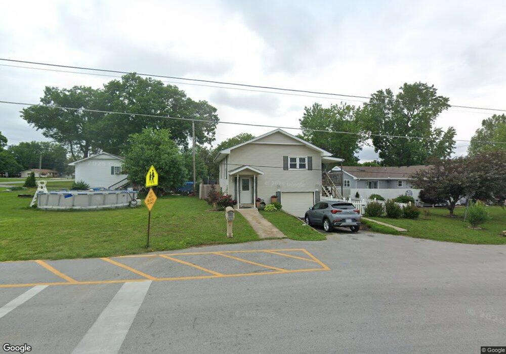
1939 Pearl St Carthage, MO 64836
Estimated Value: $167,000 - $235,000
3
Beds
2
Baths
1,780
Sq Ft
$115/Sq Ft
Est. Value
About This Home
This home is located at 1939 Pearl St, Carthage, MO 64836 and is currently estimated at $204,788, approximately $115 per square foot. 1939 Pearl St is a home located in Jasper County with nearby schools including Carthage High School, St. Ann's Catholic School, and Victory Academy.
Ownership History
Date
Name
Owned For
Owner Type
Purchase Details
Closed on
May 8, 2023
Sold by
Theil Alicia M
Bought by
Rodriguez Erika Garcia
Current Estimated Value
Home Financials for this Owner
Home Financials are based on the most recent Mortgage that was taken out on this home.
Original Mortgage
$151,515
Outstanding Balance
$147,325
Interest Rate
6.42%
Mortgage Type
New Conventional
Estimated Equity
$57,463
Purchase Details
Closed on
May 31, 2007
Sold by
Amos Jack L and Gilpin Stephanie K
Bought by
Theil Alicia M
Home Financials for this Owner
Home Financials are based on the most recent Mortgage that was taken out on this home.
Original Mortgage
$62,500
Interest Rate
6.17%
Mortgage Type
Purchase Money Mortgage
Purchase Details
Closed on
Jul 21, 2004
Sold by
Williams Ora L and Williams Karen G
Bought by
Amos Jack L and Gilpin Stephanie K
Create a Home Valuation Report for This Property
The Home Valuation Report is an in-depth analysis detailing your home's value as well as a comparison with similar homes in the area
Home Values in the Area
Average Home Value in this Area
Purchase History
| Date | Buyer | Sale Price | Title Company |
|---|---|---|---|
| Rodriguez Erika Garcia | -- | Fatco | |
| Theil Alicia M | -- | Abbey | |
| Amos Jack L | -- | -- |
Source: Public Records
Mortgage History
| Date | Status | Borrower | Loan Amount |
|---|---|---|---|
| Open | Rodriguez Erika Garcia | $151,515 | |
| Previous Owner | Theil Alicia M | $62,500 |
Source: Public Records
Tax History Compared to Growth
Tax History
| Year | Tax Paid | Tax Assessment Tax Assessment Total Assessment is a certain percentage of the fair market value that is determined by local assessors to be the total taxable value of land and additions on the property. | Land | Improvement |
|---|---|---|---|---|
| 2024 | $608 | $11,810 | $2,120 | $9,690 |
| 2023 | $608 | $11,810 | $2,120 | $9,690 |
| 2022 | $601 | $11,710 | $2,120 | $9,590 |
| 2021 | $594 | $11,710 | $2,120 | $9,590 |
| 2020 | $576 | $10,870 | $2,120 | $8,750 |
| 2019 | $577 | $10,870 | $2,120 | $8,750 |
| 2018 | $579 | $10,950 | $0 | $0 |
| 2017 | $581 | $10,950 | $0 | $0 |
| 2016 | $599 | $11,320 | $0 | $0 |
| 2015 | $553 | $11,320 | $0 | $0 |
| 2014 | $553 | $11,320 | $0 | $0 |
Source: Public Records
Map
Nearby Homes
- 000 E Fairview Ave
- TBD E Fairview Ave
- 2141 Carrie St
- 1922 Southwood Ln
- 1131 Belle Air Place
- 619 Belle Air Place
- 1743 S River St
- 1647 Glenwood Place
- 1012 Euclid Blvd
- 1431 Quail Place
- 837 Modern Way
- 839 Euclid Blvd
- 839 Modern Way
- 1004 Gene Taylor Dr
- 1341 E Airport Dr
- NE COR Airport Dr & River
- 2221 Bennett Wilson Dr
- 739 Sheridan St
- 2206 Benjamin Dr
- 603 E Centennial Ave
- 1112 Hawthorn St
- 1112 Hawthorn St Unit 1
- 1111 E Fairview Ave
- 1101 E Fairview Ave
- 1101 E Fairview Ave Unit 1
- 1028 Hawthorn St
- 1107 Hawthorn St
- 1115 Hawthorn St
- 1114 E Fairview Ave
- 1114 E Fairview Ave Unit 1
- 1029 Hawthorn St
- 1104 E Fairview Ave
- 1019 E Fairview Ave
- 1019 Hawthorn St
- 1024 E Fairview Ave
- 1028 E College Ave
- 1013 Hawthorn St
- 1930 Edgewood Ave
- 1015 E Fairview Ave
- 1115 Ridgecrest Ave