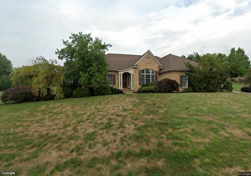
1939 Pickering Trail Lancaster, PA 17601
Eden NeighborhoodEstimated Value: $650,073 - $799,000
3
Beds
4
Baths
3,018
Sq Ft
$242/Sq Ft
Est. Value
About This Home
This home is located at 1939 Pickering Trail, Lancaster, PA 17601 and is currently estimated at $729,768, approximately $241 per square foot. 1939 Pickering Trail is a home located in Lancaster County with nearby schools including Nitrauer School, Landis Run Intermediate School, and Manheim Township Middle School.
Ownership History
Date
Name
Owned For
Owner Type
Purchase Details
Closed on
Nov 30, 2010
Sold by
Weismandel Wayne L and Weismandel Bonnie C
Bought by
Titus Michael H
Current Estimated Value
Home Financials for this Owner
Home Financials are based on the most recent Mortgage that was taken out on this home.
Original Mortgage
$115,500
Outstanding Balance
$76,386
Interest Rate
4.24%
Mortgage Type
New Conventional
Estimated Equity
$653,382
Create a Home Valuation Report for This Property
The Home Valuation Report is an in-depth analysis detailing your home's value as well as a comparison with similar homes in the area
Home Values in the Area
Average Home Value in this Area
Purchase History
| Date | Buyer | Sale Price | Title Company |
|---|---|---|---|
| Titus Michael H | $400,000 | None Available |
Source: Public Records
Mortgage History
| Date | Status | Borrower | Loan Amount |
|---|---|---|---|
| Open | Titus Michael H | $115,500 |
Source: Public Records
Tax History Compared to Growth
Tax History
| Year | Tax Paid | Tax Assessment Tax Assessment Total Assessment is a certain percentage of the fair market value that is determined by local assessors to be the total taxable value of land and additions on the property. | Land | Improvement |
|---|---|---|---|---|
| 2025 | $7,941 | $367,000 | $88,000 | $279,000 |
| 2024 | $7,941 | $367,000 | $88,000 | $279,000 |
| 2023 | $7,734 | $367,000 | $88,000 | $279,000 |
| 2022 | $7,604 | $367,000 | $88,000 | $279,000 |
| 2021 | $7,434 | $367,000 | $88,000 | $279,000 |
| 2020 | $7,434 | $367,000 | $88,000 | $279,000 |
| 2019 | $7,362 | $367,000 | $88,000 | $279,000 |
| 2018 | $5,439 | $367,000 | $88,000 | $279,000 |
| 2017 | $7,883 | $309,800 | $76,500 | $233,300 |
| 2016 | $7,883 | $309,800 | $76,500 | $233,300 |
| 2015 | $1,981 | $309,800 | $76,500 | $233,300 |
| 2014 | $5,667 | $309,800 | $76,500 | $233,300 |
Source: Public Records
Map
Nearby Homes
- 1923 Pickering Trail
- 1922 Pickering Trail
- 1919 Pickering Trail
- 1935 New Holland Pike
- 1915 Pickering Trail
- 1914 Pickering Trail
- 1981 Landis Valley Rd
- 2111 Landis Valley Rd
- 1550 Euclid Dr
- 2010 Landis Valley Rd
- 2007 Meadow Ridge Dr
- 0 Butter Rd
- 0 Butter Rd
- 212 Greenview Dr Unit T2212
- 1150 Groff Ln
- 2043 Stonecrest Dr
- 672 Stockdale Dr
- 200 Hershey Ln Unit CRESTWOOD
- 200 Hershey Ln Unit CEDARBROOK
- 2098 Mallard Dr
- 1936 Glendower Dr
- 1943 Pickering Trail
- 1935 Pickering Trail
- 1942 Pickering Trail
- 1940 Glendower Dr
- 1938 Pickering Trail
- 1932 Glendower Dr
- 1934 Pickering Trail
- 1946 Pickering Trail
- 1944 Glendower Dr
- 1937 Glendower Dr
- 1947 Pickering Trail
- 1941 Glendower Dr
- 1930 Pickering Trail
- 1948 Glendower Dr
- 1927 Glendower Dr
- 1945 Glendower Dr
- 1931 Glendower Dr
- 1951 Pickering Trail
- 1989 Copperfield Dr