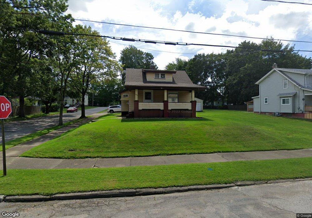
1939 Pointview Ave Youngstown, OH 44502
Buckeye Plat NeighborhoodEstimated Value: $63,212 - $86,000
About This Home
This home is located at 1939 Pointview Ave, Youngstown, OH 44502 and is currently estimated at $76,303, approximately $57 per square foot. 1939 Pointview Ave is a home located in Mahoning County with nearby schools including Paul C. Bunn Elementary School, Chaney High School, and Summit Academy Secondary School - Youngstown.
Ownership History
We collect this data history from publicly available records. To have your information removed, we recommend requesting removal directly through your county’s website.
Purchase Details
Purchase Details
Purchase Details
Home Values in the Area
Average Home Value in this Area
Purchase History
We collect this data history from publicly available records. To have your information removed, we recommend requesting removal directly through your county’s website.
| Date | Buyer | Sale Price | Title Company |
|---|---|---|---|
| -- | None Available | ||
| $36,000 | -- | ||
| $36,000 | -- |
Tax History
We collect this data history from publicly available records. To have your information removed, we recommend requesting removal directly through your county’s website.
| Year | Tax Paid | Tax Assessment Tax Assessment Total Assessment is a certain percentage of the fair market value that is determined by local assessors to be the total taxable value of land and additions on the property. | Land | Improvement |
|---|---|---|---|---|
| 2025 | $510 | $11,800 | $1,070 | $10,730 |
| 2024 | $578 | $11,800 | $1,070 | $10,730 |
| 2023 | $574 | $11,800 | $1,070 | $10,730 |
| 2022 | $415 | $6,550 | $1,070 | $5,480 |
| 2021 | $415 | $6,550 | $1,070 | $5,480 |
| 2020 | $417 | $6,550 | $1,070 | $5,480 |
| 2019 | $424 | $5,950 | $970 | $4,980 |
| 2018 | $429 | $5,950 | $970 | $4,980 |
| 2017 | $426 | $5,950 | $970 | $4,980 |
| 2016 | $589 | $8,870 | $970 | $7,900 |
| 2015 | $577 | $8,870 | $970 | $7,900 |
| 2014 | $557 | $8,870 | $970 | $7,900 |
| 2013 | $550 | $8,870 | $970 | $7,900 |
Map
- 2025 Pointview Ave
- 1934 E Midlothian Blvd
- 2003 E Midlothian Blvd
- 3621 Neilson Ave
- 1970 Weston Ave
- 0 Weston Ave
- 1654 Everett Ave
- 3443 Sheridan Rd
- 3424 Ambert Ave
- 636 Lincoln Ave
- 3533 Wyandot Ln
- 2001 Brownlee Ave
- 3332 Sheridan Rd
- 3563 Valerie Dr
- 3443 Belden Ave
- 414 10th St
- 1968 Wakefield Ave
- 438 10th St
- 3516 Champlain Ave
- 1661 Wakefield Ave
- 1937 Pointview Ave
- 1931 Pointview Ave
- 1927 Pointview Ave
- 1921 Pointview Ave
- 2005 Pointview Ave
- 1936 Pointview Ave
- 1932 Pointview Ave
- 1924 Pointview Ave
- 1917 Pointview Ave
- 1928 Pointview Ave
- 2004 Pointview Ave
- 2009 Pointview Ave
- 3701 Irma St
- 1920 Pointview Ave
- 1946 S Heights Ave
- 1950 S Heights Ave
- 1913 Pointview Ave
- 1940 S Heights Ave
- 1934 S Heights Ave
- 2015 Pointview Ave
Ask me questions while you tour the home.