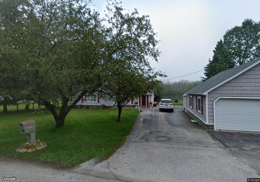
1939 Riverside Dr Sault Sainte Marie, MI 49783
Estimated Value: $298,000 - $451,000
2
Beds
2
Baths
2,666
Sq Ft
$143/Sq Ft
Est. Value
About This Home
This home is located at 1939 Riverside Dr, Sault Sainte Marie, MI 49783 and is currently estimated at $380,532, approximately $142 per square foot. 1939 Riverside Dr is a home located in Chippewa County with nearby schools including Sault Area Middle School, Sault Area High School, and Joseph K. Lumsden Bahweting Anishnabe Academy.
Ownership History
Date
Name
Owned For
Owner Type
Purchase Details
Closed on
Oct 17, 2011
Sold by
Webb Lovell and Webb Joan I
Bought by
Webb Family Trust
Current Estimated Value
Purchase Details
Closed on
Sep 11, 2008
Sold by
Golanka Gary and Golanka Nicole
Bought by
Webb Lovell and Webb Joan W
Home Financials for this Owner
Home Financials are based on the most recent Mortgage that was taken out on this home.
Original Mortgage
$157,500
Interest Rate
5.5%
Mortgage Type
Purchase Money Mortgage
Purchase Details
Closed on
Sep 30, 2005
Sold by
Melody Melody and Vanprooyen Melody
Bought by
Golanka Gary and Golanka Nicole
Home Financials for this Owner
Home Financials are based on the most recent Mortgage that was taken out on this home.
Original Mortgage
$131,250
Interest Rate
5.83%
Mortgage Type
Purchase Money Mortgage
Create a Home Valuation Report for This Property
The Home Valuation Report is an in-depth analysis detailing your home's value as well as a comparison with similar homes in the area
Home Values in the Area
Average Home Value in this Area
Purchase History
| Date | Buyer | Sale Price | Title Company |
|---|---|---|---|
| Webb Family Trust | -- | -- | |
| Webb Lovell | $175,000 | Eastern Upper Peninsula Titl | |
| Golanka Gary | $175,000 | Eastern Upper Peninsula |
Source: Public Records
Mortgage History
| Date | Status | Borrower | Loan Amount |
|---|---|---|---|
| Previous Owner | Webb Lovell | $157,500 | |
| Previous Owner | Golanka Gary | $131,250 |
Source: Public Records
Tax History Compared to Growth
Tax History
| Year | Tax Paid | Tax Assessment Tax Assessment Total Assessment is a certain percentage of the fair market value that is determined by local assessors to be the total taxable value of land and additions on the property. | Land | Improvement |
|---|---|---|---|---|
| 2025 | $6,264 | $176,500 | $0 | $0 |
| 2024 | $3,757 | $122,600 | $0 | $0 |
| 2023 | $4,121 | $107,900 | $0 | $0 |
| 2022 | $4,121 | $105,700 | $0 | $0 |
| 2021 | $3,941 | $110,000 | $0 | $0 |
| 2020 | $3,869 | $118,500 | $0 | $0 |
| 2019 | $3,793 | $108,800 | $0 | $0 |
| 2018 | $4,387 | $92,300 | $0 | $0 |
| 2017 | $3,024 | $88,100 | $0 | $0 |
| 2016 | $3,732 | $86,000 | $0 | $0 |
| 2011 | $3,784 | $85,200 | $0 | $0 |
Source: Public Records
Map
Nearby Homes
- 2039 Riverside Dr
- Parcel A Shunk Rd
- 1164 E Spruce St
- 2017 S Whitehead Rd
- 3032 S Frances Ave
- 2039 S Riverside Dr
- 1109 Mann Dr
- 1096 Maple St
- . E 10th Ave
- 1601 Seymour St
- 721 E Spruce St
- 724 Cedar St
- 0 W Cedar Dr Unit 24-1105
- 2699 Minneapolis St
- 1025 Swinton St
- 317 25th Ave E
- 804 Newton Ave
- 1002 Superior St
- 1801 Augusta St
- 1979 Riverside Dr
- 1979 Riverside Dr
- 1979 Riverside Dr Unit 1979
- 1937 Riverside Dr
- 2700 BLK(3 Riverside Dr
- 2700 BLK(1 Riverside Dr
- 2700 BLK(2 Riverside Dr
- 40 Acres Riverside Dr
- 1983 Riverside Dr
- 10 Acres Riverside Dr
- 2153 Riverside Dr
- 1931 Riverside Dr
- 2009 Riverside Dr
- 1925 Riverside Dr
- 1925 Riverside Dr
- 1990 Riverside Dr
- 1962 Riverside Dr
- 1923 Riverside Dr
- 2011 Riverside Dr
- 1911 Riverside Dr