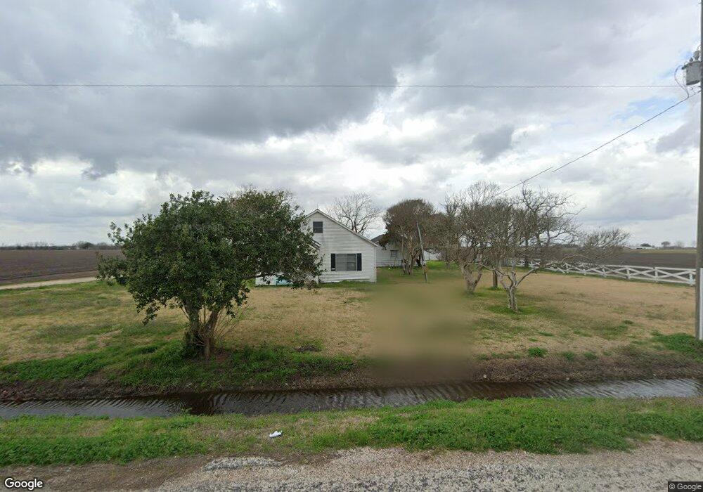
1939 Sulak Rd East Bernard, TX 77435
Estimated Value: $260,287 - $520,000
3
Beds
2
Baths
1,848
Sq Ft
$211/Sq Ft
Est. Value
About This Home
This home is located at 1939 Sulak Rd, East Bernard, TX 77435 and is currently estimated at $390,144, approximately $211 per square foot. 1939 Sulak Rd is a home located in Fort Bend County with nearby schools including Brazos Elementary School, Brazos Middle School, and Brazos High School.
Ownership History
Date
Name
Owned For
Owner Type
Purchase Details
Closed on
Jun 26, 2018
Sold by
Denny Joan Ann and Criswell Mary L
Bought by
Melnar Robbie Joseph and Melnar Wendy Michelle
Current Estimated Value
Home Financials for this Owner
Home Financials are based on the most recent Mortgage that was taken out on this home.
Original Mortgage
$408,000
Outstanding Balance
$354,375
Interest Rate
4.6%
Mortgage Type
Future Advance Clause Open End Mortgage
Estimated Equity
$35,769
Create a Home Valuation Report for This Property
The Home Valuation Report is an in-depth analysis detailing your home's value as well as a comparison with similar homes in the area
Home Values in the Area
Average Home Value in this Area
Purchase History
| Date | Buyer | Sale Price | Title Company |
|---|---|---|---|
| Melnar Robbie Joseph | -- | Select Title Llc |
Source: Public Records
Mortgage History
| Date | Status | Borrower | Loan Amount |
|---|---|---|---|
| Open | Melnar Robbie Joseph | $408,000 |
Source: Public Records
Tax History Compared to Growth
Tax History
| Year | Tax Paid | Tax Assessment Tax Assessment Total Assessment is a certain percentage of the fair market value that is determined by local assessors to be the total taxable value of land and additions on the property. | Land | Improvement |
|---|---|---|---|---|
| 2025 | $842 | $171,996 | $30,710 | $141,286 |
| 2024 | $842 | $161,218 | $30,322 | $130,896 |
| 2023 | $813 | $150,927 | $19,516 | $131,411 |
| 2022 | $748 | $135,620 | $19,520 | $116,100 |
| 2021 | $1,804 | $104,170 | $11,740 | $92,430 |
| 2020 | $1,765 | $99,800 | $11,740 | $88,060 |
| 2019 | $2,035 | $101,550 | $12,110 | $89,440 |
| 2018 | $1,932 | $96,630 | $12,110 | $84,520 |
| 2017 | $1,846 | $89,020 | $7,310 | $81,710 |
| 2016 | $1,848 | $89,120 | $7,310 | $81,810 |
| 2015 | $37 | $87,290 | $7,310 | $79,980 |
| 2014 | $32 | $85,400 | $7,310 | $78,090 |
Source: Public Records
Map
Nearby Homes
- TBD Fm 1952 Rd
- 1023 Williams Rd
- 801 Williams Rd
- 00 TBD Macha Rd
- 0 Polak Rd
- 4327 Polak Rd
- 4427 Polak Rd
- 4421 Polak Rd
- 14626 Sycamore Cir
- 10704 Buls Rd
- 14920 Bj Dusek Rd
- 0 Live Oak Ln
- 14902 Bernard Timbers Dr
- 7931 Fm 1952 Rd
- 0000 W Koym Rd
- 0 County Road 274
- 0 Koym Rd Unit 23561366
- 222 Behrens St
- TBD Texas 36
- 230 N Missouri St
- 0 Sulak Rd
- 2231 Sulak Rd
- 4031 Fm 1952 Rr Rd
- 4101 Fm 1952 Rd
- 4203 Fm 1952 Rd
- 3515 Fm 1952 Rd
- 12215 Albert Marek Rd
- 12115 Albert Marek Rd
- 4403 Pilcik Rd
- 11931 Albert Marek Rd
- 3630 Fm 1952 Rd
- 2010 Pilcik Rd
- 3330 Fm 1952 Rd
- 11903 Albert Marek Rd
- 4606 Fm 1952 Rd
- 3738 Fm 1952 Rd
- 4615 Fm 1952 Rd
- 4607 Fm 1952 Rd
- 3011 Fm 1952 Rd
- 4845 Fm 1952 Rd