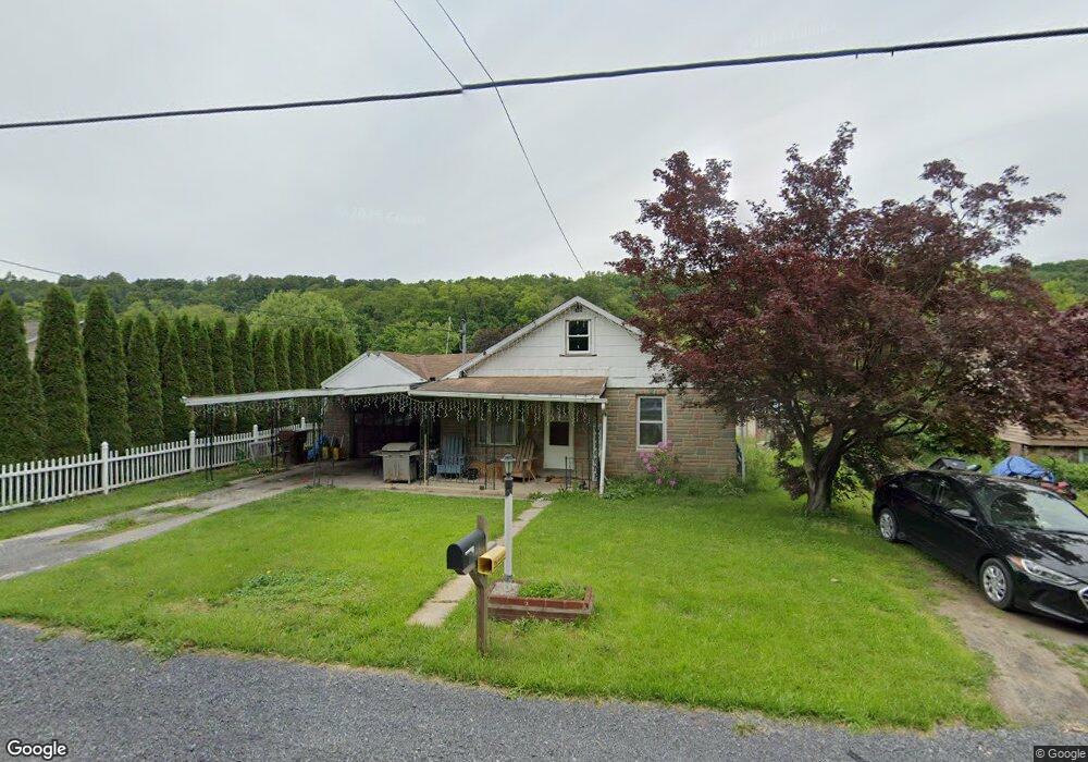
1939 Us Highway 522 N Lewistown, PA 17044
Estimated Value: $101,000 - $188,000
2
Beds
1
Bath
1,350
Sq Ft
$108/Sq Ft
Est. Value
About This Home
This home is located at 1939 Us Highway 522 N, Lewistown, PA 17044 and is currently estimated at $146,178, approximately $108 per square foot. 1939 Us Highway 522 N is a home with nearby schools including Indian Valley Elementary School, Indian Valley Intermediate School, and Mifflin County Junior High School.
Ownership History
Date
Name
Owned For
Owner Type
Purchase Details
Closed on
Nov 20, 2015
Sold by
Gentzel Derrick L and Walden Tiffany K
Bought by
Macknair Paul G
Current Estimated Value
Purchase Details
Closed on
Dec 21, 2012
Sold by
Ughetto Ii Joseph E and Ughetto Holly M
Bought by
Ughetto Ii Joseph E
Purchase Details
Closed on
Jun 8, 2010
Sold by
Forsythe Christine J and Kinslow Harry A
Bought by
Macknair Paul G and Gentzel Derrick L
Home Financials for this Owner
Home Financials are based on the most recent Mortgage that was taken out on this home.
Original Mortgage
$28,000
Interest Rate
4.98%
Mortgage Type
Purchase Money Mortgage
Create a Home Valuation Report for This Property
The Home Valuation Report is an in-depth analysis detailing your home's value as well as a comparison with similar homes in the area
Home Values in the Area
Average Home Value in this Area
Purchase History
| Date | Buyer | Sale Price | Title Company |
|---|---|---|---|
| Macknair Paul G | -- | None Available | |
| Ughetto Ii Joseph E | -- | -- | |
| Macknair Paul G | $35,000 | -- |
Source: Public Records
Mortgage History
| Date | Status | Borrower | Loan Amount |
|---|---|---|---|
| Previous Owner | Macknair Paul G | $28,000 |
Source: Public Records
Tax History Compared to Growth
Tax History
| Year | Tax Paid | Tax Assessment Tax Assessment Total Assessment is a certain percentage of the fair market value that is determined by local assessors to be the total taxable value of land and additions on the property. | Land | Improvement |
|---|---|---|---|---|
| 2025 | $1,862 | $31,050 | $6,700 | $24,350 |
| 2024 | $1,862 | $31,050 | $6,700 | $24,350 |
| 2023 | $1,862 | $31,050 | $6,700 | $24,350 |
| 2022 | $1,862 | $31,050 | $6,700 | $24,350 |
| 2021 | $1,862 | $31,050 | $6,700 | $24,350 |
| 2020 | $1,855 | $31,050 | $6,700 | $24,350 |
| 2019 | $1,566 | $31,050 | $6,700 | $24,350 |
| 2018 | $1,813 | $31,050 | $6,700 | $24,350 |
| 2017 | $1,813 | $31,050 | $6,700 | $24,350 |
| 2016 | $1,759 | $31,050 | $6,700 | $24,350 |
| 2015 | -- | $31,050 | $6,700 | $24,350 |
| 2012 | -- | $31,050 | $6,700 | $24,350 |
Source: Public Records
Map
Nearby Homes
- 1397 Back Maitland Rd
- 685 Dry Valley Rd
- 2031 Back Maitland Rd
- 610 Long Ln
- 880 Parcheytown Rd
- 420 Locust St
- 532 E Freedom Ave
- 435 1st Ave
- 43 S 5th St
- 549 Fairview Ave
- 402 8th Ave
- 6 Oakland Ave
- 501 E Walnut St
- 41 Monroe Alley
- 807 N Pine St
- 227 Jacks Creek Ln
- 360 Holiday Ln
- 325 Shaw Ave
- 130 Pannebaker Ave
- 119 S Walnut St
- 1941 Us Highway 522 N
- 1931 Us Highway 522 N
- 1945 Us Highway 522 N
- 8 Somar Dr
- 6 Somar Dr
- 1921 Us Highway 522 N
- 1944 Glenwood Ave
- 1968 Glenwood Ave
- Lot #1&2 Somar Dr
- Lot 4 Somar Dr
- 1915 Us Highway 522 N
- 1930 Glenwood Ave
- 1959 Glenwood Ave
- 1951 Glenwood Ave
- 1961 Glenwood Ave
- 1922 Glenwood Ave
- 1939 Glenwood Ave
- 1971 Glenwood Ave
- 1927 Glenwood Ave
- 1907 Us Highway 522 N