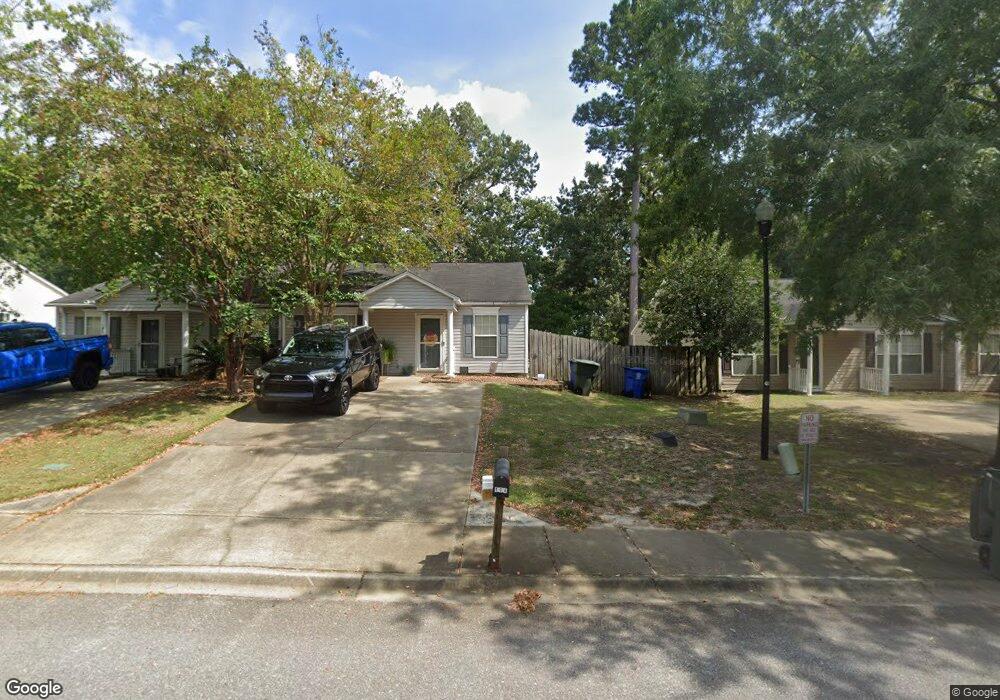
194 Ashewood Commons Dr Columbia, SC 29209
Southeast Columbia NeighborhoodEstimated Value: $155,000 - $169,367
2
Beds
2
Baths
1,036
Sq Ft
$157/Sq Ft
Est. Value
About This Home
This home is located at 194 Ashewood Commons Dr, Columbia, SC 29209 and is currently estimated at $162,842, approximately $157 per square foot. 194 Ashewood Commons Dr is a home located in Richland County with nearby schools including Annie Burnside Elementary School, Crayton Middle School, and A. C. Flora High School.
Ownership History
Date
Name
Owned For
Owner Type
Purchase Details
Closed on
Sep 20, 2017
Sold by
Skinner Edith H
Bought by
Quarles Carrie Ann and Quarles William Scott
Current Estimated Value
Home Financials for this Owner
Home Financials are based on the most recent Mortgage that was taken out on this home.
Original Mortgage
$76,095
Outstanding Balance
$63,917
Interest Rate
4.12%
Mortgage Type
FHA
Estimated Equity
$98,925
Purchase Details
Closed on
Mar 30, 2004
Sold by
Centex Homes
Bought by
Donovan Carrie L and Donovan Curtis C
Home Financials for this Owner
Home Financials are based on the most recent Mortgage that was taken out on this home.
Original Mortgage
$157,860
Interest Rate
5.53%
Mortgage Type
VA
Purchase Details
Closed on
Jul 30, 2002
Sold by
Centex Homes
Bought by
Skinner Edith H
Home Financials for this Owner
Home Financials are based on the most recent Mortgage that was taken out on this home.
Original Mortgage
$70,173
Interest Rate
6.62%
Mortgage Type
FHA
Create a Home Valuation Report for This Property
The Home Valuation Report is an in-depth analysis detailing your home's value as well as a comparison with similar homes in the area
Home Values in the Area
Average Home Value in this Area
Purchase History
| Date | Buyer | Sale Price | Title Company |
|---|---|---|---|
| Quarles Carrie Ann | $77,500 | None Available | |
| Donovan Carrie L | $157,860 | -- | |
| Skinner Edith H | $71,275 | -- |
Source: Public Records
Mortgage History
| Date | Status | Borrower | Loan Amount |
|---|---|---|---|
| Open | Quarles Carrie Ann | $76,095 | |
| Previous Owner | Donovan Carrie L | $157,860 | |
| Previous Owner | Skinner Edith H | $70,173 |
Source: Public Records
Tax History Compared to Growth
Tax History
| Year | Tax Paid | Tax Assessment Tax Assessment Total Assessment is a certain percentage of the fair market value that is determined by local assessors to be the total taxable value of land and additions on the property. | Land | Improvement |
|---|---|---|---|---|
| 2024 | $2,440 | $89,100 | $0 | $0 |
| 2023 | $2,440 | $3,100 | $0 | $0 |
| 2022 | $2,241 | $77,500 | $15,200 | $62,300 |
| 2021 | $580 | $3,100 | $0 | $0 |
| 2020 | $612 | $3,100 | $0 | $0 |
| 2019 | $617 | $3,100 | $0 | $0 |
| 2018 | $631 | $3,100 | $0 | $0 |
| 2017 | $23 | $2,120 | $0 | $0 |
| 2016 | $405 | $2,120 | $0 | $0 |
| 2015 | $405 | $2,120 | $0 | $0 |
| 2014 | $404 | $53,100 | $0 | $0 |
| 2013 | -- | $2,120 | $0 | $0 |
Source: Public Records
Map
Nearby Homes
- 168 Ashewood Commons Dr
- 349 Eastfair Dr
- 1527 Burnside Ave
- 7712 Burdell Dr
- 2 Routhland Ct
- 26 Vendue Ct
- 267 Blue Savannah St
- 263 Blue Savannah St
- 155 Colonial Commons Ln
- 360 Council Loop
- 115 Colonial Commons Ln
- 113 Colonial Commons Ln
- 101 Colonial Commons Ln
- 106 Colonial Commons Ln
- 909 Eastmont Dr
- 8025 Skylark Dr
- 7428 Fairmont Rd
- 175 Nestle Ct
- 7229 Holloway Rd
- 797 Phipps Ln
- 192 Ashewood Commons Dr
- 198 Ashewood Commons Dr
- 188 Ashewood Commons Dr
- 204 Ashewood Commons Dr
- 184 Ashewood Commons Dr
- 184 Ashewood Commons Dr
- 208 Ashewood Commons Dr
- 180 Ashewood Commons Dr
- 212 Ashewood Commons Dr
- 193 Ashewood Commons Dr
- 197 Ashewood Commons Dr
- 189 Ashewood Commons Dr
- 201 Ashewood Commons Dr
- 205 Ashewood Commons Dr
- 185 Ashewood Commons Dr
- 181 Ashewood Commons Dr
- 176 Ashewood Commons Dr
- 209 Ashewood Commons Dr
- 177 Ashewood Commons Dr
- 172 Ashewood Commons Dr