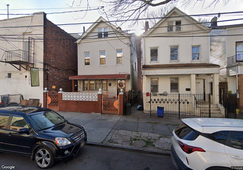
194 Ashford St Brooklyn, NY 11207
Cypress Hills NeighborhoodEstimated Value: $828,852 - $944,000
--
Bed
--
Bath
2,140
Sq Ft
$421/Sq Ft
Est. Value
About This Home
This home is located at 194 Ashford St, Brooklyn, NY 11207 and is currently estimated at $900,963, approximately $421 per square foot. 194 Ashford St is a home located in Kings County with nearby schools including P.S. 108 - Sal Abbracciamento, Liberty Avenue Middle School, and Vista Academy.
Ownership History
Date
Name
Owned For
Owner Type
Purchase Details
Closed on
May 17, 2006
Sold by
Baird Janice S and Gayle Maurice
Bought by
Baird Janice S
Current Estimated Value
Home Financials for this Owner
Home Financials are based on the most recent Mortgage that was taken out on this home.
Original Mortgage
$205,000
Outstanding Balance
$119,566
Interest Rate
6.62%
Mortgage Type
Purchase Money Mortgage
Estimated Equity
$781,397
Purchase Details
Closed on
Sep 16, 1996
Sold by
Bnei Brak Inc
Bought by
Baird Janice S and Gayle Maurice
Home Financials for this Owner
Home Financials are based on the most recent Mortgage that was taken out on this home.
Original Mortgage
$181,400
Interest Rate
8.07%
Mortgage Type
FHA
Purchase Details
Closed on
Jun 3, 1996
Sold by
Jusino Charles J
Bought by
Bnei Brak Inc
Purchase Details
Closed on
Jun 1, 1996
Sold by
Jusino Sandra L
Bought by
Jusino Charles J
Create a Home Valuation Report for This Property
The Home Valuation Report is an in-depth analysis detailing your home's value as well as a comparison with similar homes in the area
Home Values in the Area
Average Home Value in this Area
Purchase History
| Date | Buyer | Sale Price | Title Company |
|---|---|---|---|
| Baird Janice S | -- | -- | |
| Baird Janice S | -- | -- | |
| Baird Janice S | $180,000 | Commonwealth Land Title Ins | |
| Baird Janice S | $180,000 | Commonwealth Land Title Ins | |
| Bnei Brak Inc | $47,000 | Commonwealth Land Title Ins | |
| Bnei Brak Inc | $47,000 | Commonwealth Land Title Ins | |
| Jusino Charles J | $25,000 | Commonwealth Land Title Ins | |
| Jusino Charles J | -- | Commonwealth Land Title Ins |
Source: Public Records
Mortgage History
| Date | Status | Borrower | Loan Amount |
|---|---|---|---|
| Open | Baird Janice S | $205,000 | |
| Closed | Baird Janice S | $205,000 | |
| Previous Owner | Baird Janice S | $181,400 |
Source: Public Records
Tax History Compared to Growth
Tax History
| Year | Tax Paid | Tax Assessment Tax Assessment Total Assessment is a certain percentage of the fair market value that is determined by local assessors to be the total taxable value of land and additions on the property. | Land | Improvement |
|---|---|---|---|---|
| 2025 | $3,728 | $64,680 | $13,920 | $50,760 |
| 2024 | $3,728 | $55,500 | $13,920 | $41,580 |
| 2023 | $1,484 | $59,100 | $13,920 | $45,180 |
| 2022 | $1,328 | $57,900 | $13,920 | $43,980 |
| 2021 | $3,893 | $56,460 | $13,920 | $42,540 |
| 2020 | $2,214 | $42,660 | $13,920 | $28,740 |
| 2019 | $3,606 | $42,660 | $13,920 | $28,740 |
| 2018 | $3,287 | $17,583 | $8,308 | $9,275 |
| 2017 | $3,082 | $16,588 | $8,707 | $7,881 |
| 2016 | $3,006 | $16,588 | $7,502 | $9,086 |
| 2015 | $1,668 | $16,461 | $5,693 | $10,768 |
| 2014 | $1,668 | $15,530 | $6,446 | $9,084 |
Source: Public Records
Map
Nearby Homes
- 192 Ashford St
- 188 Ashford St
- 2929 Atlantic Ave
- 2923 Atlantic Ave
- 186 Ashford St
- 182 Ashford St
- 249 Warwick St
- 255 Warwick St
- 251 Warwick St
- 245 Warwick St
- 243 Warwick St
- 180 Ashford St
- 239 Warwick St
- 2935 Atlantic Ave
- 2911 Atlantic Ave
- 176 Ashford St
- 2937 Atlantic Ave
- 237 Warwick St
- 191 Ashford St
- 189 Ashford St