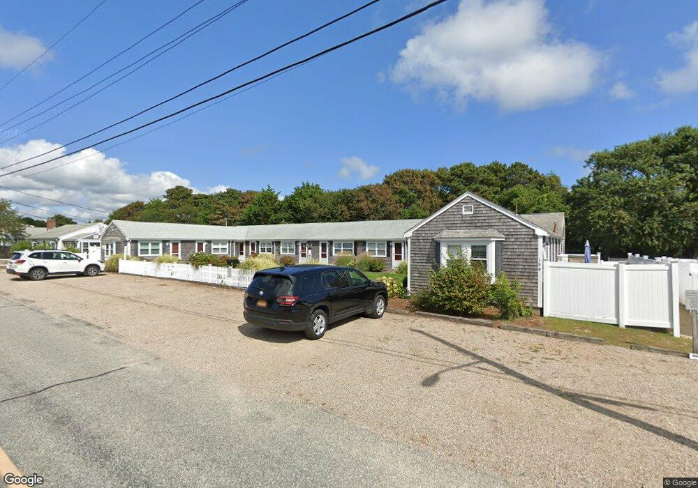
194 Captain Chase Rd Unit 260 Dennis Port, MA 02639
Dennis Port NeighborhoodEstimated Value: $264,000 - $338,803
1
Bed
2
Baths
521
Sq Ft
$565/Sq Ft
Est. Value
About This Home
This home is located at 194 Captain Chase Rd Unit 260, Dennis Port, MA 02639 and is currently estimated at $294,451, approximately $565 per square foot. 194 Captain Chase Rd Unit 260 is a home located in Barnstable County with nearby schools including Dennis-Yarmouth Regional High School and St. Pius X. School.
Ownership History
Date
Name
Owned For
Owner Type
Purchase Details
Closed on
May 29, 2020
Sold by
Mccabe Joan S
Bought by
Lavery Nicholas and Lavery Toni
Current Estimated Value
Home Financials for this Owner
Home Financials are based on the most recent Mortgage that was taken out on this home.
Original Mortgage
$123,750
Outstanding Balance
$109,419
Interest Rate
3.3%
Mortgage Type
New Conventional
Estimated Equity
$185,032
Create a Home Valuation Report for This Property
The Home Valuation Report is an in-depth analysis detailing your home's value as well as a comparison with similar homes in the area
Home Values in the Area
Average Home Value in this Area
Purchase History
| Date | Buyer | Sale Price | Title Company |
|---|---|---|---|
| Lavery Nicholas | $165,000 | None Available |
Source: Public Records
Mortgage History
| Date | Status | Borrower | Loan Amount |
|---|---|---|---|
| Open | Lavery Nicholas | $123,750 |
Source: Public Records
Tax History Compared to Growth
Tax History
| Year | Tax Paid | Tax Assessment Tax Assessment Total Assessment is a certain percentage of the fair market value that is determined by local assessors to be the total taxable value of land and additions on the property. | Land | Improvement |
|---|---|---|---|---|
| 2025 | $1,299 | $300,000 | $0 | $300,000 |
| 2024 | $1,231 | $280,500 | $0 | $280,500 |
| 2023 | $1,074 | $229,900 | $0 | $229,900 |
| 2022 | $1,140 | $203,500 | $0 | $203,500 |
| 2021 | $1,131 | $187,500 | $0 | $187,500 |
| 2020 | $1,111 | $182,100 | $0 | $182,100 |
| 2019 | $1,070 | $173,400 | $0 | $173,400 |
| 2018 | $955 | $150,700 | $0 | $150,700 |
| 2017 | $972 | $158,000 | $0 | $158,000 |
| 2016 | $938 | $143,700 | $0 | $143,700 |
| 2015 | $920 | $143,700 | $0 | $143,700 |
| 2014 | $903 | $142,200 | $0 | $142,200 |
Source: Public Records
Map
Nearby Homes
- 154 Old Wharf Rd Unit 26
- 154 Old Wharf Rd Unit 14
- 112 Old Wharf Rd Unit E4
- 112 Old Wharf Rd Unit E1
- 217 Old Wharf Rd Unit 64
- 230 Old Wharf Rd Unit 272
- 37 Ocean Dr Unit 2
- 10 Grindell Ave
- 241 Old Wharf Rd Unit 82
- 241 Old Wharf Rd Unit 127
- 262 Old Wharf Rd Unit 67
- 262 Old Wharf Rd Unit 5
- 262 Old Wharf Rd Unit 5
- 262 Old Wharf Rd Unit 87
- 37 Beach Hills Rd
- 37-A Beach Hills Rd
- 27 Mayflower Ln
- 18 Holiday Ln
- 22 Ferncliff Rd
- 6 Baker Way
- 194 Captain Chase Rd Unit 260
- 194 Captain Chase Rd Unit 260
- 194 Captain Chase Rd Unit 260
- 194 Captain Chase Rd Unit 260
- 194 Captain Chase Rd Unit 260
- 194 Captain Chase Rd Unit 260
- 17 Captain Chase Rd
- 194 Captain Chase Rd Unit 111
- 194 Captain Chase Rd Unit 116
- 194 Captain Chase Rd Unit 117
- 194 Captain Chase Rd Unit 108
- 194 Captain Chase Rd Unit 107
- 194 Captain Chase Rd Unit 118
- 194 Captain Chase Rd Unit 109
- 194 Captain Chase Rd Unit 103
- 194 Captain Chase Rd Unit 105
- 194 Captain Chase Rd Unit 104
- 194 Captain Chase Rd Unit 110
- 194 Captain Chase Rd Unit 106
- 194 Captain Chase Rd Unit 114