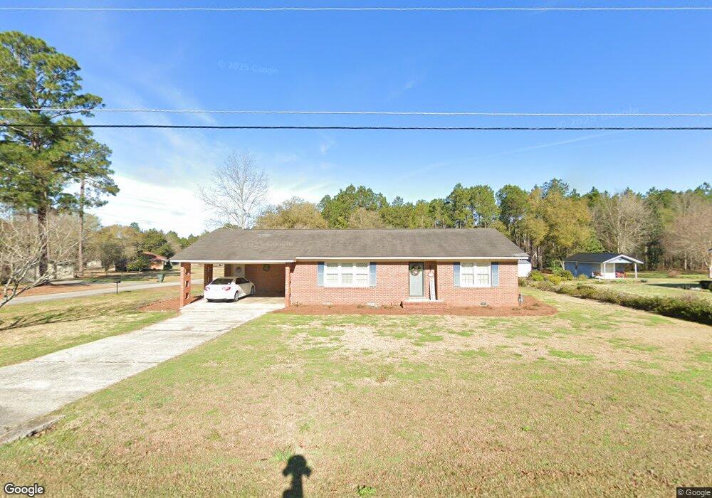
194 Carter St Soperton, GA 30457
Estimated Value: $132,000 - $153,000
Studio
2
Baths
1,553
Sq Ft
$93/Sq Ft
Est. Value
About This Home
This home is located at 194 Carter St, Soperton, GA 30457 and is currently estimated at $144,372, approximately $92 per square foot. 194 Carter St is a home located in Treutlen County with nearby schools including Treutlen Elementary School, Treutlen Middle/High School, and Faith Tabernacle Christian Academy.
Ownership History
Date
Name
Owned For
Owner Type
Purchase Details
Closed on
Apr 29, 2008
Sold by
Gills Jim L
Bought by
Webb Joe C
Current Estimated Value
Purchase Details
Closed on
Apr 18, 2008
Sold by
Gills Jim L
Bought by
Webb Joe C
Purchase Details
Closed on
May 17, 1999
Sold by
Sweat Edith
Bought by
Holt Gloria Jean
Purchase Details
Closed on
Feb 28, 1991
Bought by
Sweat Delmas Henry
Create a Home Valuation Report for This Property
The Home Valuation Report is an in-depth analysis detailing your home's value as well as a comparison with similar homes in the area
Home Values in the Area
Average Home Value in this Area
Purchase History
| Date | Buyer | Sale Price | Title Company |
|---|---|---|---|
| Webb Joe C | $12,500 | -- | |
| Webb Joe C | $12,500 | -- | |
| Holt Gloria Jean | $68,000 | -- | |
| Sweat Delmas Henry | $45,000 | -- |
Source: Public Records
Tax History
| Year | Tax Paid | Tax Assessment Tax Assessment Total Assessment is a certain percentage of the fair market value that is determined by local assessors to be the total taxable value of land and additions on the property. | Land | Improvement |
|---|---|---|---|---|
| 2024 | $992 | $33,760 | $2,080 | $31,680 |
| 2023 | $961 | $33,760 | $2,080 | $31,680 |
| 2022 | $765 | $30,360 | $2,080 | $28,280 |
| 2021 | $764 | $30,360 | $2,080 | $28,280 |
| 2020 | $764 | $30,360 | $2,080 | $28,280 |
| 2019 | $763 | $30,360 | $2,080 | $28,280 |
| 2018 | $893 | $30,360 | $2,080 | $28,280 |
| 2017 | $751 | $30,360 | $2,080 | $28,280 |
| 2016 | $736 | $30,360 | $2,080 | $28,280 |
| 2015 | -- | $30,360 | $2,080 | $28,280 |
| 2014 | -- | $30,360 | $2,080 | $28,280 |
| 2013 | -- | $30,360 | $2,080 | $28,280 |
Source: Public Records
Map
Nearby Homes
- 7586 Eastman Rd
- 46 Georgia 46
- 1785 Martin Luther King jr Dr
- 0 Hwy 297 - Tract 2 & 3
- 4798 S Third St
- 4004 E Louisiana Ave
- 1869 Florida Ave
- 0 Hwy 221 Unit 24951
- 0 Rivoli Clay Rd
- 00 Rivoli Clay Rd
- 1936 Cedar Grove Rd
- 0 Knox Mill Rd Unit 10640244
- 0 Beasley Hill Place Unit 10640367
- 4281 Ga Highway 46
- 4281 Sr-46
- 0 County Line Rd Unit n/a 113727
- 0 Muskogee Trail Unit LOT 84
- 0 Muskogee Trail Unit 30570
- 0 Muskogee Trail Unit 25917
- 0 Muskogee Trail Unit LOT 78 20128125
- 174 Carter St
- 195 Carter St
- 246 Carter St
- 144 Carter St
- 229 Carter St
- 1851 Mississippi Ave
- 147 Carter St
- 266 Carter St
- 705 Mississippi Ave W
- 257 Carter St
- 1826 Mississippi Ave
- 114 Carter St
- 115 Carter St
- 115 Carter St
- 1881 Mississippi Ave
- 285 Carter St
- 96 Carter St
- 97 Carter St
- 309 Carter St
- 320 Carter St