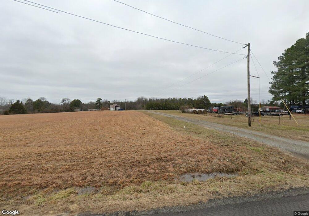
194 Firehouse Rd Quitman, AR 72131
Estimated Value: $362,799 - $404,000
--
Bed
2
Baths
2,347
Sq Ft
$162/Sq Ft
Est. Value
About This Home
This home is located at 194 Firehouse Rd, Quitman, AR 72131 and is currently estimated at $379,600, approximately $161 per square foot. 194 Firehouse Rd is a home located in Cleburne County with nearby schools including Rose Bud Elementary School, Rose Bud High School, and Triple S Christian School.
Ownership History
Date
Name
Owned For
Owner Type
Purchase Details
Closed on
Oct 2, 2024
Sold by
Commissioner Of State Lands
Bought by
Hall Jerry W
Current Estimated Value
Purchase Details
Closed on
Jul 2, 2020
Sold by
Mcgahhey Mindy
Bought by
Hall Jerry W
Purchase Details
Closed on
Dec 18, 2001
Bought by
Mcgahhey Lester S and Leminda M,
Purchase Details
Closed on
Jun 1, 1987
Bought by
Mcgahhey Lester S and Mcgahhey Eminda M
Create a Home Valuation Report for This Property
The Home Valuation Report is an in-depth analysis detailing your home's value as well as a comparison with similar homes in the area
Home Values in the Area
Average Home Value in this Area
Purchase History
| Date | Buyer | Sale Price | Title Company |
|---|---|---|---|
| Hall Jerry W | $3,564 | None Listed On Document | |
| Hall Jerry W | -- | None Available | |
| Mcgahhey Lester S | -- | -- | |
| Mcgahhey Lester S | $74,000 | -- |
Source: Public Records
Tax History Compared to Growth
Tax History
| Year | Tax Paid | Tax Assessment Tax Assessment Total Assessment is a certain percentage of the fair market value that is determined by local assessors to be the total taxable value of land and additions on the property. | Land | Improvement |
|---|---|---|---|---|
| 2024 | $1,690 | $38,067 | $2,824 | $35,243 |
| 2023 | $1,604 | $38,067 | $2,824 | $35,243 |
| 2022 | $1,474 | $38,067 | $2,824 | $35,243 |
| 2021 | $1,340 | $30,101 | $2,346 | $27,755 |
| 2020 | $1,340 | $30,101 | $2,346 | $27,755 |
| 2019 | $1,340 | $30,101 | $2,346 | $27,755 |
| 2018 | $1,340 | $30,101 | $2,346 | $27,755 |
| 2017 | $394 | $30,101 | $2,346 | $27,755 |
| 2016 | $399 | $16,846 | $2,706 | $14,140 |
| 2015 | $398 | $16,846 | $2,706 | $14,140 |
| 2014 | $398 | $16,846 | $2,706 | $14,140 |
Source: Public Records
Map
Nearby Homes
- 545 Firehouse Rd
- 606 Firehouse Rd
- 4 Simmons Loop
- 359 Pin Oak Dr W
- 00 Morgan Rd
- 935 lot 15 Goff Rd
- 935 lot 25 Goff Rd
- 935 lot 24 Goff Rd
- 935 lot 23 Goff Rd
- 935 lot 22 Goff Rd
- 935 lot 21 Goff Rd
- 935 lot 4 Goff Rd
- 935 lot 3 Goff Rd
- 935 lot 2 Goff Rd
- 935 lot 9 Goff Rd
- 1450 Goff Rd
- 738 Lone Star Rd
- 1549 Little Rock Rd
- 000 Goff Rd Via Easement
- 000 Easement Unit Goff Rd
- 255 Firehouse Rd
- 90 Firehouse Rd
- 375 Pleasant Springs Rd W
- 549 Pleasant Springs Rd W
- 455 Pleasant Springs Rd W
- 295 Firehouse Rd
- 525 Pleasant Springs Rd W
- 0 Fire House Rd
- 454 Pleasant Springs Rd W
- 2750 Little Rock Rd
- 13 Firehouse Rd
- 520 Pleasant Springs Rd W
- 14 Firehouse Rd
- 2820 Little Rock Rd
- 405 Firehouse Rd
- 2650 Little Rock Rd
- 2834 Little Rock Rd
- 000 Morgan Rd
- 2600 Little Rock Rd
- 2819 Little Rock Rd
